
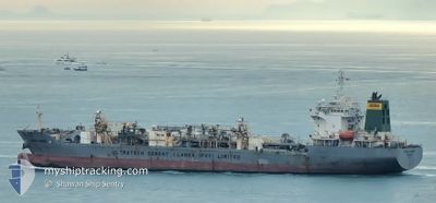
CHANYA NAREE
Cargo
Current Trip
MY BKI
| Time Travelled | 9 days |
|---|---|
| Remaining Time | --- |
| Distance Travelled | 1534.56 nm |
| Remaining Distance | --- |
| AVG Speed | 9.3 Knots |
| MAX Speed | 12.1 Knots |
| AVG Wind | 9.7 knots |
| MAX Wind | 24 knots |
| MIN Temp | 24.4°C / 75.92°F |
| MAX Temp | 30°C / 86°F |
| Draught | 9.2 m |
| Position Received | 2 m ago |
Current Position
| Longitude | 116.08208° |
|---|---|
| Latitude | 6.04831° |
| Status | At anchor |
| Speed | 0.1 Knots |
| Course | 138° |
| Area | South China Sea |
| Station | T-AIS |
| Position Received | 2 m ago |
Info
Information
The current position of CHANYA NAREE is in South China Sea with coordinates 6.04831° / 116.08208° as reported on 2024-06-11 00:23 by AIS to our vessel tracker app. The vessel's current speed is 0.1 Knots
The vessel CHANYA NAREE (IMO: 9691797, MMSI: 564031000) is a Cargo It's sailing under the flag of [SG] Singapore.
In this page you can find informations about the vessels current position, last detected port calls, and current voyage information. If the vessels is not in coverage by AIS you will find the latest position.
The current position of CHANYA NAREE is detected by our AIS receivers and we are not responsible for the reliability of the data. The last position was recorded while the vessel was in Coverage by the Ais receivers of our vessel tracking app.
The current draught of CHANYA NAREE as reported by AIS is 9.2 meters
Weather
| Temperature | 25.2°C / 77.36°F |
|---|---|
| Wind Speed | 10 knots |
| Direction | 174° S |
| Pressure | 1013.7 hPa |
| Humidity | 88.6 % |
| Cloud Coverage | 100 % |
Featured Company
Last Trips
| Origin | Departure | Destination | Arrival | Distance |
|---|
Events
| Time | Event | Details | Position / Dest | Info |
|---|---|---|---|---|
| 2024-06-10 22:38 | Status Changed | At anchor Default |
6.04825 / 116.08184
MY BKI
|
Speed: Course: 136° |
| 2024-06-10 22:35 | Status Changed | Default At anchor |
6.04823 / 116.08188
MY BKI
|
Speed: Course: 135° |
| 2024-06-10 18:50 | Status Changed | At anchor Default |
6.04751 / 116.08156
MY BKI
|
Speed: Course: 95° |
| 2024-06-10 18:47 | Status Changed | Default At anchor |
6.04751 / 116.08147
MY BKI
|
Speed: 0.1 kn Course: 95° |
| 2024-06-10 18:35 | Status Changed | At anchor Default |
6.04727 / 116.08145
MY BKI
|
Speed: 0.1 kn Course: 86° |
| 2024-06-10 18:26 | Status Changed | Default At anchor |
6.04722 / 116.08158
MY BKI
|
Speed: Course: 83° |
| 2024-06-10 18:23 | Status Changed | At anchor Default |
6.04715 / 116.08158
MY BKI
|
Speed: Course: 81° |
| 2024-06-10 18:20 | Status Changed | Default At anchor |
6.04714 / 116.08154
MY BKI
|
Speed: Course: 79° |
| 2024-06-10 18:14 | Status Changed | At anchor Default |
6.04711 / 116.08154
MY BKI
|
Speed: Course: 77° |
| 2024-06-10 18:11 | Status Changed | Default At anchor |
6.04709 / 116.08154
MY BKI
|
Speed: Course: 74° |