
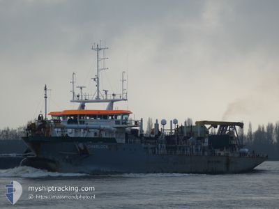
CHARLOCK
Dredging or underwater ops
Current Trip
EEMSGEUL DREDGING
| Time Travelled | 3 days |
|---|---|
| Remaining Time | --- |
| Distance Travelled | 597.74 nm |
| Remaining Distance | --- |
| AVG Speed | 10.1 Knots |
| MAX Speed | 15.3 Knots |
| AVG Wind | 12.4 knots |
| MAX Wind | 21 knots |
| MIN Temp | 11.4°C / 52.52°F |
| MAX Temp | 16.1°C / 60.98°F |
| Draught | 6.2 m |
| Position Received | 24 m ago |
Current Position
| Longitude | 6.70446° |
|---|---|
| Latitude | 53.54823° |
| Status | Restricted manoeuverability |
| Speed | 8.9 Knots |
| Course | 307.7° |
| Area | North Sea |
| Station | T-AIS |
| Position Received | 24 m ago |
Info
Information
The current position of CHARLOCK is in North Sea with coordinates 53.54823° / 6.70446° as reported on 2024-06-01 02:58 by AIS to our vessel tracker app. The vessel's current speed is 8.9 Knots
The vessel CHARLOCK (IMO: 9758636, MMSI: 244740420) is a Dredging or underwater ops It's sailing under the flag of [NL] Netherlands.
In this page you can find informations about the vessels current position, last detected port calls, and current voyage information. If the vessels is not in coverage by AIS you will find the latest position.
The current position of CHARLOCK is detected by our AIS receivers and we are not responsible for the reliability of the data. The last position was recorded while the vessel was in Coverage by the Ais receivers of our vessel tracking app.
The current draught of CHARLOCK as reported by AIS is 6.2 meters
Weather
| Temperature | 14.9°C / 58.82°F |
|---|---|
| Wind Speed | 15 knots |
| Direction | 2° N |
| Pressure | 1013.2 hPa |
| Humidity | 95.9 % |
| Cloud Coverage | 100 % |
Featured Company
Most Visited Ports (Last year)
| Port | Arrivals | |
|---|---|---|
| 327 | ||
| 126 | ||
| 48 | ||
| 5 | ||
| 4 | ||
| 3 |
Last Trips
| Origin | Departure | Destination | Arrival | Distance | |
|---|---|---|---|---|---|
| 2024-05-15 13:58 | 2024-05-26 22:53 | 1267.97 nm | |||
| 2024-04-24 16:20 | 2024-05-14 06:48 | 2630.85 nm | |||
| 2024-04-06 00:53 | 2024-04-23 00:07 | 2761.09 nm | |||
| 2024-03-30 19:18 | 2024-04-05 05:51 | 1194.61 nm |
Events
| Time | Event | Details | Position / Dest | Info |
|---|---|---|---|---|
| 2024-06-01 03:02 | Status Changed | Default Restricted manoeuverability |
53.55499 / 6.68995
EEMSGEUL DREDGING
|
Speed: 8.9 kn Course: 307.7° |
| 2024-06-01 02:42 | START Moving | 2.26 nm, South of BORKUM |
53.52383 / 6.75061
EEMSGEUL DREDGING
|
Speed: 3.7 kn Course: 321° |
| 2024-06-01 02:14 | STOP Moving | 2.46 nm, South of BORKUM |
53.52023 / 6.75697
EEMSGEUL DREDGING
|
Speed: 0.3 kn Course: 305° |
| 2024-06-01 02:12 | START Moving | 2.42 nm, South of BORKUM |
53.52098 / 6.75512
EEMSGEUL DREDGING
|
Speed: 3.6 kn Course: 309° |
| 2024-06-01 01:58 | STOP Moving | 2.5 nm, South of BORKUM |
53.51964 / 6.75785
EEMSGEUL DREDGING
|
Speed: 0.1 kn Course: 307° |
| 2024-06-01 00:46 | ETA Changed | 2025/05/15 15:00 2024/05/15 15:00 |
53.51946 / 6.75873
EEMSGEUL DREDGING
|
Speed: 1.6 kn Course: 307° |
| 2024-06-01 00:19 | Status Changed | Restricted manoeuverability Default |
53.55042 / 6.69116
EEMSGEUL DREDGING
|
Speed: 12.8 kn Course: 128° |
| 2024-06-01 00:10 | IN Coverage |
53.54965 / 6.69287
North Sea
|
Speed: 13.1 kn Course: 127.3° |
|
| 2024-05-31 22:46 | START Moving | 10.29 nm, West of BORKUM |
53.58123 / 6.47234
EEMSGEUL DREDGING
|
Speed: 5.7 kn Course: 284° |
| 2024-05-31 22:26 | STOP Moving | 10.3 nm, West of BORKUM |
53.57879 / 6.47164
EEMSGEUL DREDGING
|
Speed: 0.2 kn Course: 2° |