
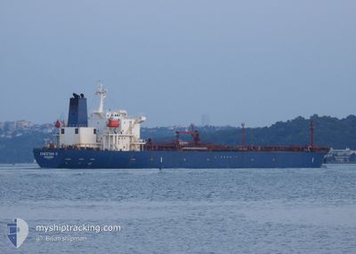
CHEETAH-II
Oil Products Tanker
Current Trip
| Time Travelled | 31 days |
|---|---|
| Remaining Time | 1 day |
| Distance Travelled | 4948.19 nm |
| Remaining Distance | 204.15 nm |
| AVG Speed | 10.4 Knots |
| MAX Speed | 13.8 Knots |
| AVG Wind | 10.7 knots |
| MAX Wind | 31 knots |
| MIN Temp | -0.1°C / 31.82°F |
| MAX Temp | 21.4°C / 70.52°F |
| Draught | 7.5 m |
| Position Received | 1 m ago |
Current Position
| Longitude | 28.82802° |
|---|---|
| Latitude | 40.81071° |
| Status | Under way using engine |
| Speed | 0.9 Knots |
| Course | 63° |
| Area | Sea of Marmara |
| Station | T-AIS |
| Position Received | 1 m ago |
Info
Information
The current position of CHEETAH-II is in Sea of Marmara with coordinates 40.81071° / 28.82802° as reported on 2024-05-23 21:52 by AIS to our vessel tracker app. The vessel's current speed is 0.9 Knots and is heading at the port of CONSTANTA. The estimated time of arrival as calculated by vessel tracking app is 2024-05-25 03:40 LT
The vessel CHEETAH-II (IMO: 9222560, MMSI: 355804000) is a Oil Products Tanker that was built in 2000 ( 24 years old ). It's sailing under the flag of [PA] Panama.
In this page you can find informations about the vessels current position, last detected port calls, and current voyage information. If the vessels is not in coverage by AIS you will find the latest position.
The current position of CHEETAH-II is detected by our AIS receivers and we are not responsible for the reliability of the data. The last position was recorded while the vessel was in Coverage by the Ais receivers of our vessel tracking app.
The current draught of CHEETAH-II as reported by AIS is 7.5 meters
Weather
| Temperature | 16.5°C / 61.7°F |
|---|---|
| Wind Speed | 8 knots |
| Direction | 336° NNW |
| Pressure | 1013 hPa |
| Humidity | 84.8 % |
| Cloud Coverage | 100 % |
Featured Company
Last Port Calls
| Port | Arrival | Departure | Time In Port |
|---|---|---|---|
| 2024-04-21 05:23 | 2024-04-22 19:16 | 1 d | |
| 2024-03-08 21:49 | 2024-03-10 11:16 | 1 d |
Most Visited Ports (Last year)
| Port | Arrivals | |
|---|---|---|
| 8 | ||
| 4 | ||
| 2 | ||
| 2 | ||
| 1 | ||
| 1 |
Last Trips
| Origin | Departure | Destination | Arrival | Distance | |
|---|---|---|---|---|---|
| 2024-03-10 14:16 | 2024-04-21 08:23 | 5511.33 nm | |||
| 2024-01-26 18:14 | 2024-03-09 00:49 | 2126.55 nm |
Events
| Time | Event | Details | Position / Dest | Info |
|---|---|---|---|---|
| 2024-05-23 19:23 | STOP Moving | 7.94 nm, South of YESILKOY |
40.82364 / 28.84362
CONSTANTA/ROMANIA
|
Speed: 0.3 kn Course: 311° |
| 2024-05-23 16:12 | START Moving | 7.02 nm, South of YESILKOY |
40.84648 / 28.88247
CONSTANTA/ROMANIA
|
Speed: 3.2 kn Course: 32° |
| 2024-05-23 15:35 | STOP Moving | 7.11 nm, South East of YESILKOY |
40.84679 / 28.88845
CONSTANTA/ROMANIA
|
Speed: 0.3 kn Course: 23° |
| 2024-05-23 09:00 | START Moving | 16.19 nm, South West of AMBARLI |
40.75471 / 28.44281
CONSTANTA/ROMANIA
|
Speed: 3.4 kn Course: 22° |
| 2024-05-23 08:43 | Status Changed | Under way using engine Default |
40.75166 / 28.43902
CONSTANTA/ROMANIA
|
Speed: 0.5 kn Course: 20° |
| 2024-05-23 08:32 | Status Changed | Default Under way using engine |
40.75086 / 28.43745
CONSTANTA/ROMANIA
|
Speed: 0.3 kn Course: 20° |
| 2024-05-23 07:39 | Status Changed | Under way using engine Default |
40.74695 / 28.43402
CONSTANTA/ROMANIA
|
Speed: 0.2 kn Course: 103° |
| 2024-05-23 07:33 | Status Changed | Default Under way using engine |
40.74637 / 28.43394
CONSTANTA/ROMANIA
|
Speed: 0.2 kn Course: 105° |
| 2024-05-23 06:51 | Status Changed | Under way using engine Default |
40.74302 / 28.43408
CONSTANTA/ROMANIA
|
Speed: 0.2 kn Course: 115° |
| 2024-05-23 06:32 | Status Changed | Default Under way using engine |
40.74153 / 28.43472
CONSTANTA/ROMANIA
|
Speed: 0.1 kn Course: 122° |