
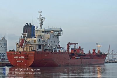
CHEM HYDRA
Oil/Chemical Tanker
Current Trip
| Time Travelled | 4 days |
|---|---|
| Remaining Time | 10 h, 29 mins |
| Distance Travelled | 1096.23 nm |
| Remaining Distance | 134.20 nm |
| AVG Speed | 10.6 Knots |
| MAX Speed | 12.3 Knots |
| AVG Wind | 12.8 knots |
| MAX Wind | 26.3 knots |
| MIN Temp | 21.1°C / 69.98°F |
| MAX Temp | 31.4°C / 88.52°F |
| Draught | 6 m |
| Position Received | 2 h, 43 m ago |
Current Position
| Longitude | 26.53878° |
|---|---|
| Latitude | 40.26890° |
| Status | Under way using engine |
| Speed | 10.8 Knots |
| Course | 48.6° |
| Area | Sea of Marmara |
| Station | T-AIS |
| Position Received | 2 h, 43 m ago |
Info
Information
The current position of CHEM HYDRA is in Sea of Marmara with coordinates 40.26890° / 26.53878° as reported on 2024-06-20 09:28 by AIS to our vessel tracker app. The vessel's current speed is 10.8 Knots and is heading at the port of TUZLA. The estimated time of arrival as calculated by vessel tracking app is 2024-06-20 22:41 LT
The vessel CHEM HYDRA (IMO: 9486180, MMSI: 636017991) is a Oil/Chemical Tanker that was built in 2009 ( 15 years old ). It's sailing under the flag of [LR] Liberia.
In this page you can find informations about the vessels current position, last detected port calls, and current voyage information. If the vessels is not in coverage by AIS you will find the latest position.
The current position of CHEM HYDRA is detected by our AIS receivers and we are not responsible for the reliability of the data. The last position was recorded while the vessel was in Coverage by the Ais receivers of our vessel tracking app.
The current draught of CHEM HYDRA as reported by AIS is 6 meters
Weather
| Temperature | 24.6°C / 76.28°F |
|---|---|
| Wind Speed | 14 knots |
| Direction | 84° E |
| Pressure | 1014.8 hPa |
| Humidity | 67 % |
| Cloud Coverage | --- |
Featured Company
Last Port Calls
| Port | Arrival | Departure | Time In Port |
|---|---|---|---|
| 2024-06-15 07:02 | 2024-06-16 07:24 | 1 d | |
| 2024-06-08 18:51 | 2024-06-09 18:47 | 23 h | |
| 2024-05-25 20:14 | 2024-05-27 12:39 | 1 d | |
| 2024-05-21 10:40 | 2024-05-22 23:04 | 1 d | |
| 2024-05-07 20:50 | 2024-05-10 17:07 | 2 d | |
| 2024-04-25 05:36 | 2024-04-27 06:41 | 2 d | |
| 2024-04-19 15:57 | 2024-04-22 13:45 | 2 d | |
| 2024-04-11 17:11 | 2024-04-14 21:42 | 3 d |
Most Visited Ports (Last year)
| Port | Arrivals | |
|---|---|---|
| 6 | ||
| 5 | ||
| 4 | ||
| 4 | ||
| 3 | ||
| 2 |
Last Trips
| Origin | Departure | Destination | Arrival | Distance | |
|---|---|---|---|---|---|
| 2024-06-09 20:47 | 2024-06-15 09:02 | 1494.29 nm | |||
| 2024-05-27 12:39 | 2024-06-08 20:51 | 3125.21 nm | |||
| 2024-05-22 23:04 | 2024-05-25 20:14 | 468.20 nm | |||
| 2024-05-10 14:07 | 2024-05-21 10:40 | 2673.44 nm | |||
| 2024-04-27 01:41 | 2024-05-07 17:50 | 2485.35 nm | |||
| 2024-04-22 09:45 | 2024-04-25 00:36 | 693.99 nm | |||
| 2024-04-14 16:42 | 2024-04-19 11:57 | 770.90 nm | |||
| 2024-03-28 14:09 | 2024-04-11 12:11 | 1272.40 nm |
Events
| Time | Event | Details | Position / Dest | Info |
|---|---|---|---|---|
| 2024-06-20 09:32 | Status Changed | Default Under way using engine |
40.27603 / 26.54938
TRTUZ
|
Speed: 10.8 kn Course: 48.6° |
| 2024-06-20 09:28 | OUT of Coverage |
40.26890 / 26.53878
Sea of Marmara
TRTUZ
|
Speed: 10.8 kn Course: 48.6° |
|
| 2024-06-20 07:07 | Change Sea Area | Turkish part of the Sea of Marmara Turkish part of the Aegean Sea |
40.01939 / 26.20351
Sea of Marmara
TRTUZ
|
Speed: 9.4 kn Course: 75.1° |
| 2024-06-20 07:02 | Status Changed | Under way using engine Default |
40.01602 / 26.18741
TRTUZ
|
Speed: 8.5 kn Course: 67° |
| 2024-06-20 06:45 | Status Changed | Default Under way using engine |
40.00663 / 26.14766
TRTUZ
|
Speed: 9 kn Course: 74.5° |
| 2024-06-20 06:38 | Status Changed | Under way using engine Default |
40.00275 / 26.12863
TRTUZ
|
Speed: 8.7 kn Course: 70° |
| 2024-06-20 06:21 | IN Coverage |
40.00275 / 26.12863
Aegean Sea
TRTUZ
|
Speed: 9 kn Course: 74.5° |
|
| 2024-06-20 05:07 | Status Changed | Default Under way using engine |
39.90287 / 25.92578
TRTUZ
|
Speed: 10.1 kn Course: 39.5° |
| 2024-06-20 05:03 | OUT of Coverage |
39.89508 / 25.91766
Aegean Sea
TRTUZ
|
Speed: 10.1 kn Course: 39.5° |
|
| 2024-06-20 04:51 | Change Sea Area | Turkish part of the Aegean Sea Greek part of the Aegean Sea |
39.86726 / 25.88923
Aegean Sea
TRTUZ
|
Speed: 10 kn Course: 38.6° |