
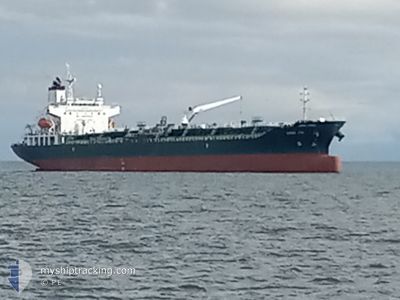
CHEM SOL
Tanker
Current Trip
| Time Travelled | 14 days |
|---|---|
| Remaining Time | --- |
| Distance Travelled | 4742.37 nm |
| Remaining Distance | --- |
| AVG Speed | 13.7 Knots |
| MAX Speed | 19.6 Knots |
| AVG Wind | 14.2 knots |
| MAX Wind | 28 knots |
| MIN Temp | 6.3°C / 43.34°F |
| MAX Temp | 27.7°C / 81.86°F |
| Draught | 9.2 m |
| Position Received | 9 d ago |
Current Position
| Longitude | 141.72081° |
|---|---|
| Latitude | 41.62340° |
| Status | Under way using engine |
| Speed | 14.3 Knots |
| Course | 92.3° |
| Area | North Pacific Ocean |
| Station | T-AIS |
| Position Received | 9 d ago |
Info
Information
The current position of CHEM SOL is in North Pacific Ocean with coordinates 41.62340° / 141.72081° as reported on 2024-05-24 10:24 by AIS to our vessel tracker app. The vessel's current speed is 14.3 Knots and is heading at the port of KALAMA. The estimated time of arrival as calculated by vessel tracking app is 2024-06-06 20:00 LT
The vessel CHEM SOL (IMO: 9739276, MMSI: 636022067) is a Tanker It's sailing under the flag of [LR] Liberia.
In this page you can find informations about the vessels current position, last detected port calls, and current voyage information. If the vessels is not in coverage by AIS you will find the latest position.
The current position of CHEM SOL is detected by our AIS receivers and we are not responsible for the reliability of the data. The last position was recorded while the vessel was in Coverage by the Ais receivers of our vessel tracking app.
The current draught of CHEM SOL as reported by AIS is 9.2 meters
Weather
| Temperature | 11.5°C / 52.7°F |
|---|---|
| Wind Speed | 21 knots |
| Direction | 274° W |
| Pressure | 1016.3 hPa |
| Humidity | 84.6 % |
| Cloud Coverage | 100 % |
Featured Company
Last Port Calls
| Port | Arrival | Departure | Time In Port |
|---|---|---|---|
| 2024-05-18 05:10 | 2024-05-19 01:57 | 20 h | |
| 2024-05-03 07:00 | 2024-05-04 13:12 | 1 d | |
| 2024-04-27 15:17 | 2024-04-28 23:04 | 1 d | |
| 2024-04-21 12:10 | 2024-04-22 03:19 | 15 h | |
| 2024-04-13 17:32 | 2024-04-14 07:05 | 13 h | |
| 2024-04-11 03:33 | 2024-04-12 07:57 | 1 d |
Most Visited Ports (Last year)
| Port | Arrivals | |
|---|---|---|
| 5 | ||
| 3 | ||
| 2 | ||
| 2 | ||
| 1 | ||
| 1 |
Last Trips
| Origin | Departure | Destination | Arrival | Distance | |
|---|---|---|---|---|---|
| 2024-05-04 20:12 | 2024-05-18 13:10 | 3298.68 nm | |||
| 2024-04-29 07:04 | 2024-05-03 14:00 | 401.83 nm | |||
| 2024-04-22 11:19 | 2024-04-27 23:17 | 1640.33 nm | |||
| 2024-04-14 16:05 | 2024-04-21 20:10 | 1378.02 nm | |||
| 2024-04-12 16:57 | 2024-04-14 02:32 | 54.33 nm | |||
| 2024-03-21 14:24 | 2024-04-11 12:33 | 6034.41 nm |
Events
| Time | Event | Details | Position / Dest | Info |
|---|---|---|---|---|
| 2024-05-24 10:29 | Status Changed | Default Under way using engine |
41.62264 / 141.74699
USKAM
|
Speed: 14.3 kn Course: 92.3° |
| 2024-05-24 10:24 | OUT of Coverage |
41.62340 / 141.72081
North Pacific Ocean
USKAM
|
Speed: 14.3 kn Course: 92.3° |
|
| 2024-05-24 09:05 | Change Sea Area | Japanese part of the North Pacific Ocean Japanese part of the Japan Sea |
41.62425 / 141.29579
North Pacific Ocean
USKAM
|
Speed: 14 kn Course: 88.2° |
| 2024-05-24 08:15 | Status Changed | Under way using engine Default |
41.61838 / 141.01196
USKAM
|
Speed: 17.4 kn Course: 89° |
| 2024-05-24 08:13 | Status Changed | Default Under way using engine |
41.61827 / 140.99448
USKAM
|
Speed: 17.2 kn Course: 88.8° |
| 2024-05-24 06:31 | ETA Changed | 2024/06/06 20:00 2024/06/07 12:00 |
41.40021 / 140.46545
USKAM
|
Speed: 18.6 kn Course: 58° |
| 2024-05-24 06:14 | Status Changed | Under way using engine Default |
41.35847 / 140.36789
USKAM
|
Speed: 19.6 kn Course: 62° |
| 2024-05-24 06:04 | Status Changed | Default Under way using engine |
41.33295 / 140.30280
USKAM
|
Speed: 17.7 kn Course: 63.4° |
| 2024-05-24 05:20 | Status Changed | Under way using engine Default |
41.25014 / 140.05581
USKAM
|
Speed: 14.3 kn Course: 74° |
| 2024-05-24 04:55 | Status Changed | Default Under way using engine |
41.22129 / 139.93320
USKAM
|
Speed: 15.1 kn Course: 72.1° |