
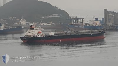
CHEMROAD WING
Oil/Chemical Tanker
Current Trip
| Time Travelled | 4 days |
|---|---|
| Remaining Time | --- |
| Distance Travelled | 1288.21 nm |
| Remaining Distance | --- |
| AVG Speed | 9.6 Knots |
| MAX Speed | 14.7 Knots |
| AVG Wind | 15.1 knots |
| MAX Wind | 29.2 knots |
| MIN Temp | 22.9°C / 73.22°F |
| MAX Temp | 32.6°C / 90.68°F |
| Draught | 10.4 m |
| Position Received | 3 d ago |
Current Position
| Longitude | -92.92938° |
|---|---|
| Latitude | 28.26190° |
| Status | Under way using engine |
| Speed | 11.8 Knots |
| Course | 140° |
| Area | Gulf of Mexico |
| Station | T-AIS |
| Position Received | 3 d ago |
Info
Information
The current position of CHEMROAD WING is in Gulf of Mexico with coordinates 28.26190° / -92.92938° as reported on 2024-05-29 07:00 by AIS to our vessel tracker app. The vessel's current speed is 11.8 Knots and is heading at the port of ARATU. The estimated time of arrival as calculated by vessel tracking app is 2024-06-13 10:00 LT
The vessel CHEMROAD WING (IMO: 9309502, MMSI: 357740000) is a Oil/Chemical Tanker that was built in 2005 ( 19 years old ). It's sailing under the flag of [PA] Panama.
In this page you can find informations about the vessels current position, last detected port calls, and current voyage information. If the vessels is not in coverage by AIS you will find the latest position.
The current position of CHEMROAD WING is detected by our AIS receivers and we are not responsible for the reliability of the data. The last position was recorded while the vessel was in Coverage by the Ais receivers of our vessel tracking app.
The current draught of CHEMROAD WING as reported by AIS is 10.4 meters
Weather
| Temperature | 28.6°C / 83.48°F |
|---|---|
| Wind Speed | 4 knots |
| Direction | 97° E |
| Pressure | 1013.4 hPa |
| Humidity | 67.3 % |
| Cloud Coverage | 100 % |
Featured Company
Last Port Calls
| Port | Arrival | Departure | Time In Port |
|---|---|---|---|
| 2024-05-28 17:51 | 2024-05-28 18:10 | 18 m | |
| 2024-05-27 08:47 | 2024-05-28 06:46 | 21 h | |
| 2024-05-19 06:04 | 2024-05-22 06:47 | 3 d | |
| 2024-05-10 08:19 | 2024-05-10 10:26 | 2 h | |
| 2024-04-17 14:13 | 2024-04-19 04:06 | 1 d |
Most Visited Ports (Last year)
| Port | Arrivals | |
|---|---|---|
| 3 | ||
| 2 | ||
| 2 | ||
| 2 | ||
| 1 | ||
| 1 |
Last Trips
| Origin | Departure | Destination | Arrival | Distance | |
|---|---|---|---|---|---|
| 2024-05-28 01:46 | 2024-05-28 12:51 | 10.45 nm | |||
| 2024-05-22 01:47 | 2024-05-27 03:47 | 1190.96 nm | |||
| 2024-05-10 06:26 | 2024-05-19 01:04 | 2118.33 nm | |||
| 2024-04-19 01:06 | 2024-05-10 04:19 | 5393.48 nm | |||
| 2024-02-20 20:30 | 2024-04-17 11:13 | 10936.28 nm |
Events
| Time | Event | Details | Position / Dest | Info |
|---|---|---|---|---|
| 2024-05-29 07:07 | Status Changed | Default Under way using engine |
28.24362 / -92.91215
BRARB
|
Speed: 11.8 kn Course: 140° |
| 2024-05-29 07:00 | Status Changed | Under way using engine Default |
28.26190 / -92.92938
BRARB
|
Speed: 11.7 kn Course: 149° |
| 2024-05-29 07:00 | OUT of Coverage |
28.26190 / -92.92938
Gulf of Mexico
BRARB
|
Speed: 11.8 kn Course: 140° |
|
| 2024-05-29 06:56 | Status Changed | Default Under way using engine |
28.27248 / -92.93905
BRARB
|
Speed: 11.8 kn Course: 151° |
| 2024-05-29 06:47 | Status Changed | Under way using engine Default |
28.29785 / -92.95527
BRARB
|
Speed: 11.9 kn Course: 148° |
| 2024-05-29 06:42 | Status Changed | Default Under way using engine |
28.31137 / -92.96383
BRARB
|
Speed: 11.9 kn Course: 145° |
| 2024-05-29 06:20 | Status Changed | Under way using engine Default |
28.37245 / -93.01292
BRARB
|
Speed: 12 kn Course: 143° |
| 2024-05-29 06:10 | Status Changed | Default Under way using engine |
28.39805 / -93.03408
BRARB
|
Speed: 11.9 kn Course: 144° |
| 2024-05-29 06:09 | Status Changed | Under way using engine Default |
28.40165 / -93.03710
BRARB
|
Speed: 12 kn Course: 142° |
| 2024-05-29 05:47 | Status Changed | Default Under way using engine |
28.46002 / -93.08791
BRARB
|
Speed: 11.9 kn Course: 143° |