
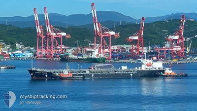
CHEMROUTE PEGASUS
Tanker B
Current Trip
ES LSA
| Time Travelled | 14 days |
|---|---|
| Remaining Time | --- |
| Distance Travelled | 4660.49 nm |
| Remaining Distance | --- |
| AVG Speed | 13.8 Knots |
| MAX Speed | 15.6 Knots |
| AVG Wind | 11.7 knots |
| MAX Wind | 25 knots |
| MIN Temp | 22.1°C / 71.78°F |
| MAX Temp | 31.8°C / 89.24°F |
| Draught | 9.5 m |
| Position Received | 1 h, 41 m ago |
Current Position
| Longitude | 31.59269° |
|---|---|
| Latitude | -31.70273° |
| Status | Under way using engine |
| Speed | 13.4 Knots |
| Course | 211.6° |
| Area | Indian Ocean |
| Station | T-AIS |
| Position Received | 1 h, 41 m ago |
Info
Information
The current position of CHEMROUTE PEGASUS is in Indian Ocean with coordinates -31.70273° / 31.59269° as reported on 2024-05-29 04:58 by AIS to our vessel tracker app. The vessel's current speed is 13.4 Knots
The vessel CHEMROUTE PEGASUS (IMO: 9566162, MMSI: 373530000) is a Tanker B It's sailing under the flag of [PA] Panama.
In this page you can find informations about the vessels current position, last detected port calls, and current voyage information. If the vessels is not in coverage by AIS you will find the latest position.
The current position of CHEMROUTE PEGASUS is detected by our AIS receivers and we are not responsible for the reliability of the data. The last position was recorded while the vessel was in Coverage by the Ais receivers of our vessel tracking app.
The current draught of CHEMROUTE PEGASUS as reported by AIS is 9.5 meters
Weather
| Temperature | 23.4°C / 74.12°F |
|---|---|
| Wind Speed | 19 knots |
| Direction | 19° NNE |
| Pressure | 1020.9 hPa |
| Humidity | 76.7 % |
| Cloud Coverage | 53 % |
Featured Company
Most Visited Ports (Last year)
| Port | Arrivals | |
|---|---|---|
| 8 | ||
| 3 | ||
| 3 | ||
| 3 | ||
| 2 | ||
| 2 |
Last Trips
| Origin | Departure | Destination | Arrival | Distance | |
|---|---|---|---|---|---|
| 2024-05-08 08:46 | 2024-05-12 04:19 | 14.78 nm | |||
| 2024-05-04 05:55 | 2024-05-05 12:04 | 6.40 nm | |||
| 2024-04-05 21:26 | 2024-05-02 12:36 | 7057.93 nm | |||
| 2024-03-29 07:01 | 2024-04-04 10:49 | 707.55 nm | |||
| 2024-02-26 08:11 | 2024-03-27 10:15 | 6672.39 nm |
Events
| Time | Event | Details | Position / Dest | Info |
|---|---|---|---|---|
| 2024-05-29 05:02 | Status Changed | Default Under way using engine |
-31.71601 / 31.58295
ES LSA
|
Speed: 13.4 kn Course: 211.6° |
| 2024-05-29 04:58 | Status Changed | Under way using engine Default |
-31.70273 / 31.59269
ES LSA
|
Speed: 13.5 kn Course: 210° |
| 2024-05-29 04:58 | OUT of Coverage |
-31.70273 / 31.59269
Indian Ocean
ES LSA
|
Speed: 13.4 kn Course: 211.6° |
|
| 2024-05-29 04:24 | Status Changed | Default Under way using engine |
-31.59313 / 31.66981
ES LSA
|
Speed: 14.1 kn Course: 212.6° |
| 2024-05-29 04:19 | Status Changed | Under way using engine Default |
-31.57500 / 31.68341
ES LSA
|
Speed: 14 kn Course: 213° |
| 2024-05-29 04:14 | Status Changed | Default Under way using engine |
-31.56116 / 31.69377
ES LSA
|
Speed: 14 kn Course: 211.9° |
| 2024-05-29 04:06 | Status Changed | Under way using engine Default |
-31.53220 / 31.71523
ES LSA
|
Speed: 14 kn Course: 212° |
| 2024-05-29 04:04 | Status Changed | Default Under way using engine |
-31.52519 / 31.72034
ES LSA
|
Speed: 14.2 kn Course: 212° |
| 2024-05-29 03:39 | Status Changed | Under way using engine Default |
-31.44386 / 31.78050
ES LSA
|
Speed: 14.7 kn Course: 211° |
| 2024-05-29 03:19 | Status Changed | Default Under way using engine |
-31.37682 / 31.83134
ES LSA
|
Speed: 14.5 kn Course: 214.3° |