
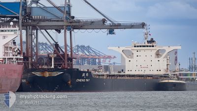
CHENG MAY
Cargo
Aktuelle Reise
| Bisherige Reisezeit | 14 Tage |
|---|---|
| Verbleibende Reisezeit | --- |
| Zurückgelegte Distanz | 4136.63 nm |
| Verbleibende Distanz | --- |
| Durchschnittliche Geschwindigkeit | 10.4 Knoten |
| Maximale Geschwindigkeit | 15 Knoten |
| Durchschnittliche Windgeschwindigkeit | 9.5 Knoten |
| Maximale Windgeschwindigkeit | 26.2 Knoten |
| Minimale Temperatur | 23.4°C / 74.12°F |
| Maximale Temperatur | 29.8°C / 85.64°F |
| Tiefgang | 9.3 m |
| Position erhalten | 6 d alt |
Aktuelle Position
| Länge | --- |
|---|---|
| Breite | --- |
| Zustand | Under way using engine |
| Geschwindigkeit | 11.3 Knoten |
| Kurs | 308.1° |
| Gebiet | Malacca Strait |
| Station | T-AIS |
| Position erhalten | 6 d alt |
Schiffsdetails
Information
Die CHENG MAY befindet sich derzeit in Malacca Strait mit den Koordinaten 1.24901° / 103.40346°, Diese Position wurde am 2024-10-25 15:09 von unserer Schiffsverfolgungs-App über AIS erfasst. Das Schiff fährt momentan mit einer Geschwindigkeit von 11.3 Knoten und fahrt in den Hafen von SALDANHA. Die geschatzte Ankunftszeit, berechnet von der -App zur Schiffsverfolgung, ist 2024-11-14 11:00 LT
Das Schiff CHENG MAY (IMO: 9751028, MMSI: 636016581) ist Cargo und fährt unter der Flagge von [LR] Liberia.
Auf dieser Seite erhalten Sie Informationen zur aktuellen Position des Schiffes, zu den letzten bekannten Hafenanläufen und zu den aktuellen Reiseinformationen. Sollte das Schiff nicht durch AIS abgedeckt sein, wird die zuletzt erfasste Position angezeigt.
Die CHENG MAY wird durch unsere AIS-Empfänger ermittelt. Wir übernehmen keine Gewähr für die Richtigkeit der Daten. Die letzte Position wurde von unseren AIS-Empfängern aufgezeichnet, während das Schiff in Reichweite war.
Der aktuelle Entwurf von CHENG MAY, wie von AIS gemeldet, betragt 9.3 meter
Wetter
| Temperatur | 28°C / 82.4°F |
|---|---|
| Windgeschwindigkeit | 4 Knoten |
| Windrichtung | 136° SE |
| Luftdruck | 1010 hPa |
| Luftfeuchtigkeit | 72.9 % |
| Wolken | 94 % |
Featured Company
Meistbesuchte Häfen (Letztes Jahr)
| Hafen | Ankünfte | |
|---|---|---|
| 2 | ||
| 1 | ||
| 1 | ||
| 1 | ||
| 1 | ||
| 1 |
Events
| Zeit | Ereignis | Details | Position / Ziel | Information |
|---|---|---|---|---|
| 2024-10-25 15:13 | geänderter Status | Default Under way using engine |
1.25578 / 103.39613
SALDANHA BAY
|
Geschwindigkeit: 11.3 kn Kurs: 308.1° |
| 2024-10-25 15:09 | geänderter Status | Under way using engine Default |
1.24902 / 103.40346
SALDANHA BAY
|
Geschwindigkeit: 11.2 kn Kurs: 297° |
| 2024-10-25 15:09 | außerhalb Abdeckung |
1.24902 / 103.40346
Malacca Strait
SALDANHA BAY
|
Geschwindigkeit: 11.3 kn Kurs: 308.1° |
|
| 2024-10-25 15:04 | geänderter Status | Default Under way using engine |
1.23961 / 103.41734
SALDANHA BAY
|
Geschwindigkeit: 11.3 kn Kurs: 284.8° |
| 2024-10-25 14:50 | Ändere Seegebiet | Malaysian part of the Malacca Strait Malaysian part of the Singapore Strait |
1.22782 / 103.45855
Malacca Strait
SALDANHA BAY
|
Geschwindigkeit: 11.2 kn Kurs: 281.4° |
| 2024-10-25 14:07 | Ändere Seegebiet | Malaysian part of the Singapore Strait Indonesian part of the Singapore Strait |
1.19397 / 103.58816
Singapore Strait
SALDANHA BAY
|
Geschwindigkeit: 11 kn Kurs: 285.4° |
| 2024-10-25 13:40 | Ändere Seegebiet | Indonesian part of the Singapore Strait Singaporean part of the Singapore Strait |
1.18187 / 103.66621
Singapore Strait
SALDANHA BAY
|
Geschwindigkeit: 10.3 kn Kurs: 295.1° |
| 2024-10-25 11:19 | Ändere Seegebiet | Singaporean part of the Singapore Strait Indonesian part of the Singapore Strait |
1.26470 / 104.01959
Singapore Strait
SALDANHA BAY
|
Geschwindigkeit: 7.8 kn Kurs: 265.8° |
| 2024-10-25 11:14 | Ändere Seegebiet | Indonesian part of the Singapore Strait Singaporean part of the Singapore Strait |
1.26630 / 104.02990
Singapore Strait
SALDANHA BAY
|
Geschwindigkeit: 6.9 kn Kurs: 248.1° |
| 2024-10-25 11:07 | geändertes Ziel | SALDANHA BAY SALDANHA |
1.27859 / 104.04092
SALDANHA BAY
|
Geschwindigkeit: 9.7 kn Kurs: 220.1° |