
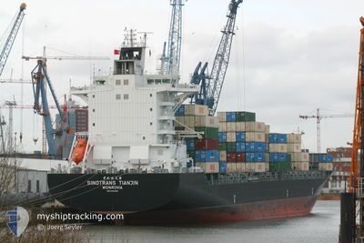
CHIQUITA EXPLORER
Container Ship
Current Trip
| Time Travelled | 19 h, 51 mins |
|---|---|
| Remaining Time | 18 h, 47 mins |
| Distance Travelled | 310.34 nm |
| Remaining Distance | 335.24 nm |
| AVG Speed | 16.5 Knots |
| MAX Speed | 17.4 Knots |
| AVG Wind | 13.3 knots |
| MAX Wind | 17.5 knots |
| MIN Temp | 27.9°C / 82.22°F |
| MAX Temp | 30.1°C / 86.18°F |
| Draught | 8.4 m |
| Position Received | 17 h, 34 m ago |
Current Position
| Longitude | -87.71616° |
|---|---|
| Latitude | 16.33952° |
| Status | Under way using engine |
| Speed | 16.5 Knots |
| Course | 31.9° |
| Area | Caribbean Sea |
| Station | T-AIS |
| Position Received | 17 h, 34 m ago |
Info
Information
The current position of CHIQUITA EXPLORER is in Caribbean Sea with coordinates 16.33952° / -87.71616° as reported on 2024-05-30 18:42 by AIS to our vessel tracker app. The vessel's current speed is 16.5 Knots and is heading at the port of PUERTO BARRIOS. The estimated time of arrival as calculated by vessel tracking app is 2024-06-01 07:04 LT
The vessel CHIQUITA EXPLORER (IMO: 9304966, MMSI: 636022893) is a Container Ship that was built in 2005 ( 19 years old ). It's sailing under the flag of [LR] Liberia.
In this page you can find informations about the vessels current position, last detected port calls, and current voyage information. If the vessels is not in coverage by AIS you will find the latest position.
The current position of CHIQUITA EXPLORER is detected by our AIS receivers and we are not responsible for the reliability of the data. The last position was recorded while the vessel was in Coverage by the Ais receivers of our vessel tracking app.
The current draught of CHIQUITA EXPLORER as reported by AIS is 8.4 meters
Weather
| Temperature | 29°C / 84.2°F |
|---|---|
| Wind Speed | 12 knots |
| Direction | 86° E |
| Pressure | 1013.6 hPa |
| Humidity | 74.9 % |
| Cloud Coverage | 3 % |
Featured Company
Last Port Calls
| Port | Arrival | Departure | Time In Port |
|---|---|---|---|
| 2024-05-30 06:47 | 2024-05-30 16:26 | 9 h | |
| 2024-05-28 17:31 | 2024-05-29 20:00 | 1 d | |
| 2024-05-25 17:39 | 2024-05-26 03:30 | 9 h | |
| 2024-05-25 17:06 | 2024-05-25 17:18 | 11 m | |
| 2024-05-21 04:18 | 2024-05-23 10:22 | 2 d | |
| 2024-05-15 07:45 | 2024-05-16 11:50 | 1 d | |
| 2024-05-14 15:53 | 2024-05-15 02:41 | 10 h | |
| 2024-05-11 17:22 | 2024-05-12 05:10 | 11 h | |
| 2024-05-11 16:52 | 2024-05-11 17:02 | 10 m | |
| 2024-05-07 04:42 | 2024-05-09 04:20 | 1 d |
Most Visited Ports (Last year)
| Port | Arrivals | |
|---|---|---|
| 10 | ||
| 8 | ||
| 6 | ||
| 5 | ||
| 4 |
Last Trips
| Origin | Departure | Destination | Arrival | Distance | |
|---|---|---|---|---|---|
| 2024-05-29 14:00 | 2024-05-30 00:47 | 70.68 nm | |||
| 2024-05-25 23:30 | 2024-05-28 11:31 | 900.04 nm | |||
| 2024-05-25 13:18 | 2024-05-25 13:39 | 0.80 nm | |||
| 2024-05-23 06:22 | 2024-05-25 13:06 | 900.21 nm | |||
| 2024-05-16 05:50 | 2024-05-21 00:18 | 1766.19 nm | |||
| 2024-05-14 20:41 | 2024-05-15 01:45 | 62.08 nm | |||
| 2024-05-12 01:10 | 2024-05-14 09:53 | 872.63 nm | |||
| 2024-05-11 13:02 | 2024-05-11 13:22 | 1.02 nm | |||
| 2024-05-09 00:20 | 2024-05-11 12:52 | 908.89 nm | |||
| 2024-05-02 08:17 | 2024-05-07 00:42 | 1755.94 nm |
Events
| Time | Event | Details | Position / Dest | Info |
|---|---|---|---|---|
| 2024-05-30 18:49 | Status Changed | Default Under way using engine |
16.36285 / -87.69984
GTPBR
|
Speed: 16.5 kn Course: 31.9° |
| 2024-05-30 18:42 | OUT of Coverage |
16.33952 / -87.71616
Caribbean Sea
|
Speed: 16.5 kn Course: 31.9° |
|
| 2024-05-30 18:17 | Change Sea Area | Belizean part of the Caribbean Sea Honduran part of the Caribbean Sea |
16.24035 / -87.78201
Caribbean Sea
|
Speed: 17.2 kn Course: 33.3° |
| 2024-05-30 18:15 | Status Changed | Under way using engine Default |
16.23228 / -87.78750
GTPBR
|
Speed: 17 kn Course: 32° |
| 2024-05-30 18:11 | Status Changed | Default Under way using engine |
16.21666 / -87.79667
GTPBR
|
Speed: 17.4 kn Course: 34.3° |
| 2024-05-30 18:02 | Status Changed | Under way using engine Default |
16.18044 / -87.82361
GTPBR
|
Speed: 17 kn Course: 36° |
| 2024-05-30 17:56 | Status Changed | Default Under way using engine |
16.15667 / -87.84167
GTPBR
|
Speed: 17.2 kn Course: 34.6° |
| 2024-05-30 17:44 | Status Changed | Under way using engine Default |
16.10750 / -87.87825
GTPBR
|
Speed: 17 kn Course: 34° |
| 2024-05-30 17:32 | Status Changed | Default Under way using engine |
16.06167 / -87.90833
GTPBR
|
Speed: 17.3 kn Course: 32.6° |
| 2024-05-30 17:25 | Change Sea Area | Honduran part of the Caribbean Sea Bahamas part of the North Atlantic Ocean |
16.03100 / -87.93076
Caribbean Sea
|
Speed: 17.2 kn Course: 32.4° |