
CHIQUITA FARMER
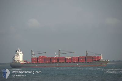
Container Ship
Current Trip
| Time Travelled | 5 days |
|---|---|
| Remaining Time | --- |
| Distance Travelled | 1958.51 nm |
| Remaining Distance | --- |
| AVG Speed | 15 Knots |
| MAX Speed | 19.4 Knots |
| AVG Wind | 13.9 knots |
| MAX Wind | 21 knots |
| MIN Temp | 11.3°C / 52.34°F |
| MAX Temp | 22.6°C / 72.68°F |
| Draught | 8.4 m |
| Position Received | 1 d ago |
Current Position
| Longitude | -29.39364° |
|---|---|
| Latitude | 39.96073° |
| Status | Under way using engine |
| Speed | 15.1 Knots |
| Course | 239° |
| Area | North Atlantic Ocean |
| Station | T-AIS |
| Position Received | 1 d ago |
Info
Information
The current position of CHIQUITA FARMER is in North Atlantic Ocean with coordinates 39.96073° / -29.39364° as reported on 2024-06-24 03:04 by AIS to our vessel tracker app. The vessel's current speed is 15.1 Knots and is heading at the port of MOIN. The estimated time of arrival as calculated by vessel tracking app is 2024-07-03 19:00 LT
The vessel CHIQUITA FARMER (IMO: 9336189, MMSI: 211256150) is a Container Ship that was built in 2007 ( 17 years old ). It's sailing under the flag of [DE] Germany.
In this page you can find informations about the vessels current position, last detected port calls, and current voyage information. If the vessels is not in coverage by AIS you will find the latest position.
The current position of CHIQUITA FARMER is detected by our AIS receivers and we are not responsible for the reliability of the data. The last position was recorded while the vessel was in Coverage by the Ais receivers of our vessel tracking app.
The current draught of CHIQUITA FARMER as reported by AIS is 8.4 meters
Weather
| Temperature | 22.3°C / 72.14°F |
|---|---|
| Wind Speed | 7 knots |
| Direction | 264° W |
| Pressure | 1023.1 hPa |
| Humidity | 80.5 % |
| Cloud Coverage | 65 % |
Featured Company
Last Port Calls
| Port | Arrival | Departure | Time In Port |
|---|---|---|---|
| 2024-06-16 15:14 | 2024-06-19 14:48 | 2 d | |
| 2024-06-15 17:33 | 2024-06-16 03:16 | 9 h | |
| 2024-06-02 03:41 | 2024-06-02 08:21 | 4 h | |
| 2024-05-30 08:59 | 2024-05-31 10:35 | 1 d | |
| 2024-05-12 15:37 | 2024-05-15 18:18 | 3 d | |
| 2024-05-11 13:27 | 2024-05-12 02:15 | 12 h | |
| 2024-04-28 10:40 | 2024-04-28 15:48 | 5 h | |
| 2024-04-25 14:45 | 2024-04-26 18:48 | 1 d | |
| 2024-04-07 19:01 | 2024-04-10 17:45 | 2 d | |
| 2024-04-06 21:38 | 2024-04-07 08:23 | 10 h |
Most Visited Ports (Last year)
| Port | Arrivals | |
|---|---|---|
| 14 | ||
| 8 | ||
| 7 | ||
| 6 | ||
| 3 | ||
| 2 |
Last Trips
| Origin | Departure | Destination | Arrival | Distance | |
|---|---|---|---|---|---|
| 2024-06-16 04:16 | 2024-06-16 17:14 | 119.82 nm | |||
| 2024-06-02 03:21 | 2024-06-15 18:33 | 4882.31 nm | |||
| 2024-05-31 05:35 | 2024-06-01 22:41 | 3.94 nm | |||
| 2024-05-15 20:18 | 2024-05-30 03:59 | 4960.53 nm | |||
| 2024-05-12 03:15 | 2024-05-12 17:37 | 122.71 nm | |||
| 2024-04-28 10:48 | 2024-05-11 14:27 | 5000.05 nm | |||
| 2024-04-26 13:48 | 2024-04-28 05:40 | 3.13 nm | |||
| 2024-04-10 19:45 | 2024-04-25 09:45 | 4998.16 nm | |||
| 2024-04-07 09:23 | 2024-04-07 21:01 | 120.92 nm | |||
| 2024-03-23 16:56 | 2024-04-06 22:38 | 5100.87 nm |
Events
| Time | Event | Details | Position / Dest | Info |
|---|---|---|---|---|
| 2024-06-24 03:10 | Status Changed | Default Under way using engine |
39.94893 / -29.42207
CR PMN
|
Speed: 15.1 kn Course: 239° |
| 2024-06-24 03:04 | Status Changed | Under way using engine Default |
39.96073 / -29.39364
CR PMN
|
Speed: 15.2 kn Course: 240° |
| 2024-06-24 03:04 | OUT of Coverage |
39.96073 / -29.39364
North Atlantic Ocean
CR PMN
|
Speed: 15.1 kn Course: 239° |
|
| 2024-06-24 02:59 | Status Changed | Default Under way using engine |
39.97219 / -29.36791
CR PMN
|
Speed: 15.4 kn Course: 240° |
| 2024-06-24 01:55 | Status Changed | Under way using engine Default |
40.10374 / -29.05941
CR PMN
|
Speed: 15 kn Course: 242° |
| 2024-06-24 01:47 | Status Changed | Default Under way using engine |
40.12043 / -29.02029
CR PMN
|
Speed: 15.1 kn Course: 239.5° |
| 2024-06-24 00:02 | Detected in Sea | Portuguese (Azores) part of the North Atlantic Ocean |
40.31914 / -28.53743
North Atlantic Ocean
CR PMN
|
Speed: 13.5 kn Course: 243.4° |
| 2024-06-24 00:02 | Status Changed | Under way using engine Default |
40.31914 / -28.53743
CR PMN
|
Speed: 14 kn Course: 245° |
| 2024-06-24 00:02 | IN Coverage |
40.31914 / -28.53743
North Atlantic Ocean
CR PMN
|
Speed: 13.5 kn Course: 243.4° |
|
| 2024-06-21 00:11 | OUT of Coverage |
48.75042 / -7.83548
Celtic Sea
CR PMN
|
Speed: 14.2 kn Course: 248.1° |