
CHRIS. DE MARGERIE
Tanker D
Current Trip
FOR ORDER
| Time Travelled | 5 days |
|---|---|
| Remaining Time | --- |
| Distance Travelled | 2403.05 nm |
| Remaining Distance | --- |
| AVG Speed | 17.6 Knots |
| MAX Speed | 20.9 Knots |
| AVG Wind | 9 knots |
| MAX Wind | 25 knots |
| MIN Temp | 0.1°C / 32.18°F |
| MAX Temp | 16.7°C / 62.06°F |
| Draught | 11.4 m |
| Position Received | 2 d ago |
Current Position
| Longitude | 27.35562° |
|---|---|
| Latitude | 72.46174° |
| Status | Under way using engine |
| Speed | 18.4 Knots |
| Course | 53.9° |
| Area | Barentsz Sea |
| Station | T-AIS |
| Position Received | 2 d ago |
Info
Information
The current position of CHRIS. DE MARGERIE is in Barentsz Sea with coordinates 72.46174° / 27.35562° as reported on 2024-06-24 16:13 by AIS to our vessel tracker app. The vessel's current speed is 18.4 Knots
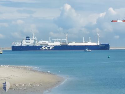
The vessel CHRIS. DE MARGERIE (IMO: 9737187, MMSI: 352002442) is a Tanker D It's sailing under the flag of [PA] Panama.
In this page you can find informations about the vessels current position, last detected port calls, and current voyage information. If the vessels is not in coverage by AIS you will find the latest position.
The current position of CHRIS. DE MARGERIE is detected by our AIS receivers and we are not responsible for the reliability of the data. The last position was recorded while the vessel was in Coverage by the Ais receivers of our vessel tracking app.
The current draught of CHRIS. DE MARGERIE as reported by AIS is 11.4 meters
Weather
| Temperature | 0.5°C / 32.9°F |
|---|---|
| Wind Speed | 10 knots |
| Direction | 25° NNE |
| Pressure | 1001.8 hPa |
| Humidity | 98.5 % |
| Cloud Coverage | 100 % |
Featured Company
Last Port Calls
| Port | Arrival | Departure | Time In Port |
|---|---|---|---|
| 2024-06-20 07:52 | 2024-06-21 06:46 | 22 h | |
| 2024-06-11 07:43 | |||
| 2024-05-19 05:45 | 2024-05-20 06:05 | 1 d | |
| 2024-05-10 22:18 | 2024-05-11 22:50 | 1 d | |
| 2024-05-03 05:27 | 2024-05-04 05:08 | 23 h | |
| 2024-04-23 19:40 | 2024-04-25 11:24 | 1 d | |
| 2024-04-12 07:34 | 2024-04-13 08:39 | 1 d | |
| 2024-04-04 10:50 | 2024-04-05 11:30 | 1 d |
Last Trips
| Origin | Departure | Destination | Arrival | Distance | |
|---|---|---|---|---|---|
| 2024-06-11 12:43 | 2024-06-20 09:52 | 2674.84 nm | |||
| 2024-05-12 03:50 | 2024-05-19 07:45 | 2646.44 nm | |||
| 2024-05-04 07:08 | 2024-05-11 03:18 | 2634.02 nm | |||
| 2024-04-25 16:24 | 2024-05-03 07:27 | 2649.75 nm | |||
| 2024-04-13 13:39 | 2024-04-24 00:40 | 2383.02 nm | |||
| 2024-04-05 13:30 | 2024-04-12 12:34 | 2651.89 nm | |||
| 2024-03-27 07:16 | 2024-04-04 12:50 | 2641.18 nm |
Events
| Time | Event | Details | Position / Dest | Info |
|---|---|---|---|---|
| 2024-06-24 16:51 | Status Changed | Default Under way using engine |
72.57228 / 27.87315
FOR ORDER
|
Speed: 18.4 kn Course: 53.9° |
| 2024-06-24 16:13 | OUT of Coverage |
72.46174 / 27.35562
Barentsz Sea
FOR ORDER
|
Speed: 18.4 kn Course: 53.9° |
|
| 2024-06-24 12:36 | Change Sea Area | Norwegian part of the Barentsz Sea Norwegian part of the Norwegian Sea |
71.82489 / 24.39260
Barentsz Sea
FOR ORDER
|
Speed: 18.6 kn Course: 55° |
| 2024-06-23 14:30 | Status Changed | Under way using engine Default |
67.42270 / 9.16080
FOR ORDER
|
Speed: 19.1 kn Course: 28° |
| 2024-06-23 14:21 | IN Coverage |
67.42270 / 9.16080
Norwegian Sea
FOR ORDER
|
Speed: 19.2 kn Course: 27° |
|
| 2024-06-23 03:40 | Status Changed | Default Under way using engine |
64.34412 / 5.66547
FOR ORDER
|
Speed: 19.3 kn Course: 23.6° |
| 2024-06-23 03:35 | OUT of Coverage |
64.32361 / 5.64484
Norwegian Sea
FOR ORDER
|
Speed: 19.3 kn Course: 23.6° |
|
| 2024-06-23 03:16 | Status Changed | Under way using engine Default |
64.22900 / 5.54455
FOR ORDER
|
Speed: 19.2 kn Course: 25° |
| 2024-06-23 03:07 | Status Changed | Default Under way using engine |
64.18637 / 5.49941
FOR ORDER
|
Speed: 19.2 kn Course: 25.4° |
| 2024-06-22 16:41 | Change Sea Area | Norwegian part of the Norwegian Sea Norwegian part of the North Sea |
61.01042 / 4.18405
Norwegian Sea
FOR ORDER
|
Speed: 19.3 kn Course: 1.7° |