
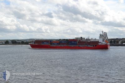
CHRISTINA
Container Ship
Current Trip
| Time Travelled | 2 days |
|---|---|
| Remaining Time | 10 h, 39 mins |
| Distance Travelled | 849.16 nm |
| Remaining Distance | 751.90 nm |
| AVG Speed | 14.6 Knots |
| MAX Speed | 17.9 Knots |
| AVG Wind | 17.3 knots |
| MAX Wind | 33 knots |
| MIN Temp | 12.1°C / 53.78°F |
| MAX Temp | 17.3°C / 63.14°F |
| Draught | 7.9 m |
| Position Received | 27 m ago |
Current Position
| Longitude | -10.08704° |
|---|---|
| Latitude | 41.12608° |
| Status | Under way using engine |
| Speed | 15.1 Knots |
| Course | 176.8° |
| Area | North Atlantic Ocean |
| Station | T-AIS |
| Position Received | 27 m ago |
Info
Information
The current position of CHRISTINA is in North Atlantic Ocean with coordinates 41.12608° / -10.08704° as reported on 2024-05-31 13:50 by AIS to our vessel tracker app. The vessel's current speed is 15.1 Knots and is heading at the port of SETUBAL. The estimated time of arrival as calculated by vessel tracking app is 2024-06-01 00:56 LT
The vessel CHRISTINA (IMO: 9429211, MMSI: 255806310) is a Container Ship that was built in 2010 ( 14 years old ). It's sailing under the flag of [PT] Portugal.
In this page you can find informations about the vessels current position, last detected port calls, and current voyage information. If the vessels is not in coverage by AIS you will find the latest position.
The current position of CHRISTINA is detected by our AIS receivers and we are not responsible for the reliability of the data. The last position was recorded while the vessel was in Coverage by the Ais receivers of our vessel tracking app.
The current draught of CHRISTINA as reported by AIS is 7.9 meters
Weather
| Temperature | 17.3°C / 63.14°F |
|---|---|
| Wind Speed | 19 knots |
| Direction | 5° N |
| Pressure | 1011.9 hPa |
| Humidity | 76.3 % |
| Cloud Coverage | --- |
Featured Company
Last Port Calls
| Port | Arrival | Departure | Time In Port |
|---|---|---|---|
| 2024-05-28 01:06 | 2024-05-29 06:50 | 1 d | |
| 2024-05-27 05:47 | 2024-05-27 23:26 | 17 h | |
| 2024-05-26 09:24 | 2024-05-26 19:33 | 10 h | |
| 2024-05-21 10:51 | 2024-05-22 17:22 | 1 d | |
| 2024-05-19 20:06 | 2024-05-20 20:24 | 1 d | |
| 2024-05-18 00:57 | 2024-05-18 09:29 | 8 h | |
| 2024-05-17 05:14 | 2024-05-17 11:16 | 6 h | |
| 2024-05-15 15:50 | 2024-05-15 23:50 | 8 h | |
| 2024-05-14 16:28 | 2024-05-15 07:24 | 14 h | |
| 2024-05-13 21:47 | 2024-05-14 08:08 | 10 h |
Most Visited Ports (Last year)
| Port | Arrivals | |
|---|---|---|
| 49 | ||
| 46 | ||
| 46 | ||
| 44 | ||
| 44 | ||
| 3 |
Last Trips
| Origin | Departure | Destination | Arrival | Distance | |
|---|---|---|---|---|---|
| 2024-05-26 20:33 | 2024-05-28 02:06 | 123.32 nm | |||
| 2024-05-26 20:33 | 2024-05-27 06:47 | 103.38 nm | |||
| 2024-05-22 18:22 | 2024-05-26 10:24 | 1042.17 nm | |||
| 2024-05-20 21:24 | 2024-05-21 11:51 | 231.24 nm | |||
| 2024-05-18 10:29 | 2024-05-19 21:06 | 494.39 nm | |||
| 2024-05-17 13:16 | 2024-05-18 01:57 | 214.26 nm | |||
| 2024-05-16 01:50 | 2024-05-17 07:14 | 424.96 nm | |||
| 2024-05-15 09:24 | 2024-05-15 17:50 | 127.39 nm | |||
| 2024-05-14 10:08 | 2024-05-14 18:28 | 130.29 nm | |||
| 2024-05-11 23:40 | 2024-05-13 23:47 | 724.08 nm |
Events
| Time | Event | Details | Position / Dest | Info |
|---|---|---|---|---|
| 2024-05-31 13:56 | Status Changed | Default Under way using engine |
41.10083 / -10.08617
PT SET
|
Speed: 15.1 kn Course: 176.8° |
| 2024-05-31 13:48 | Status Changed | Under way using engine Default |
41.13191 / -10.08719
PT SET
|
Speed: 15 kn Course: 176° |
| 2024-05-31 13:19 | Status Changed | Default Under way using engine |
41.25313 / -10.09163
PT SET
|
Speed: 14.7 kn Course: 183.2° |
| 2024-05-31 13:15 | Detected in Sea | Portuguese part of the North Atlantic Ocean |
41.26681 / -10.09182
North Atlantic Ocean
PT SET
|
Speed: 14.7 kn Course: 183.2° |
| 2024-05-31 13:14 | Status Changed | Under way using engine Default |
41.27387 / -10.09168
PT SET
|
Speed: 15 kn Course: 180° |
| 2024-05-31 13:14 | IN Coverage |
41.26681 / -10.09182
North Atlantic Ocean
PT SET
|
Speed: 14.7 kn Course: 183.2° |
|
| 2024-05-29 17:51 | Status Changed | Default Under way using engine |
51.99416 / -5.81352
PT SET
|
Speed: 17.4 kn Course: 201.3° |
| 2024-05-29 17:08 | OUT of Coverage |
52.19077 / -5.68928
Irish Sea and St. George's Channel
PT SET
|
Speed: 17.4 kn Course: 201.3° |
|
| 2024-05-29 17:02 | Status Changed | Under way using engine Default |
52.21456 / -5.67392
PT SET
|
Speed: 17 kn Course: 204° |
| 2024-05-29 16:52 | Status Changed | Default Under way using engine |
52.26317 / -5.64267
PT SET
|
Speed: 17.2 kn Course: 201.6° |