
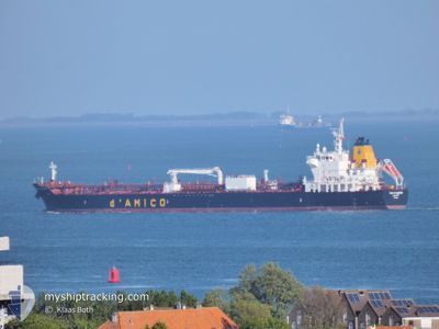
CIELO DI SALERNO
Tanker
Current Trip
MR NDB ANCH.
| Time Travelled | 7 days |
|---|---|
| Remaining Time | --- |
| Distance Travelled | 146.51 nm |
| Remaining Distance | --- |
| AVG Speed | 10.9 Knots |
| MAX Speed | 13.8 Knots |
| AVG Wind | 18.3 knots |
| MAX Wind | 25.5 knots |
| MIN Temp | 18.1°C / 64.58°F |
| MAX Temp | 20.2°C / 68.36°F |
| Draught | 8 m |
| Position Received | 2 d ago |
Current Position
| Longitude | -17.01940° |
|---|---|
| Latitude | 20.81196° |
| Status | At anchor |
| Speed | |
| Course | 9° |
| Area | North Atlantic Ocean |
| Station | T-AIS |
| Position Received | 2 d ago |
Info
Information
The current position of CIELO DI SALERNO is in North Atlantic Ocean with coordinates 20.81196° / -17.01940° as reported on 2024-06-24 06:31 by AIS to our vessel tracker app. The vessel's current speed is 0 Knots
The vessel CIELO DI SALERNO (IMO: 9717292, MMSI: 249775000) is a Tanker It's sailing under the flag of [MT] Malta.
In this page you can find informations about the vessels current position, last detected port calls, and current voyage information. If the vessels is not in coverage by AIS you will find the latest position.
The current position of CIELO DI SALERNO is detected by our AIS receivers and we are not responsible for the reliability of the data. The last position was recorded while the vessel was in Coverage by the Ais receivers of our vessel tracking app.
The current draught of CIELO DI SALERNO as reported by AIS is 8 meters
Weather
| Temperature | 18.5°C / 65.3°F |
|---|---|
| Wind Speed | 19 knots |
| Direction | 360° N |
| Pressure | 1011.8 hPa |
| Humidity | 87.3 % |
| Cloud Coverage | 5 % |
Featured Company
Last Port Calls
| Port | Arrival | Departure | Time In Port |
|---|---|---|---|
| 2024-06-16 12:42 | 2024-06-19 11:10 | 2 d | |
| 2024-06-04 16:44 | 2024-06-08 00:12 | 3 d | |
| 2024-05-22 12:17 | 2024-05-24 11:01 | 1 d | |
| 2024-05-14 09:42 | 2024-05-15 12:54 | 1 d | |
| 2024-05-07 13:38 | 2024-05-10 10:45 | 2 d | |
| 2024-04-26 17:57 | 2024-04-29 08:44 | 2 d | |
| 2024-04-16 10:48 | 2024-04-18 16:37 | 2 d |
Last Trips
| Origin | Departure | Destination | Arrival | Distance | |
|---|---|---|---|---|---|
| 2024-06-08 02:12 | 2024-06-16 12:42 | 2325.19 nm | |||
| 2024-05-24 11:01 | 2024-06-04 18:44 | 2329.75 nm | |||
| 2024-05-15 12:54 | 2024-05-22 12:17 | 940.80 nm | |||
| 2024-05-10 10:45 | 2024-05-14 09:42 | 954.04 nm | |||
| 2024-04-29 10:44 | 2024-05-07 13:38 | 2323.23 nm | |||
| 2024-04-18 16:37 | 2024-04-26 19:57 | 2315.22 nm | |||
| 2024-03-28 16:23 | 2024-04-16 10:48 | 285.04 nm |
Events
| Time | Event | Details | Position / Dest | Info |
|---|---|---|---|---|
| 2024-06-26 19:19 | STOP Moving | 1 nm, South East of CASADO |
20.81084 / -17.01894
MR NDB ANCH.
|
Speed: Course: 7° |
| 2024-06-26 06:39 | START Moving | 1.12 nm, South East of CASADO |
20.80665 / -17.01893
MR NDB ANCH.
|
Speed: 6.2 kn Course: 211° |
| 2024-06-24 06:37 | Status Changed | Default At anchor |
20.81193 / -17.01938
MR NDB ANCH.
|
Speed: Course: 9° |
| 2024-06-24 06:31 | Status Changed | At anchor Default |
20.81196 / -17.01940
MR NDB ANCH.
|
Speed: Course: 11° |
| 2024-06-24 06:31 | OUT of Coverage |
20.81196 / -17.01940
North Atlantic Ocean
|
Speed: Course: 104.3° |
|
| 2024-06-24 06:13 | IN Coverage |
20.81196 / -17.01940
North Atlantic Ocean
|
Speed: Course: 104.3° |
|
| 2024-06-24 04:55 | Status Changed | Default At anchor |
20.81196 / -17.01947
MR NDB ANCH.
|
Speed: Course: 11° |
| 2024-06-24 04:43 | Status Changed | At anchor Default |
20.81193 / -17.01949
MR NDB ANCH.
|
Speed: Course: 12° |
| 2024-06-24 04:43 | OUT of Coverage |
20.81193 / -17.01949
North Atlantic Ocean
|
Speed: Course: 181.3° |
|
| 2024-06-24 04:37 | Status Changed | Default At anchor |
20.81197 / -17.01956
MR NDB ANCH.
|
Speed: 0.1 kn Course: 8° |