
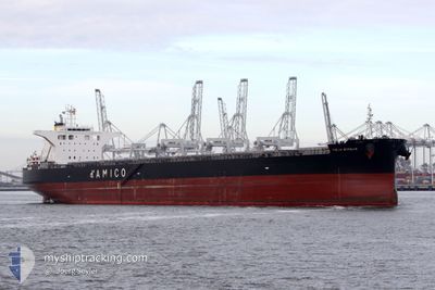
CIELO D'ITALIA
Cargo
Current Trip
| Time Travelled | 4 days |
|---|---|
| Remaining Time | --- |
| Distance Travelled | 1075.70 nm |
| Remaining Distance | --- |
| AVG Speed | 10.9 Knots |
| MAX Speed | 13.8 Knots |
| AVG Wind | 8.8 knots |
| MAX Wind | 25.8 knots |
| MIN Temp | 19.9°C / 67.82°F |
| MAX Temp | 28.7°C / 83.66°F |
| Draught | 8.7 m |
| Position Received | 15 h, 28 m ago |
Current Position
| Longitude | 121.25773° |
|---|---|
| Latitude | 25.60899° |
| Status | Under way using engine |
| Speed | 9.9 Knots |
| Course | 225° |
| Area | Eastern China Sea |
| Station | T-AIS |
| Position Received | 15 h, 28 m ago |
Info
Information
The current position of CIELO D'ITALIA is in Eastern China Sea with coordinates 25.60899° / 121.25773° as reported on 2024-06-25 20:24 by AIS to our vessel tracker app. The vessel's current speed is 9.9 Knots and is heading at the port of ONSLOW. The estimated time of arrival as calculated by vessel tracking app is 2024-07-06 12:00 LT
The vessel CIELO D'ITALIA (IMO: 9539274, MMSI: 636019932) is a Cargo It's sailing under the flag of [LR] Liberia.
In this page you can find informations about the vessels current position, last detected port calls, and current voyage information. If the vessels is not in coverage by AIS you will find the latest position.
The current position of CIELO D'ITALIA is detected by our AIS receivers and we are not responsible for the reliability of the data. The last position was recorded while the vessel was in Coverage by the Ais receivers of our vessel tracking app.
The current draught of CIELO D'ITALIA as reported by AIS is 8.7 meters
Weather
| Temperature | 29.6°C / 85.28°F |
|---|---|
| Wind Speed | 8 knots |
| Direction | 12° NNE |
| Pressure | 1011.8 hPa |
| Humidity | 76.6 % |
| Cloud Coverage | 58 % |
Featured Company
Last Port Calls
| Port | Arrival | Departure | Time In Port |
|---|---|---|---|
| 2024-06-19 09:21 | 2024-06-22 02:23 | 2 d | |
| 2024-06-03 00:38 | 2024-06-04 13:27 | 1 d | |
| 2024-04-26 08:03 | 2024-04-28 00:20 | 1 d | |
| 2024-04-07 03:51 | 2024-04-10 11:12 | 3 d |
Most Visited Ports (Last year)
| Port | Arrivals | |
|---|---|---|
| 3 | ||
| 2 | ||
| 1 | ||
| 1 | ||
| 1 | ||
| 1 |
Last Trips
| Origin | Departure | Destination | Arrival | Distance | |
|---|---|---|---|---|---|
| 2024-06-04 21:27 | 2024-06-19 17:21 | 3886.31 nm | |||
| 2024-04-28 08:20 | 2024-06-03 08:38 | 6358.27 nm | |||
| 2024-04-10 19:12 | 2024-04-26 16:03 | 2913.46 nm | |||
| 2024-03-23 23:35 | 2024-04-07 11:51 | 2873.74 nm |
Events
| Time | Event | Details | Position / Dest | Info |
|---|---|---|---|---|
| 2024-06-25 20:24 | Status Changed | Default Under way using engine |
25.60833 / 121.25701
AU ONS
|
Speed: 9.9 kn Course: 225° |
| 2024-06-25 20:24 | Status Changed | Under way using engine Default |
25.60899 / 121.25773
AU ONS
|
Speed: 9.7 kn Course: 226° |
| 2024-06-25 20:24 | OUT of Coverage |
25.60899 / 121.25773
Eastern China Sea
AU ONS
|
Speed: 9.9 kn Course: 225° |
|
| 2024-06-25 20:05 | Status Changed | Default Under way using engine |
25.64711 / 121.29937
AU ONS
|
Speed: 10.4 kn Course: 204.9° |
| 2024-06-25 19:37 | Status Changed | Under way using engine Default |
25.71404 / 121.34794
AU ONS
|
Speed: 10.2 kn Course: 218° |
| 2024-06-25 19:24 | Status Changed | Default Under way using engine |
25.74406 / 121.37302
AU ONS
|
Speed: 10.4 kn Course: 211.2° |
| 2024-06-25 17:28 | Draught Changed | 8.7 15.7 |
26.05346 / 121.55509
AU ONS
|
Speed: 10.8 kn Course: 205.2° |
| 2024-06-25 17:28 | Destination Changed | AU ONS CN HUH |
26.05346 / 121.55509
AU ONS
|
Speed: 10.8 kn Course: 205.2° |
| 2024-06-25 17:28 | ETA Changed | 2024/07/06 12:00 2024/06/19 02:00 |
26.05346 / 121.55509
AU ONS
|
Speed: 10.8 kn Course: 205.2° |
| 2024-06-25 17:26 | Status Changed | Under way using engine Default |
26.05892 / 121.55802
CN HUH
|
Speed: 10.7 kn Course: 206° |