
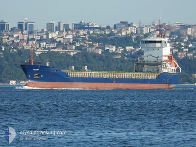
CIELO
General Cargo
Current Trip
| Trip Time | 6 days |
|---|---|
| Trip Distance | 1150.27 nm |
| AVG Speed | 10.9 Knots |
| MAX Speed | 10.9 Knots |
| Draught | 7.1 m |
| AVG Wind | 10.2 knots |
| MAX Wind | 20 knots |
| MIN Temp | 19.1°C / 66.38°F |
| MAX Temp | 28.3°C / 82.94°F |
| Position Received | 6 m ago |
Current Position
| Longitude | 14.74417° |
|---|---|
| Latitude | 40.67583° |
| Status | Moored |
| Speed | |
| Course | 70° |
| Area | Tyrrhenian Sea |
| Station | T-AIS |
| Position Received | 6 m ago |
Info
Information
The current position of CIELO is in Tyrrhenian Sea with coordinates 40.67583° / 14.74417° as reported on 2024-06-27 07:14 by AIS to our vessel tracker app. The vessel's current speed is 0 Knots and is currently inside the port of SALERNO.
The vessel CIELO (IMO: 9180865, MMSI: 305808000) is a General Cargo that was built in 1999 ( 25 years old ). It's sailing under the flag of [AG] Antigua Barbuda.
In this page you can find informations about the vessels current position, last detected port calls, and current voyage information. If the vessels is not in coverage by AIS you will find the latest position.
The current position of CIELO is detected by our AIS receivers and we are not responsible for the reliability of the data. The last position was recorded while the vessel was in Coverage by the Ais receivers of our vessel tracking app.
The current draught of CIELO as reported by AIS is 7.1 meters
Weather
| Temperature | 21.9°C / 71.42°F |
|---|---|
| Wind Speed | 3 knots |
| Direction | 203° SSW |
| Pressure | 1013.7 hPa |
| Humidity | 64.1 % |
| Cloud Coverage | 14 % |
Featured Company
Last Port Calls
| Port | Arrival | Departure | Time In Port |
|---|---|---|---|
| 2024-06-26 18:42 | |||
| 2024-06-19 00:21 | 2024-06-20 16:26 | 1 d | |
| 2024-06-16 15:35 | 2024-06-17 17:37 | 1 d | |
| 2024-06-16 05:28 | 2024-06-16 15:10 | 9 h | |
| 2024-06-15 19:37 | 2024-06-16 05:21 | 9 h | |
| 2024-06-07 09:35 | 2024-06-07 10:05 | 29 m | |
| 2024-05-18 08:33 |
Last Trips
| Origin | Departure | Destination | Arrival | Distance | |
|---|---|---|---|---|---|
| 2024-06-20 19:26 | 2024-06-26 20:42 | 1150.27 nm | |||
| 2024-06-17 20:37 | 2024-06-19 03:21 | 316.84 nm | |||
| 2024-06-16 18:10 | 2024-06-16 18:35 | 23.65 nm | |||
| 2024-06-16 08:21 | 2024-06-16 08:28 | 4.27 nm | |||
| 2024-06-07 13:05 | 2024-06-15 22:37 | 1592.28 nm | |||
| 2024-05-18 11:33 | 2024-06-07 12:35 | 741.19 nm |
Events
| Time | Event | Details | Position / Dest | Info |
|---|---|---|---|---|
| 2024-06-26 19:44 | Status Changed | Moored Default |
40.67583 / 14.74417
[IT] SALERNO
|
Speed: Course: 68° |
| 2024-06-26 19:44 | IN Coverage |
40.67583 / 14.74417
Tyrrhenian Sea
[IT] SALERNO
|
Speed: Course: 199° |
|
| 2024-06-26 19:02 | STOP Moving |
40.67550 / 14.74450
[IT] SALERNO
|
Speed: 0.2 kn Course: 52° |
|
| 2024-06-26 18:42 | PORT ARRIVAL |
|
40.66800 / 14.74767
[IT] SALERNO
|
Speed: 5.3 kn Course: 57° |
| 2024-06-26 18:12 | START Moving | 1.34 nm, South of SALERNO |
40.64533 / 14.74583
ITSAL
|
Speed: 4.7 kn Course: 264° |
| 2024-06-26 13:09 | Status Changed | Default At anchor |
40.64600 / 14.75683
ITSAL
|
Speed: Course: 260° |
| 2024-06-26 12:56 | Status Changed | At anchor Default |
40.64600 / 14.75683
ITSAL
|
Speed: 0.1 kn Course: 264° |
| 2024-06-26 12:56 | OUT of Coverage |
40.64600 / 14.75683
Tyrrhenian Sea
|
Speed: Course: 49° |
|
| 2024-06-26 12:49 | IN Coverage |
40.64600 / 14.75683
Tyrrhenian Sea
|
Speed: Course: 49° |
|
| 2024-06-26 02:56 | OUT of Coverage |
40.64483 / 14.75550
Tyrrhenian Sea
|
Speed: Course: 79° |