
CL BILIU HE
Cargo
Aktuelle Reise
| Bisherige Reisezeit | 4 Tage |
|---|---|
| Verbleibende Reisezeit | 2 Tage |
| Zurückgelegte Distanz | 1181.13 nm |
| Verbleibende Distanz | 869.45 nm |
| Durchschnittliche Geschwindigkeit | 11.8 Knoten |
| Maximale Geschwindigkeit | 13.1 Knoten |
| Durchschnittliche Windgeschwindigkeit | 9.5 Knoten |
| Maximale Windgeschwindigkeit | 19 Knoten |
| Minimale Temperatur | 20.9°C / 69.62°F |
| Maximale Temperatur | 24.4°C / 75.92°F |
| Tiefgang | 13.2 m |
| Position erhalten | 23 h, 46 m alt |
Aktuelle Position
| Länge | --- |
|---|---|
| Breite | --- |
| Zustand | Under way using engine |
| Geschwindigkeit | 11.5 Knoten |
| Kurs | 284.5° |
| Gebiet | Mediterranean Sea - Eastern Basin |
| Station | T-AIS |
| Position erhalten | 23 h, 46 m alt |
Schiffsdetails
Information
Die CL BILIU HE befindet sich derzeit in Mediterranean Sea - Eastern Basin mit den Koordinaten 36.36666° / 14.28161°, Diese Position wurde am 2024-10-31 00:42 von unserer Schiffsverfolgungs-App über AIS erfasst. Das Schiff fährt momentan mit einer Geschwindigkeit von 11.5 Knoten und fahrt in den Hafen von GIBRALTAR. Die geschatzte Ankunftszeit, berechnet von der -App zur Schiffsverfolgung, ist 2024-11-03 09:34 LT
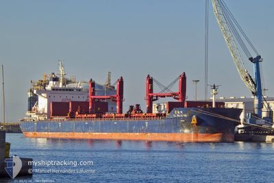
Das Schiff CL BILIU HE (IMO: 9890604, MMSI: 477632300) ist Cargo und fährt unter der Flagge von [HK] Hong Kong.
Auf dieser Seite erhalten Sie Informationen zur aktuellen Position des Schiffes, zu den letzten bekannten Hafenanläufen und zu den aktuellen Reiseinformationen. Sollte das Schiff nicht durch AIS abgedeckt sein, wird die zuletzt erfasste Position angezeigt.
Die CL BILIU HE wird durch unsere AIS-Empfänger ermittelt. Wir übernehmen keine Gewähr für die Richtigkeit der Daten. Die letzte Position wurde von unseren AIS-Empfängern aufgezeichnet, während das Schiff in Reichweite war.
Der aktuelle Entwurf von CL BILIU HE, wie von AIS gemeldet, betragt 13.2 meter
Wetter
| Temperatur | 22.1°C / 71.78°F |
|---|---|
| Windgeschwindigkeit | 20 Knoten |
| Windrichtung | 95° E |
| Luftdruck | 1019.9 hPa |
| Luftfeuchtigkeit | 87 % |
| Wolken | 2 % |
Featured Company
Letzte Hafenanläufe
| Hafen | Ankunft | Abfahrt | Time In Port |
|---|---|---|---|
| 2024-10-22 07:06 | 2024-10-27 18:44 | 5 d | |
| 2024-10-11 01:37 | 2024-10-15 12:52 | 4 d | |
| 2024-09-30 09:28 | 2024-10-07 12:57 | 7 d | |
| 2024-09-17 10:13 | 2024-09-21 17:04 | 4 d | |
| 2024-09-11 18:09 | 2024-09-12 12:56 | 18 h | |
| 2024-09-09 17:18 | 2024-09-10 21:15 | 1 d |
Meistbesuchte Häfen (Letztes Jahr)
| Hafen | Ankünfte | |
|---|---|---|
| 2 | ||
| 2 | ||
| 1 | ||
| 1 | ||
| 1 | ||
| 1 |
Letzte Reisen
| Herkunft | Abfahrt | Ziel | Ankunft | Distanz | |
|---|---|---|---|---|---|
| 2024-10-15 15:52 | 2024-10-22 09:06 | 726.73 nm | |||
| 2024-10-07 14:57 | 2024-10-11 04:37 | 1098.39 nm | |||
| 2024-09-21 19:04 | 2024-09-30 11:28 | 105.41 nm | |||
| 2024-09-12 14:56 | 2024-09-17 12:13 | 1358.98 nm | |||
| 2024-09-10 23:15 | 2024-09-11 20:09 | 154.15 nm | |||
| 2024-07-29 15:30 | 2024-09-09 19:18 | 11245.86 nm |
Events
| Zeit | Ereignis | Details | Position / Ziel | Information |
|---|---|---|---|---|
| 2024-10-31 00:56 | geänderter Status | Default Under way using engine |
36.38059 / 14.23030
GI GIB
|
Geschwindigkeit: 11.5 kn Kurs: 284.5° |
| 2024-10-31 00:42 | außerhalb Abdeckung |
36.36666 / 14.28161
Mediterranean Sea - Eastern Basin
GI GIB
|
Geschwindigkeit: 11.5 kn Kurs: 284.5° |
|
| 2024-10-31 00:21 | geänderter Status | Under way using engine Default |
36.34389 / 14.35778
GI GIB
|
Geschwindigkeit: 11.2 kn Kurs: 293° |
| 2024-10-31 00:19 | geänderter Status | Default Under way using engine |
36.34108 / 14.36605
GI GIB
|
Geschwindigkeit: 11.2 kn Kurs: 293° |
| 2024-10-30 23:50 | geänderter Tiefgang | 13.2 7.4 |
36.30409 / 14.47448
GI GIB
|
Geschwindigkeit: 11.3 kn Kurs: 292.2° |
| 2024-10-30 23:50 | geändertes Ziel | GI GIB EG DAM |
36.30409 / 14.47448
GI GIB
|
Geschwindigkeit: 11.3 kn Kurs: 292.2° |
| 2024-10-30 23:50 | geänderte voraussichtliche Ankunftszeit | 2024/11/03 07:00 2024/10/17 19:00 |
36.30409 / 14.47448
GI GIB
|
Geschwindigkeit: 11.3 kn Kurs: 292.2° |
| 2024-10-30 23:23 | geänderter Status | Under way using engine Default |
36.27521 / 14.56769
EG DAM
|
Geschwindigkeit: 11.3 kn Kurs: 290° |
| 2024-10-30 23:20 | geänderter Status | Default Under way using engine |
36.27167 / 14.57929
EG DAM
|
Geschwindigkeit: 11.3 kn Kurs: 289.1° |
| 2024-10-30 23:10 | geänderter Status | Under way using engine Default |
36.26040 / 14.61854
EG DAM
|
Geschwindigkeit: 11.4 kn Kurs: 289° |