
CL SHA HE
Cargo
Current Trip
| Time Travelled | 1 day |
|---|---|
| Remaining Time | 2 days |
| Distance Travelled | 529.98 nm |
| Remaining Distance | 603.70 nm |
| AVG Speed | 10.8 Knots |
| MAX Speed | 13.9 Knots |
| AVG Wind | 15.1 knots |
| MAX Wind | 21.8 knots |
| MIN Temp | 24.3°C / 75.74°F |
| MAX Temp | 27.9°C / 82.22°F |
| Draught | 7.5 m |
| Position Received | 32 m ago |
Current Position
| Longitude | -80.71655° |
|---|---|
| Latitude | 24.54974° |
| Status | Under way using engine |
| Speed | 12 Knots |
| Course | 251.7° |
| Area | North Atlantic Ocean |
| Station | T-AIS |
| Position Received | 32 m ago |
Info
Information
The current position of CL SHA HE is in North Atlantic Ocean with coordinates 24.54974° / -80.71655° as reported on 2024-06-01 21:31 by AIS to our vessel tracker app. The vessel's current speed is 12 Knots and is heading at the port of MOBILE. The estimated time of arrival as calculated by vessel tracking app is 2024-06-04 04:37 LT
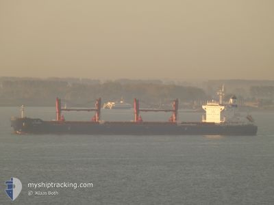
The vessel CL SHA HE (IMO: 9890654, MMSI: 477629300) is a Cargo It's sailing under the flag of [HK] Hong Kong.
In this page you can find informations about the vessels current position, last detected port calls, and current voyage information. If the vessels is not in coverage by AIS you will find the latest position.
The current position of CL SHA HE is detected by our AIS receivers and we are not responsible for the reliability of the data. The last position was recorded while the vessel was in Coverage by the Ais receivers of our vessel tracking app.
The current draught of CL SHA HE as reported by AIS is 7.5 meters
Weather
| Temperature | 27.8°C / 82.04°F |
|---|---|
| Wind Speed | 18 knots |
| Direction | 60° ENE |
| Pressure | 1015.9 hPa |
| Humidity | 72.7 % |
| Cloud Coverage | 5 % |
Featured Company
Last Port Calls
| Port | Arrival | Departure | Time In Port |
|---|---|---|---|
| 2024-05-30 04:02 | 2024-05-30 22:31 | 18 h | |
| 2024-05-09 21:06 | 2024-05-16 23:09 | 7 d | |
| 2024-04-16 23:57 | 2024-04-18 08:26 | 1 d | |
| 2024-04-10 11:10 | 2024-04-15 16:15 | 5 d | |
| 2024-04-10 05:33 |
Most Visited Ports (Last year)
| Port | Arrivals | |
|---|---|---|
| 3 | ||
| 1 | ||
| 1 | ||
| 1 | ||
| 1 | ||
| 1 |
Last Trips
| Origin | Departure | Destination | Arrival | Distance | |
|---|---|---|---|---|---|
| 2024-05-16 18:09 | 2024-05-30 00:02 | 3391.33 nm | |||
| 2024-04-18 17:26 | 2024-05-09 16:06 | 6508.94 nm | |||
| 2024-04-16 01:15 | 2024-04-17 08:57 | 385.22 nm | |||
| 2024-04-10 14:33 | 2024-04-10 20:10 | 47.01 nm |
Events
| Time | Event | Details | Position / Dest | Info |
|---|---|---|---|---|
| 2024-06-01 21:33 | Status Changed | Default Under way using engine |
24.54667 / -80.72500
MOBILE
|
Speed: 12 kn Course: 251.7° |
| 2024-06-01 20:00 | Status Changed | Under way using engine Default |
24.64455 / -80.42034
MOBILE
|
Speed: 10 kn Course: 215° |
| 2024-06-01 19:42 | IN Coverage |
24.64260 / -80.42774
North Atlantic Ocean
MOBILE
|
Speed: 10.7 kn Course: 259.3° |
|
| 2024-06-01 17:27 | Status Changed | Default Under way using engine |
24.99833 / -80.13666
MOBILE
|
Speed: 10 kn Course: 215.6° |
| 2024-06-01 17:12 | Status Changed | Under way using engine Default |
25.03333 / -80.11006
MOBILE
|
Speed: 10 kn Course: 216° |
| 2024-06-01 17:12 | OUT of Coverage |
25.03333 / -80.11006
North Atlantic Ocean
MOBILE
|
Speed: 10 kn Course: 215.6° |
|
| 2024-06-01 16:57 | Status Changed | Default Under way using engine |
25.06667 / -80.08167
MOBILE
|
Speed: 10.1 kn Course: 216.3° |
| 2024-06-01 16:28 | Status Changed | Under way using engine Default |
25.13468 / -80.02925
MOBILE
|
Speed: 9 kn Course: 216° |
| 2024-06-01 15:42 | Status Changed | Default Under way using engine |
25.23667 / -79.94666
MOBILE
|
Speed: 9.9 kn Course: 215.9° |
| 2024-06-01 07:40 | Status Changed | Under way using engine Default |
26.56702 / -79.79094
MOBILE
|
Speed: 9 kn Course: 184° |