
CL TOMO
Cargo
Current Trip
| Trip Time | 9 h, 26 mins |
|---|---|
| Trip Distance | 2.64 nm |
| AVG Speed | 2.5 Knots |
| MAX Speed | 2.9 Knots |
| Draught | 4.2 m |
| AVG Wind | 1.7 knots |
| MAX Wind | 3 knots |
| MIN Temp | 14.8°C / 58.64°F |
| MAX Temp | 19.5°C / 67.1°F |
| Position Received | 3 m ago |
Current Position
| Longitude | 29.46516° |
|---|---|
| Latitude | 40.71353° |
| Status | Moored |
| Speed | |
| Course | 126° |
| Area | Sea of Marmara |
| Station | T-AIS |
| Position Received | 3 m ago |
Info
Information
The current position of CL TOMO is in Sea of Marmara with coordinates 40.71353° / 29.46516° as reported on 2024-05-31 03:42 by AIS to our vessel tracker app. The vessel's current speed is 0 Knots and is currently inside the port of YALOVA.
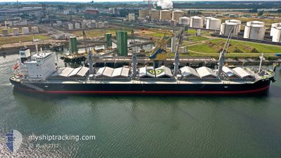
The vessel CL TOMO (IMO: 9908279, MMSI: 374182000) is a Cargo It's sailing under the flag of [PA] Panama.
In this page you can find informations about the vessels current position, last detected port calls, and current voyage information. If the vessels is not in coverage by AIS you will find the latest position.
The current position of CL TOMO is detected by our AIS receivers and we are not responsible for the reliability of the data. The last position was recorded while the vessel was in Coverage by the Ais receivers of our vessel tracking app.
The current draught of CL TOMO as reported by AIS is 4.2 meters
Weather
| Temperature | 18°C / 64.4°F |
|---|---|
| Wind Speed | 3 knots |
| Direction | 151° SSE |
| Pressure | 1012.8 hPa |
| Humidity | 69.3 % |
| Cloud Coverage | --- |
Featured Company
Last Port Calls
| Port | Arrival | Departure | Time In Port |
|---|---|---|---|
| 2024-05-29 07:58 | |||
| 2024-05-21 03:10 | 2024-05-28 22:32 | 7 d | |
| 2024-05-18 07:09 | 2024-05-20 12:15 | 2 d | |
| 2024-05-09 18:52 | 2024-05-14 14:16 | 4 d | |
| 2024-04-09 18:31 | 2024-04-12 10:21 | 2 d | |
| 2024-03-30 01:51 | 2024-03-30 02:35 | 44 m |
Last Trips
| Origin | Departure | Destination | Arrival | Distance | |
|---|---|---|---|---|---|
| 2024-05-29 01:32 | 2024-05-29 10:58 | 2.64 nm | |||
| 2024-05-20 15:15 | 2024-05-21 06:10 | 2.75 nm | |||
| 2024-05-14 17:16 | 2024-05-18 10:09 | 895.56 nm | |||
| 2024-04-12 05:21 | 2024-05-09 21:52 | 7044.46 nm | |||
| 2024-03-29 21:35 | 2024-04-09 13:31 | 230.36 nm | |||
| 2024-02-29 17:11 | 2024-03-29 20:51 | 5492.10 nm |
Events
| Time | Event | Details | Position / Dest | Info |
|---|---|---|---|---|
| 2024-05-30 23:12 | Status Changed | Moored Default |
40.71352 / 29.46514
[TR] YALOVA
|
Speed: Course: 126° |
| 2024-05-30 23:09 | Status Changed | Default Moored |
40.71353 / 29.46509
[TR] YALOVA
|
Speed: Course: 126° |
| 2024-05-29 08:09 | Status Changed | Moored Under way using engine |
40.71357 / 29.46511
[TR] YALOVA
|
Speed: Course: 126° |
| 2024-05-29 07:58 | PORT ARRIVAL |
|
40.71376 / 29.46521
[TR] YALOVA
|
Speed: 0.7 kn Course: 131° |
| 2024-05-29 07:56 | Draught Changed | 4.2 3.9 |
40.71415 / 29.46465
EGPSD
|
Speed: 0.8 kn Course: 132° |
| 2024-05-29 07:13 | Status Changed | Under way using engine At anchor |
40.72617 / 29.44681
EGPSD
|
Speed: 0.1 kn Course: 63° |
| 2024-05-28 22:58 | Status Changed | At anchor Under way using engine |
40.72788 / 29.44921
EGPSD
|
Speed: 0.3 kn Course: 240° |
| 2024-05-28 22:51 | STOP Moving | 1.18 nm, North West of YALOVA |
40.72791 / 29.44993
EGPSD
|
Speed: 0.3 kn Course: 245° |
| 2024-05-28 22:35 | START Moving | 0.57 nm, West of YALOVA |
40.72089 / 29.46040
EGPSD
|
Speed: 3.1 kn Course: 324° |
| 2024-05-28 22:32 | Status Changed | Under way using engine Moored |
40.71878 / 29.46147
EGPSD
|
Speed: 0.9 kn Course: 244° |