
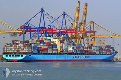
CLEMENTINE MAERSK
Container Ship
Current Trip
| Time Travelled | 4 days |
|---|---|
| Remaining Time | --- |
| Distance Travelled | 2020.11 nm |
| Remaining Distance | --- |
| AVG Speed | 17.7 Knots |
| MAX Speed | 20.5 Knots |
| AVG Wind | 12.8 knots |
| MAX Wind | 23.1 knots |
| MIN Temp | 16.5°C / 61.7°F |
| MAX Temp | 26.1°C / 78.98°F |
| Draught | 11.4 m |
| Position Received | 3 d ago |
Current Position
| Longitude | -70.62625° |
|---|---|
| Latitude | 38.77061° |
| Status | Under way using engine |
| Speed | 18.5 Knots |
| Course | 123.8° |
| Area | North Atlantic Ocean |
| Station | T-AIS |
| Position Received | 3 d ago |
Info
Information
The current position of CLEMENTINE MAERSK is in North Atlantic Ocean with coordinates 38.77061° / -70.62625° as reported on 2024-05-28 04:57 by AIS to our vessel tracker app. The vessel's current speed is 18.5 Knots and is heading at the port of SINGAPORE. The estimated time of arrival as calculated by vessel tracking app is 2024-06-23 20:00 LT
The vessel CLEMENTINE MAERSK (IMO: 9245770, MMSI: 220164000) is a Container Ship that was built in 2002 ( 22 years old ). It's sailing under the flag of [DK] Denmark.
In this page you can find informations about the vessels current position, last detected port calls, and current voyage information. If the vessels is not in coverage by AIS you will find the latest position.
The current position of CLEMENTINE MAERSK is detected by our AIS receivers and we are not responsible for the reliability of the data. The last position was recorded while the vessel was in Coverage by the Ais receivers of our vessel tracking app.
The current draught of CLEMENTINE MAERSK as reported by AIS is 11.4 meters
Weather
| Temperature | 24.8°C / 76.64°F |
|---|---|
| Wind Speed | 9 knots |
| Direction | 78° ENE |
| Pressure | 1018.5 hPa |
| Humidity | 80.2 % |
| Cloud Coverage | 62 % |
Featured Company
Last Port Calls
| Port | Arrival | Departure | Time In Port |
|---|---|---|---|
| 2024-05-25 09:30 | 2024-05-27 17:13 | 2 d | |
| 2024-05-21 10:04 | 2024-05-21 22:25 | 12 h | |
| 2024-05-16 18:08 | 2024-05-17 23:24 | 1 d | |
| 2024-05-12 14:26 | 2024-05-13 08:50 | 18 h | |
| 2024-04-18 00:06 | 2024-04-19 07:59 | 1 d | |
| 2024-04-14 23:53 | 2024-04-15 13:02 | 13 h | |
| 2024-04-06 07:23 | 2024-04-07 06:03 | 22 h | |
| 2024-04-01 19:28 | 2024-04-03 00:22 | 1 d |
Last Trips
| Origin | Departure | Destination | Arrival | Distance | |
|---|---|---|---|---|---|
| 2024-05-21 18:25 | 2024-05-25 05:30 | 611.56 nm | |||
| 2024-05-17 19:24 | 2024-05-21 06:04 | 475.86 nm | |||
| 2024-05-13 03:50 | 2024-05-16 14:08 | 1576.66 nm | |||
| 2024-04-19 16:59 | 2024-05-12 09:26 | 8678.05 nm | |||
| 2024-04-15 21:02 | 2024-04-18 09:06 | 491.31 nm | |||
| 2024-04-07 14:03 | 2024-04-15 07:53 | 970.26 nm | |||
| 2024-04-03 08:22 | 2024-04-06 15:23 | 1472.82 nm | |||
| 2024-02-27 15:34 | 2024-04-02 03:28 | 11439.03 nm |
Events
| Time | Event | Details | Position / Dest | Info |
|---|---|---|---|---|
| 2024-05-28 05:13 | Status Changed | Default Under way using engine |
38.72205 / -70.53403
USNWK>SGSIN
|
Speed: 18.5 kn Course: 123.8° |
| 2024-05-28 04:57 | OUT of Coverage |
38.77061 / -70.62625
North Atlantic Ocean
USNWK>SGSIN
|
Speed: 18.5 kn Course: 123.8° |
|
| 2024-05-28 02:05 | Status Changed | Under way using engine Default |
39.24231 / -71.56446
USNWK>SGSIN
|
Speed: 17.8 kn Course: 122° |
| 2024-05-28 02:05 | IN Coverage |
39.23552 / -71.55083
North Atlantic Ocean
USNWK>SGSIN
|
Speed: 18 kn Course: 123.3° |
|
| 2024-05-27 23:22 | Status Changed | Default Under way using engine |
39.68218 / -72.45342
USNWK>SGSIN
|
Speed: 17.7 kn Course: 122.5° |
| 2024-05-27 23:01 | Status Changed | Under way using engine Default |
39.73817 / -72.56970
USNWK>SGSIN
|
Speed: 18.2 kn Course: 120° |
| 2024-05-27 23:01 | OUT of Coverage |
39.73817 / -72.56970
North Atlantic Ocean
USNWK>SGSIN
|
Speed: 17.7 kn Course: 122.5° |
|
| 2024-05-27 22:35 | Status Changed | Default Under way using engine |
39.80548 / -72.71024
USNWK>SGSIN
|
Speed: 18.1 kn Course: 116.3° |
| 2024-05-27 17:13 | PORT DEPARTURE |
|
40.57728 / -74.03569
USNWK>SGSIN
|
Speed: 14.9 kn Course: 167° |
| 2024-05-27 16:00 | START Moving |
40.66209 / -74.14332
[US] NEW YORK
|
Speed: 3.1 kn Course: 200° |