
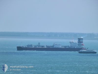
CLIPPER ENYO
Tanker D
Current Trip
| Time Travelled | 1 day |
|---|---|
| Remaining Time | --- |
| Distance Travelled | 469.65 nm |
| Remaining Distance | --- |
| AVG Speed | 11.6 Knots |
| MAX Speed | 21.1 Knots |
| AVG Wind | 13.4 knots |
| MAX Wind | 19.9 knots |
| MIN Temp | 11.9°C / 53.42°F |
| MAX Temp | 19°C / 66.2°F |
| Draught | 6.7 m |
| Position Received | Now |
Current Position
| Longitude | 10.02652° |
|---|---|
| Latitude | 57.86502° |
| Status | Under way using engine |
| Speed | 15.1 Knots |
| Course | 263.9° |
| Area | Skaggerak |
| Station | T-AIS |
| Position Received | Now |
Info
Information
The current position of CLIPPER ENYO is in Skaggerak with coordinates 57.86502° / 10.02652° as reported on 2024-05-29 11:13 by AIS to our vessel tracker app. The vessel's current speed is 15.1 Knots and is heading at the port of HOUSTON. The estimated time of arrival as calculated by vessel tracking app is 2024-06-13 18:00 LT
The vessel CLIPPER ENYO (IMO: 9827217, MMSI: 257066990) is a Tanker D It's sailing under the flag of [NO] Norway.
In this page you can find informations about the vessels current position, last detected port calls, and current voyage information. If the vessels is not in coverage by AIS you will find the latest position.
The current position of CLIPPER ENYO is detected by our AIS receivers and we are not responsible for the reliability of the data. The last position was recorded while the vessel was in Coverage by the Ais receivers of our vessel tracking app.
The current draught of CLIPPER ENYO as reported by AIS is 6.7 meters
Weather
| Temperature | 14.8°C / 58.64°F |
|---|---|
| Wind Speed | 18 knots |
| Direction | 132° SE |
| Pressure | 1009.7 hPa |
| Humidity | 77.4 % |
| Cloud Coverage | 89 % |
Featured Company
Last Port Calls
| Port | Arrival | Departure | Time In Port |
|---|---|---|---|
| 2024-04-25 18:47 | 2024-05-27 14:56 | ||
| 2024-04-19 22:32 | 2024-04-20 23:16 | 1 d | |
| 2024-03-31 06:19 | 2024-04-01 11:00 | 1 d | |
| 2024-03-25 16:35 | |||
| 2024-03-09 16:09 | 2024-03-11 04:10 | 1 d |
Most Visited Ports (Last year)
| Port | Arrivals | |
|---|---|---|
| 8 | ||
| 4 | ||
| 3 | ||
| 1 | ||
| 1 |
Last Trips
| Origin | Departure | Destination | Arrival | Distance | |
|---|---|---|---|---|---|
| 2024-04-21 01:16 | 2024-04-25 20:47 | 450.24 nm | |||
| 2024-04-01 06:00 | 2024-04-20 00:32 | 5782.57 nm | |||
| 2024-03-25 10:35 | 2024-03-31 01:19 | 750.94 nm |
Events
| Time | Event | Details | Position / Dest | Info |
|---|---|---|---|---|
| 2024-05-29 07:35 | Change Sea Area | Danish part of the Skaggerak Danish part of the Kattegat |
57.80701 / 10.94583
Skaggerak
USHOU
|
Speed: 7.2 kn Course: 312.7° |
| 2024-05-29 06:47 | Change Sea Area | Danish part of the Kattegat Swedish part of the Kattegat |
57.73514 / 11.12571
Kattegat
USHOU
|
Speed: 8 kn Course: 296.8° |
| 2024-05-29 05:21 | ETA Changed | 2024/06/13 18:00 2024/06/14 19:30 |
57.58443 / 11.44710
USHOU
|
Speed: 9.9 kn Course: 296.6° |
| 2024-05-29 04:24 | START Moving | 3.16 nm, West of VRANGO |
57.58102 / 11.68037
USHOU
|
Speed: 3.1 kn Course: 235° |
| 2024-05-29 04:14 | Status Changed | Under way using engine At anchor |
57.58210 / 11.68455
USHOU
|
Speed: 0.1 kn Course: 179° |
| 2024-05-29 03:00 | ETA Changed | 2024/06/14 19:30 2024/05/28 19:30 |
57.58278 / 11.68694
USHOU
|
Speed: Course: 179° |
| 2024-05-29 02:54 | Draught Changed | 6.7 5.8 |
57.58280 / 11.68701
USHOU
|
Speed: Course: 179° |
| 2024-05-29 02:54 | Destination Changed | USHOU SEGOT |
57.58280 / 11.68701
USHOU
|
Speed: Course: 179° |
| 2024-05-28 20:34 | Status Changed | At anchor Under way using engine |
57.58054 / 11.68684
SEGOT
|
Speed: 0.8 kn Course: 290° |
| 2024-05-28 20:30 | STOP Moving | 2.99 nm, West of VRANGO |
57.58054 / 11.68576
SEGOT
|
Speed: 0.3 kn Course: 271° |