
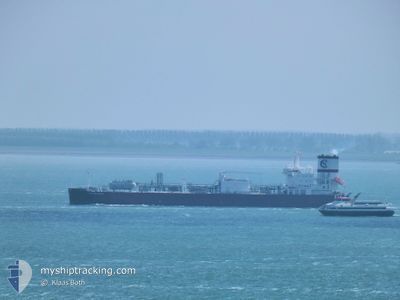
CLIPPER ENYO
Tanker D
Current Trip
| Time Travelled | 6 days |
|---|---|
| Remaining Time | 7 days |
| Distance Travelled | 2171.45 nm |
| Remaining Distance | 2633.45 nm |
| AVG Speed | 13.5 Knots |
| MAX Speed | 16.3 Knots |
| AVG Wind | 15.8 knots |
| MAX Wind | 24 knots |
| MIN Temp | 26°C / 78.8°F |
| MAX Temp | 29°C / 84.2°F |
| Draught | 8.8 m |
| Position Received | 6 d ago |
Current Position
| Longitude | -94.83163° |
|---|---|
| Latitude | 29.42554° |
| Status | Under way using engine |
| Speed | 12.9 Knots |
| Course | 158.8° |
| Area | Gulf of Mexico |
| Station | T-AIS |
| Position Received | 6 d ago |
Info
Information
The current position of CLIPPER ENYO is in Gulf of Mexico with coordinates 29.42554° / -94.83163° as reported on 2024-06-20 16:38 by AIS to our vessel tracker app. The vessel's current speed is 12.9 Knots and is heading at the port of ARATU. The estimated time of arrival as calculated by vessel tracking app is 2024-07-05 04:19 LT
The vessel CLIPPER ENYO (IMO: 9827217, MMSI: 257066990) is a Tanker D It's sailing under the flag of [NO] Norway.
In this page you can find informations about the vessels current position, last detected port calls, and current voyage information. If the vessels is not in coverage by AIS you will find the latest position.
The current position of CLIPPER ENYO is detected by our AIS receivers and we are not responsible for the reliability of the data. The last position was recorded while the vessel was in Coverage by the Ais receivers of our vessel tracking app.
The current draught of CLIPPER ENYO as reported by AIS is 8.8 meters
Weather
| Temperature | 27.7°C / 81.86°F |
|---|---|
| Wind Speed | 13 knots |
| Direction | 82° E |
| Pressure | 1013.9 hPa |
| Humidity | 80 % |
| Cloud Coverage | 100 % |
Featured Company
Most Visited Ports (Last year)
| Port | Arrivals | |
|---|---|---|
| 8 | ||
| 3 | ||
| 3 | ||
| 1 | ||
| 1 |
Last Trips
| Origin | Departure | Destination | Arrival | Distance | |
|---|---|---|---|---|---|
| 2024-06-14 13:30 | 2024-06-17 20:25 | 78.02 nm | |||
| 2024-05-27 16:56 | 2024-06-13 16:55 | 5831.63 nm | |||
| 2024-04-21 01:16 | 2024-04-25 20:47 | 450.24 nm | |||
| 2024-04-01 06:00 | 2024-04-20 00:32 | 5782.57 nm |
Events
| Time | Event | Details | Position / Dest | Info |
|---|---|---|---|---|
| 2024-06-20 16:43 | Status Changed | Default Under way using engine |
29.40748 / -94.82201
USHOU>BRARB
|
Speed: 12.9 kn Course: 158.8° |
| 2024-06-20 16:38 | OUT of Coverage |
29.42554 / -94.83163
Gulf of Mexico
USHOU>BRARB
|
Speed: 12.9 kn Course: 158.8° |
|
| 2024-06-20 15:55 | Draught Changed | 8.8 6.5 |
29.55882 / -94.91559
USHOU>BRARB
|
Speed: 12.6 kn Course: 146.9° |
| 2024-06-20 15:55 | Destination Changed | USHOU>BRARB USHOU>USHOU |
29.55882 / -94.91559
USHOU>BRARB
|
Speed: 12.6 kn Course: 146.9° |
| 2024-06-20 15:55 | ETA Changed | 2024/07/01 20:00 2024/06/14 20:00 |
29.55882 / -94.91559
USHOU>BRARB
|
Speed: 12.6 kn Course: 146.9° |
| 2024-06-20 15:43 | PORT DEPARTURE |
|
29.59036 / -94.93934
USHOU>USHOU
|
Speed: 10.2 kn Course: 148° |
| 2024-06-20 14:58 | START Moving |
29.68180 / -95.00459
[US] HOUSTON
|
Speed: 3.2 kn Course: 88° |
|
| 2024-06-20 14:57 | Status Changed | Under way using engine Default |
29.68179 / -95.00537
[US] HOUSTON
|
Speed: 0.4 kn Course: 9° |
| 2024-06-20 14:43 | IN Coverage |
29.68181 / -95.00420
Gulf of Mexico
[US] HOUSTON
|
Speed: 3.3 kn Course: 87.8° |
|
| 2024-06-18 01:40 | OUT of Coverage |
29.68132 / -95.00894
Gulf of Mexico
[US] HOUSTON
|
Speed: Course: 287° |