
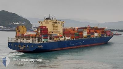
CMA CGM AMAZON
Cargo A
Current Trip
| Time Travelled | 6 days |
|---|---|
| Remaining Time | --- |
| Distance Travelled | 2412.79 nm |
| Remaining Distance | --- |
| AVG Speed | 15 Knots |
| MAX Speed | 18.3 Knots |
| AVG Wind | 11.2 knots |
| MAX Wind | 21.8 knots |
| MIN Temp | 21°C / 69.8°F |
| MAX Temp | 29.1°C / 84.38°F |
| Draught | 14.5 m |
| Position Received | 6 d ago |
Current Position
| Longitude | -42.84719° |
|---|---|
| Latitude | -23.32495° |
| Status | Under way using engine |
| Speed | 15.8 Knots |
| Course | 80.1° |
| Area | South Atlantic Ocean |
| Station | T-AIS |
| Position Received | 6 d ago |
Info
Information
The current position of CMA CGM AMAZON is in South Atlantic Ocean with coordinates -23.32495° / -42.84719° as reported on 2024-05-15 13:39 by AIS to our vessel tracker app. The vessel's current speed is 15.8 Knots and is heading at the port of TANGIER. The estimated time of arrival as calculated by vessel tracking app is 2024-05-27 09:00 LT
The vessel CMA CGM AMAZON (IMO: 9706308, MMSI: 215499000) is a Cargo A It's sailing under the flag of [MT] Malta.
In this page you can find informations about the vessels current position, last detected port calls, and current voyage information. If the vessels is not in coverage by AIS you will find the latest position.
The current position of CMA CGM AMAZON is detected by our AIS receivers and we are not responsible for the reliability of the data. The last position was recorded while the vessel was in Coverage by the Ais receivers of our vessel tracking app.
The current draught of CMA CGM AMAZON as reported by AIS is 14.5 meters
Weather
| Temperature | 25.3°C / 77.54°F |
|---|---|
| Wind Speed | 9 knots |
| Direction | 23° NNE |
| Pressure | 1015.3 hPa |
| Humidity | 77.8 % |
| Cloud Coverage | 100 % |
Featured Company
Last Port Calls
| Port | Arrival | Departure | Time In Port |
|---|---|---|---|
| 2024-05-14 12:33 | 2024-05-15 06:37 | 18 h | |
| 2024-05-12 07:03 | 2024-05-12 07:55 | 51 m | |
| 2024-05-08 10:54 | 2024-05-09 16:35 | 1 d | |
| 2024-05-05 22:36 | 2024-05-07 10:39 | 1 d | |
| 2024-05-03 19:04 | 2024-05-03 20:01 | 56 m | |
| 2024-04-23 05:15 | 2024-04-24 09:58 | 1 d | |
| 2024-04-19 18:04 | 2024-04-20 19:19 | 1 d | |
| 2024-04-17 22:11 | 2024-04-18 19:55 | 21 h | |
| 2024-04-15 16:58 | 2024-04-16 03:28 | 10 h | |
| 2024-04-04 05:38 | 2024-04-06 13:53 | 2 d |
Most Visited Ports (Last year)
| Port | Arrivals | |
|---|---|---|
| 5 | ||
| 5 | ||
| 5 | ||
| 4 | ||
| 3 | ||
| 3 |
Last Trips
| Origin | Departure | Destination | Arrival | Distance | |
|---|---|---|---|---|---|
| 2024-05-12 04:55 | 2024-05-14 09:33 | 201.83 nm | |||
| 2024-05-09 13:35 | 2024-05-12 04:03 | 171.29 nm | |||
| 2024-05-07 07:39 | 2024-05-08 07:54 | 67.69 nm | |||
| 2024-05-03 17:01 | 2024-05-05 19:36 | 202.79 nm | |||
| 2024-04-24 10:58 | 2024-05-03 16:04 | 4413.74 nm | |||
| 2024-04-20 21:19 | 2024-04-23 06:15 | 38.43 nm | |||
| 2024-04-18 21:55 | 2024-04-19 20:04 | 7.59 nm | |||
| 2024-04-16 04:28 | 2024-04-18 00:11 | 140.92 nm | |||
| 2024-04-06 10:53 | 2024-04-15 17:58 | 4278.75 nm | |||
| 2024-04-03 14:24 | 2024-04-04 02:38 | 187.34 nm |
Events
| Time | Event | Details | Position / Dest | Info |
|---|---|---|---|---|
| 2024-05-15 13:45 | Status Changed | Default Under way using engine |
-23.32155 / -42.82105
MATNG
|
Speed: 15.8 kn Course: 80.1° |
| 2024-05-15 13:39 | OUT of Coverage |
-23.32495 / -42.84719
South Atlantic Ocean
MATNG
|
Speed: 15.8 kn Course: 80.1° |
|
| 2024-05-15 13:37 | Status Changed | Under way using engine Default |
-23.32652 / -42.85804
MATNG
|
Speed: 15.6 kn Course: 93° |
| 2024-05-15 13:24 | Status Changed | Default Under way using engine |
-23.32894 / -42.91867
MATNG
|
Speed: 15.6 kn Course: 92.5° |
| 2024-05-15 12:50 | Status Changed | Under way using engine Default |
-23.33196 / -43.07878
MATNG
|
Speed: 15.4 kn Course: 85° |
| 2024-05-15 12:37 | Status Changed | Default Under way using engine |
-23.33644 / -43.14049
MATNG
|
Speed: 15.5 kn Course: 84.2° |
| 2024-05-15 11:19 | Destination Changed | MATNG BRIGI |
-23.35791 / -43.50537
MATNG
|
Speed: 15.4 kn Course: 87.5° |
| 2024-05-15 11:19 | ETA Changed | 2024/05/27 09:00 2024/05/14 10:00 |
-23.35791 / -43.50537
MATNG
|
Speed: 15.4 kn Course: 87.5° |
| 2024-05-15 10:40 | Status Changed | Under way using engine Default |
-23.34636 / -43.68445
BRIGI
|
Speed: 15.1 kn Course: 98° |
| 2024-05-15 10:36 | Status Changed | Default Under way using engine |
-23.34367 / -43.70487
BRIGI
|
Speed: 15.1 kn Course: 97° |