
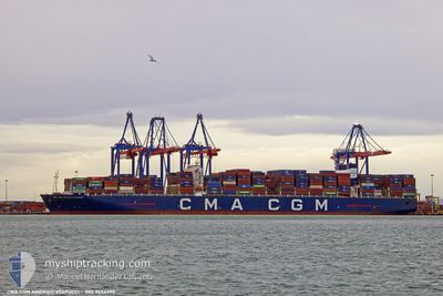
CMA CGM AMERIGO VESP
Container Ship
Current Trip
| Time Travelled | 3 days |
|---|---|
| Remaining Time | 8 h, 26 mins |
| Distance Travelled | 911.50 nm |
| Remaining Distance | 165.88 nm |
| AVG Speed | 17.2 Knots |
| MAX Speed | 21.1 Knots |
| AVG Wind | 7.1 knots |
| MAX Wind | 15.5 knots |
| MIN Temp | 19.1°C / 66.38°F |
| MAX Temp | 24.5°C / 76.1°F |
| Draught | 12.5 m |
| Position Received | 1 m ago |
Current Position
| Longitude | 32.31217° |
|---|---|
| Latitude | 34.13690° |
| Status | Under way using engine |
| Speed | 20 Knots |
| Course | 94.8° |
| Area | Mediterranean Sea - Eastern Basin |
| Station | T-AIS |
| Position Received | 1 m ago |
Info
Information
The current position of CMA CGM AMERIGO VESP is in Mediterranean Sea - Eastern Basin with coordinates 34.13690° / 32.31217° as reported on 2024-06-01 07:44 by AIS to our vessel tracker app. The vessel's current speed is 20 Knots and is heading at the port of BEIRUT. The estimated time of arrival as calculated by vessel tracking app is 2024-06-01 16:12 LT
The vessel CMA CGM AMERIGO VESP (IMO: 9454395, MMSI: 215992000) is a Container Ship that was built in 2010 ( 14 years old ). It's sailing under the flag of [MT] Malta.
In this page you can find informations about the vessels current position, last detected port calls, and current voyage information. If the vessels is not in coverage by AIS you will find the latest position.
The current position of CMA CGM AMERIGO VESP is detected by our AIS receivers and we are not responsible for the reliability of the data. The last position was recorded while the vessel was in Coverage by the Ais receivers of our vessel tracking app.
The current draught of CMA CGM AMERIGO VESP as reported by AIS is 12.5 meters
Weather
| Temperature | 22.4°C / 72.32°F |
|---|---|
| Wind Speed | 3 knots |
| Direction | 296° WNW |
| Pressure | 1018.6 hPa |
| Humidity | 67.5 % |
| Cloud Coverage | --- |
Featured Company
Last Port Calls
| Port | Arrival | Departure | Time In Port |
|---|---|---|---|
| 2024-05-26 20:48 | 2024-05-29 03:06 | 2 d | |
| 2024-05-23 13:26 | 2024-05-25 12:46 | 1 d | |
| 2024-05-20 03:28 | 2024-05-22 00:25 | 1 d | |
| 2024-05-17 18:40 | 2024-05-19 15:37 | 1 d | |
| 2024-05-14 20:09 | 2024-05-16 21:40 | 2 d | |
| 2024-04-19 21:04 | |||
| 2024-04-15 14:05 | 2024-04-16 12:08 | 22 h | |
| 2024-04-10 12:29 | 2024-04-11 14:38 | 1 d | |
| 2024-04-09 15:05 | 2024-04-10 03:49 | 12 h | |
| 2024-04-03 22:16 | 2024-04-04 23:33 | 1 d |
Most Visited Ports (Last year)
| Port | Arrivals | |
|---|---|---|
| 4 | ||
| 4 | ||
| 3 | ||
| 3 | ||
| 3 | ||
| 2 |
Last Trips
| Origin | Departure | Destination | Arrival | Distance | |
|---|---|---|---|---|---|
| 2024-05-25 14:46 | 2024-05-26 22:48 | 612.72 nm | |||
| 2024-05-22 02:25 | 2024-05-23 15:26 | 254.27 nm | |||
| 2024-05-19 17:37 | 2024-05-20 05:28 | 193.57 nm | |||
| 2024-05-16 23:40 | 2024-05-17 20:40 | 187.72 nm | |||
| 2024-04-20 05:04 | 2024-05-14 22:09 | 11025.78 nm | |||
| 2024-04-11 22:38 | 2024-04-15 22:05 | 1477.17 nm | |||
| 2024-04-10 11:49 | 2024-04-10 20:29 | 74.63 nm | |||
| 2024-04-05 07:33 | 2024-04-09 23:05 | 1031.10 nm | |||
| 2024-04-02 18:40 | 2024-04-04 06:16 | 466.05 nm | |||
| 2024-03-30 11:12 | 2024-04-01 16:01 | 505.79 nm |
Events
| Time | Event | Details | Position / Dest | Info |
|---|---|---|---|---|
| 2024-06-01 02:11 | Change Sea Area | Cypriote part of the Mediterranean Sea - Eastern Basin Greek part of the Mediterranean Sea - Eastern Basin |
34.28186 / 30.17733
Mediterranean Sea - Eastern Basin
BEIRUT
|
Speed: 19.1 kn Course: 94.2° |
| 2024-05-31 17:37 | ETA Changed | 2024/06/01 17:00 2024/06/01 13:00 |
34.50524 / 26.91488
BEIRUT
|
Speed: 19.1 kn Course: 99.6° |
| 2024-05-31 14:23 | Destination Changed | BEIRUT KALI LIMENES |
34.59414 / 25.67830
BEIRUT
|
Speed: 19.6 kn Course: 112.1° |
| 2024-05-31 14:23 | ETA Changed | 2024/06/01 13:00 2024/05/30 17:00 |
34.59414 / 25.67830
BEIRUT
|
Speed: 19.6 kn Course: 112.1° |
| 2024-05-31 13:56 | Status Changed | Under way using engine Default |
34.65635 / 25.51841
KALI LIMENES
|
Speed: 19.2 kn Course: 116° |
| 2024-05-31 13:38 | IN Coverage |
34.65310 / 25.52655
Mediterranean Sea - Eastern Basin
|
Speed: 19.4 kn Course: 115.8° |
|
| 2024-05-31 11:55 | START Moving | 3.54 nm, East of KALI LIMENES |
34.92128 / 24.87340
KALI LIMENES
|
Speed: 7.9 kn Course: 129° |
| 2024-05-30 17:43 | STOP Moving | 3.17 nm, East of KALI LIMENES |
34.92539 / 24.86642
KALI LIMENES
|
Speed: 0.2 kn Course: 13° |
| 2024-05-30 15:49 | Status Changed | Default Under way using engine |
34.78129 / 24.75901
KALI LIMENES
|
Speed: 16.5 kn Course: 54.5° |
| 2024-05-30 15:46 | OUT of Coverage |
34.77250 / 24.74708
Mediterranean Sea - Eastern Basin
KALI LIMENES
|
Speed: 16.5 kn Course: 54.5° |