
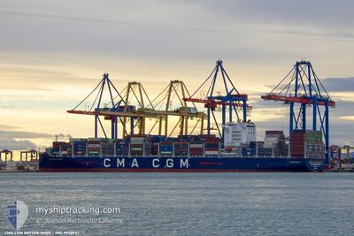
CMA CGM BETTER WAYS
Cargo
Current Trip
| Trip Time | 9 h, 14 mins |
|---|---|
| Trip Distance | 116.79 nm |
| AVG Speed | 12.5 Knots |
| MAX Speed | 14.3 Knots |
| Draught | 13.5 m |
| AVG Wind | 12.1 knots |
| MAX Wind | 19.3 knots |
| MIN Temp | 26.3°C / 79.34°F |
| MAX Temp | 28.7°C / 83.66°F |
| Position Received | 9 h, 6 m ago |
Current Position
| Longitude | -61.34236° |
|---|---|
| Latitude | 14.83422° |
| Status | Under way using engine |
| Speed | 12.9 Knots |
| Course | 333.4° |
| Area | Caribbean Sea |
| Station | T-AIS |
| Position Received | 9 h, 6 m ago |
Info
Information
The current position of CMA CGM BETTER WAYS is in Caribbean Sea with coordinates 14.83422° / -61.34236° as reported on 2024-06-20 01:49 by AIS to our vessel tracker app. The vessel's current speed is 12.9 Knots and is currently inside the port of POINTE A PITRE.
The vessel CMA CGM BETTER WAYS (IMO: 9950557, MMSI: 256587000) is a Cargo It's sailing under the flag of [MT] Malta.
In this page you can find informations about the vessels current position, last detected port calls, and current voyage information. If the vessels is not in coverage by AIS you will find the latest position.
The current position of CMA CGM BETTER WAYS is detected by our AIS receivers and we are not responsible for the reliability of the data. The last position was recorded while the vessel was in Coverage by the Ais receivers of our vessel tracking app.
The current draught of CMA CGM BETTER WAYS as reported by AIS is 13.5 meters
Weather
| Temperature | 26.5°C / 79.7°F |
|---|---|
| Wind Speed | 8 knots |
| Direction | 93° E |
| Pressure | 1013.8 hPa |
| Humidity | 80.2 % |
| Cloud Coverage | 93 % |
Featured Company
Last Port Calls
| Port | Arrival | Departure | Time In Port |
|---|---|---|---|
| 2024-06-20 09:13 | |||
| 2024-06-19 09:16 | 2024-06-19 23:59 | 14 h | |
| 2024-06-09 23:10 | 2024-06-10 14:39 | 15 h | |
| 2024-06-04 07:49 | 2024-06-05 15:36 | 1 d | |
| 2024-06-01 21:40 | 2024-06-02 12:22 | 14 h | |
| 2024-05-30 03:15 | 2024-05-31 08:54 | 1 d | |
| 2024-05-28 16:15 | 2024-05-29 15:45 | 23 h | |
| 2024-05-27 08:18 | 2024-05-28 09:39 | 1 d | |
| 2024-05-25 05:13 | 2024-05-26 02:29 | 21 h | |
| 2024-05-21 16:57 | 2024-05-22 20:24 | 1 d |
Most Visited Ports (Last year)
| Port | Arrivals | |
|---|---|---|
| 6 | ||
| 4 | ||
| 4 | ||
| 4 | ||
| 3 | ||
| 3 |
Last Trips
| Origin | Departure | Destination | Arrival | Distance | |
|---|---|---|---|---|---|
| 2024-06-19 19:59 | 2024-06-20 05:13 | 116.79 nm | |||
| 2024-06-10 15:39 | 2024-06-19 05:16 | 3285.17 nm | |||
| 2024-06-05 17:36 | 2024-06-10 00:10 | 646.22 nm | |||
| 2024-06-02 14:22 | 2024-06-04 09:49 | 178.12 nm | |||
| 2024-05-31 10:54 | 2024-06-01 23:40 | 206.89 nm | |||
| 2024-05-29 17:45 | 2024-05-30 05:15 | 228.54 nm | |||
| 2024-05-28 11:39 | 2024-05-28 18:15 | 88.29 nm | |||
| 2024-05-26 04:29 | 2024-05-27 10:18 | 597.00 nm | |||
| 2024-05-22 22:24 | 2024-05-25 07:13 | 1022.07 nm | |||
| 2024-05-12 01:27 | 2024-05-21 18:57 | 4184.78 nm |
Events
| Time | Event | Details | Position / Dest | Info |
|---|---|---|---|---|
| 2024-06-20 09:41 | STOP Moving |
16.23054 / -61.54262
[GP] POINTE A PITRE
|
Speed: 0.2 kn Course: 232° |
|
| 2024-06-20 09:13 | PORT ARRIVAL |
|
16.22613 / -61.53581
[GP] POINTE A PITRE
|
Speed: 9.6 kn Course: 350° |
| 2024-06-20 01:52 | Status Changed | Default Under way using engine |
14.84374 / -61.34632
GPPTP
|
Speed: 12.9 kn Course: 333.4° |
| 2024-06-20 01:49 | OUT of Coverage |
14.83422 / -61.34236
Caribbean Sea
GPPTP
|
Speed: 12.9 kn Course: 333.4° |
|
| 2024-06-20 01:35 | Destination Changed | GPPTP MQFDF |
14.78564 / -61.31846
GPPTP
|
Speed: 13.1 kn Course: 334.2° |
| 2024-06-20 01:35 | ETA Changed | 2024/06/20 08:30 2024/06/19 09:00 |
14.78564 / -61.31846
GPPTP
|
Speed: 13.1 kn Course: 334.2° |
| 2024-06-20 01:26 | Status Changed | Under way using engine Default |
14.75681 / -61.30443
MQFDF
|
Speed: 13.6 kn Course: 335° |
| 2024-06-20 01:15 | IN Coverage |
14.76079 / -61.30633
Caribbean Sea
|
Speed: 13.3 kn Course: 334.9° |
|
| 2024-06-20 00:27 | Status Changed | Default Under way using engine |
14.60466 / -61.15268
MQFDF
|
Speed: 13.2 kn Course: 285° |
| 2024-06-20 00:19 | OUT of Coverage |
14.59734 / -61.12573
Caribbean Sea
|
Speed: 13.2 kn Course: 285° |