
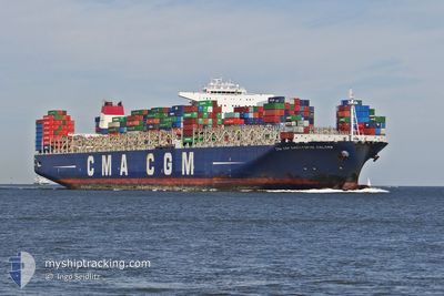
CMA CGM C COLOMB
Container Ship
Current Trip
| Time Travelled | 5 days |
|---|---|
| Remaining Time | --- |
| Distance Travelled | 2262.89 nm |
| Remaining Distance | --- |
| AVG Speed | 15.8 Knots |
| MAX Speed | 17.3 Knots |
| AVG Wind | 13.7 knots |
| MAX Wind | 20 knots |
| MIN Temp | 25.1°C / 77.18°F |
| MAX Temp | 28.8°C / 83.84°F |
| Draught | 12.5 m |
| Position Received | 5 d ago |
Current Position
| Longitude | -79.62128° |
|---|---|
| Latitude | 32.62137° |
| Status | Under way using engine |
| Speed | 7.8 Knots |
| Course | 115.3° |
| Area | North Atlantic Ocean |
| Station | T-AIS |
| Position Received | 5 d ago |
Info
Information
The current position of CMA CGM C COLOMB is in North Atlantic Ocean with coordinates 32.62137° / -79.62128° as reported on 2024-06-21 10:51 by AIS to our vessel tracker app. The vessel's current speed is 7.8 Knots and is heading at the port of PORT KLANG. The estimated time of arrival as calculated by vessel tracking app is 2024-07-24 02:00 LT
The vessel CMA CGM C COLOMB (IMO: 9453559, MMSI: 215965000) is a Container Ship that was built in 2009 ( 15 years old ). It's sailing under the flag of [MT] Malta.
In this page you can find informations about the vessels current position, last detected port calls, and current voyage information. If the vessels is not in coverage by AIS you will find the latest position.
The current position of CMA CGM C COLOMB is detected by our AIS receivers and we are not responsible for the reliability of the data. The last position was recorded while the vessel was in Coverage by the Ais receivers of our vessel tracking app.
The current draught of CMA CGM C COLOMB as reported by AIS is 12.5 meters
Weather
| Temperature | 27.2°C / 80.96°F |
|---|---|
| Wind Speed | 11 knots |
| Direction | 77° ENE |
| Pressure | 1012.3 hPa |
| Humidity | 79.3 % |
| Cloud Coverage | 38 % |
Featured Company
Last Port Calls
| Port | Arrival | Departure | Time In Port |
|---|---|---|---|
| 2024-06-20 04:20 | 2024-06-21 09:47 | 1 d | |
| 2024-06-10 14:58 | 2024-06-12 00:50 | 1 d | |
| 2024-06-06 07:46 | 2024-06-07 22:12 | 1 d | |
| 2024-06-03 08:54 | 2024-06-05 05:49 | 1 d | |
| 2024-05-31 19:19 | 2024-06-01 11:51 | 16 h | |
| 2024-05-24 13:42 | 2024-05-25 01:53 | 12 h | |
| 2024-05-02 01:08 | 2024-05-03 00:12 | 23 h | |
| 2024-04-26 10:56 | 2024-04-27 12:44 | 1 d | |
| 2024-04-24 10:45 | 2024-04-25 22:41 | 1 d | |
| 2024-04-18 00:33 | 2024-04-19 07:18 | 1 d |
Most Visited Ports (Last year)
| Port | Arrivals | |
|---|---|---|
| 5 | ||
| 5 | ||
| 4 | ||
| 3 | ||
| 3 | ||
| 3 |
Last Trips
| Origin | Departure | Destination | Arrival | Distance | |
|---|---|---|---|---|---|
| 2024-06-11 20:50 | 2024-06-20 00:20 | 155.44 nm | |||
| 2024-06-07 18:12 | 2024-06-10 10:58 | 533.93 nm | |||
| 2024-06-05 01:49 | 2024-06-06 03:46 | 296.10 nm | |||
| 2024-06-01 08:51 | 2024-06-03 04:54 | 603.62 nm | |||
| 2024-05-25 02:53 | 2024-05-31 16:19 | 2689.09 nm | |||
| 2024-05-03 05:42 | 2024-05-24 14:42 | 9512.95 nm | |||
| 2024-04-27 20:44 | 2024-05-02 06:38 | 1454.78 nm | |||
| 2024-04-26 06:41 | 2024-04-26 18:56 | 194.80 nm | |||
| 2024-04-19 15:18 | 2024-04-24 18:45 | 1579.97 nm | |||
| 2024-04-17 01:38 | 2024-04-18 08:33 | 416.03 nm |
Events
| Time | Event | Details | Position / Dest | Info |
|---|---|---|---|---|
| 2024-06-21 10:51 | Status Changed | Default Under way using engine |
32.62070 / -79.61962
MYPKG
|
Speed: 7.8 kn Course: 115.3° |
| 2024-06-21 10:51 | Status Changed | Under way using engine Default |
32.62137 / -79.62128
MYPKG
|
Speed: 7.8 kn Course: 166° |
| 2024-06-21 10:51 | OUT of Coverage |
32.62137 / -79.62128
North Atlantic Ocean
|
Speed: 7.8 kn Course: 115.3° |
|
| 2024-06-21 10:43 | Status Changed | Default Under way using engine |
32.63385 / -79.62721
MYPKG
|
Speed: 13.6 kn Course: 119.1° |
| 2024-06-21 10:28 | Status Changed | Under way using engine Default |
32.66306 / -79.68536
MYPKG
|
Speed: 15.2 kn Course: 119° |
| 2024-06-21 10:15 | Status Changed | Default Under way using engine |
32.68948 / -79.74040
MYPKG
|
Speed: 14.7 kn Course: 116.8° |
| 2024-06-21 10:09 | Status Changed | Under way using engine Default |
32.70191 / -79.76757
MYPKG
|
Speed: 14.3 kn Course: 116° |
| 2024-06-21 10:07 | Status Changed | Default Under way using engine |
32.70539 / -79.77568
MYPKG
|
Speed: 14.2 kn Course: 120° |
| 2024-06-21 09:51 | Status Changed | Under way using engine Default |
32.73560 / -79.83913
MYPKG
|
Speed: 13.4 kn Course: 140° |
| 2024-06-21 09:47 | Status Changed | Default Under way using engine |
32.74614 / -79.85319
MYPKG
|
Speed: 11.9 kn Course: 132° |