
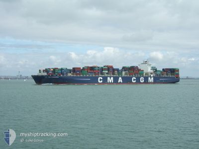
CMA CGM CASSIOPEIA
Container Ship
Current Trip
MYPKG
| Time Travelled | 13 days |
|---|---|
| Remaining Time | --- |
| Distance Travelled | 5675.76 nm |
| Remaining Distance | --- |
| AVG Speed | 17.4 Knots |
| MAX Speed | 22.2 Knots |
| AVG Wind | 13.6 knots |
| MAX Wind | 27.1 knots |
| MIN Temp | 15.6°C / 60.08°F |
| MAX Temp | 30.1°C / 86.18°F |
| Draught | 14.4 m |
| Position Received | 10 h, 15 m ago |
Current Position
| Longitude | 17.61343° |
|---|---|
| Latitude | -33.68333° |
| Status | Under way using engine |
| Speed | 18.1 Knots |
| Course | 319.4° |
| Area | South Atlantic Ocean |
| Station | T-AIS |
| Position Received | 10 h, 15 m ago |
Info
Information
The current position of CMA CGM CASSIOPEIA is in South Atlantic Ocean with coordinates -33.68333° / 17.61343° as reported on 2024-05-26 16:50 by AIS to our vessel tracker app. The vessel's current speed is 18.1 Knots
The vessel CMA CGM CASSIOPEIA (IMO: 9410765, MMSI: 215196000) is a Container Ship that was built in 2011 ( 13 years old ). It's sailing under the flag of [MT] Malta.
In this page you can find informations about the vessels current position, last detected port calls, and current voyage information. If the vessels is not in coverage by AIS you will find the latest position.
The current position of CMA CGM CASSIOPEIA is detected by our AIS receivers and we are not responsible for the reliability of the data. The last position was recorded while the vessel was in Coverage by the Ais receivers of our vessel tracking app.
The current draught of CMA CGM CASSIOPEIA as reported by AIS is 14.4 meters
Weather
| Temperature | 17.9°C / 64.22°F |
|---|---|
| Wind Speed | 18 knots |
| Direction | 138° SE |
| Pressure | 1021.2 hPa |
| Humidity | 85.1 % |
| Cloud Coverage | --- |
Featured Company
Last Port Calls
| Port | Arrival | Departure | Time In Port |
|---|---|---|---|
| 2024-05-12 09:16 | 2024-05-13 08:52 | 23 h | |
| 2024-05-10 09:08 | 2024-05-11 17:58 | 1 d | |
| 2024-05-02 09:15 | 2024-05-03 07:40 | 22 h | |
| 2024-04-30 21:55 | 2024-05-02 00:52 | 1 d | |
| 2024-04-28 10:43 | 2024-04-29 00:04 | 13 h | |
| 2024-04-11 16:32 | 2024-04-14 10:49 | 2 d | |
| 2024-04-05 11:31 | 2024-04-10 11:49 | 5 d | |
| 2024-03-20 02:50 | 2024-03-20 21:19 | 18 h | |
| 2024-03-13 06:37 | 2024-03-14 23:01 | 1 d | |
| 2024-03-09 15:58 | 2024-03-11 00:20 | 1 d |
Last Trips
| Origin | Departure | Destination | Arrival | Distance | |
|---|---|---|---|---|---|
| 2024-05-12 01:58 | 2024-05-12 17:16 | 201.24 nm | |||
| 2024-05-03 15:40 | 2024-05-10 17:08 | 1596.44 nm | |||
| 2024-05-02 08:52 | 2024-05-02 17:15 | 102.90 nm | |||
| 2024-04-29 08:04 | 2024-05-01 05:55 | 445.89 nm | |||
| 2024-04-14 03:49 | 2024-04-28 18:43 | 5957.21 nm | |||
| 2024-04-10 04:49 | 2024-04-11 09:32 | 383.54 nm | |||
| 2024-03-21 05:19 | 2024-04-05 04:31 | 6606.99 nm | |||
| 2024-03-15 06:01 | 2024-03-20 10:50 | 1482.66 nm | |||
| 2024-03-11 08:20 | 2024-03-13 13:37 | 823.28 nm | |||
| 2024-03-08 00:18 | 2024-03-09 23:58 | 206.45 nm |
Events
| Time | Event | Details | Position / Dest | Info |
|---|---|---|---|---|
| 2024-05-26 16:54 | Status Changed | Default Under way using engine |
-33.66768 / 17.59640
MYPKG
|
Speed: 18.1 kn Course: 319.4° |
| 2024-05-26 16:50 | OUT of Coverage |
-33.68333 / 17.61343
South Atlantic Ocean
|
Speed: 18.1 kn Course: 319.4° |
|
| 2024-05-26 16:50 | Status Changed | Under way using engine Default |
-33.68372 / 17.61382
MYPKG
|
Speed: 18.1 kn Course: 319° |
| 2024-05-26 16:27 | Status Changed | Default Under way using engine |
-33.77023 / 17.70402
MYPKG
|
Speed: 18.2 kn Course: 318.4° |
| 2024-05-26 16:22 | Status Changed | Under way using engine Default |
-33.78990 / 17.72412
MYPKG
|
Speed: 18 kn Course: 321° |
| 2024-05-26 16:15 | Status Changed | Default Under way using engine |
-33.81555 / 17.75003
MYPKG
|
Speed: 18.2 kn Course: 319.2° |
| 2024-05-26 15:57 | Status Changed | Under way using engine Default |
-33.88572 / 17.82015
MYPKG
|
Speed: 18 kn Course: 320° |
| 2024-05-26 15:51 | IN Coverage |
-33.88462 / 17.81905
South Atlantic Ocean
|
Speed: 18.1 kn Course: 320.7° |
|
| 2024-05-26 13:47 | Status Changed | Default Under way using engine |
-34.37736 / 18.32023
MYPKG
|
Speed: 18.2 kn Course: 318.1° |
| 2024-05-26 13:43 | OUT of Coverage |
-34.39202 / 18.33682
South Atlantic Ocean
|
Speed: 18.2 kn Course: 318.1° |