
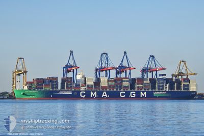
CMA CGM CEDRUS
Cargo D
Current Trip
| Time Travelled | 10 h, 11 mins |
|---|---|
| Remaining Time | --- |
| Distance Travelled | 163.67 nm |
| Remaining Distance | --- |
| AVG Speed | 17.3 Knots |
| MAX Speed | 19 Knots |
| AVG Wind | 22.7 knots |
| MAX Wind | 26 knots |
| MIN Temp | 28.4°C / 83.12°F |
| MAX Temp | 29°C / 84.2°F |
| Draught | 15.8 m |
| Position Received | 11 d ago |
Current Position
| Longitude | 103.37717° |
|---|---|
| Latitude | 1.26235° |
| Status | Under way using engine |
| Speed | 12.1 Knots |
| Course | 301.4° |
| Area | Malacca Strait |
| Station | T-AIS |
| Position Received | 11 d ago |
Info
Information
The current position of CMA CGM CEDRUS is in Malacca Strait with coordinates 1.26235° / 103.37717° as reported on 2024-05-18 09:31 by AIS to our vessel tracker app. The vessel's current speed is 12.1 Knots
The vessel CMA CGM CEDRUS (IMO: 9938121, MMSI: 256615000) is a Cargo D It's sailing under the flag of [MT] Malta.
In this page you can find informations about the vessels current position, last detected port calls, and current voyage information. If the vessels is not in coverage by AIS you will find the latest position.
The current position of CMA CGM CEDRUS is detected by our AIS receivers and we are not responsible for the reliability of the data. The last position was recorded while the vessel was in Coverage by the Ais receivers of our vessel tracking app.
The current draught of CMA CGM CEDRUS as reported by AIS is 15.8 meters
Weather
| Temperature | 28.7°C / 83.66°F |
|---|---|
| Wind Speed | 22 knots |
| Direction | 273° W |
| Pressure | 1006.3 hPa |
| Humidity | 83.1 % |
| Cloud Coverage | 61 % |
Featured Company
Last Port Calls
| Port | Arrival | Departure | Time In Port |
|---|---|---|---|
| 2024-05-28 04:01 | 2024-05-28 23:49 | 19 h | |
| 2024-05-20 20:09 | 2024-05-22 06:48 | 1 d | |
| 2024-05-17 06:20 | 2024-05-18 06:31 | 1 d | |
| 2024-05-09 11:23 | 2024-05-10 00:12 | 12 h | |
| 2024-05-06 14:08 | 2024-05-08 23:04 | 2 d | |
| 2024-04-29 03:39 | 2024-05-01 11:08 | 2 d | |
| 2024-04-18 06:53 | 2024-04-18 15:48 | 8 h | |
| 2024-03-26 05:02 | 2024-03-27 08:22 | 1 d | |
| 2024-03-21 18:47 | 2024-03-23 07:00 | 1 d | |
| 2024-03-19 03:55 | 2024-03-20 22:01 | 1 d |
Most Visited Ports (Last year)
| Port | Arrivals | |
|---|---|---|
| 2 | ||
| 2 | ||
| 2 | ||
| 1 | ||
| 1 | ||
| 1 |
Last Trips
| Origin | Departure | Destination | Arrival | Distance | |
|---|---|---|---|---|---|
| 2024-05-22 14:48 | 2024-05-28 09:31 | 1549.69 nm | |||
| 2024-05-18 14:31 | 2024-05-21 04:09 | 212.76 nm | |||
| 2024-05-10 08:12 | 2024-05-17 14:20 | 1716.44 nm | |||
| 2024-05-09 07:04 | 2024-05-09 19:23 | 115.19 nm | |||
| 2024-05-01 19:08 | 2024-05-06 22:08 | 1689.15 nm | |||
| 2024-04-18 19:48 | 2024-04-29 11:39 | 3253.40 nm | |||
| 2024-03-27 09:22 | 2024-04-18 10:53 | 8083.98 nm | |||
| 2024-03-23 08:00 | 2024-03-26 06:02 | 671.12 nm | |||
| 2024-03-20 23:01 | 2024-03-21 19:47 | 249.05 nm | |||
| 2024-03-18 14:18 | 2024-03-19 04:55 | 197.33 nm |
Events
| Time | Event | Details | Position / Dest | Info |
|---|---|---|---|---|
| 2024-05-28 23:49 | PORT DEPARTURE |
|
6.97087 / 79.83455
SGSIN>>MYPKG
|
Speed: 7.5 kn Course: 3° |
| 2024-05-28 23:42 | START Moving |
6.95526 / 79.83463
[LK] COLOMBO
|
Speed: 4.7 kn Course: 3° |
|
| 2024-05-28 04:33 | STOP Moving |
6.94630 / 79.82886
[LK] COLOMBO
|
Speed: 0.1 kn Course: 268° |
|
| 2024-05-28 04:01 | PORT ARRIVAL |
|
6.96097 / 79.83569
[LK] COLOMBO
|
Speed: 5.8 kn Course: 167° |
| 2024-05-28 02:34 | START Moving | 6.57 nm, North West of COLOMBO |
7.00016 / 79.73584
SGSIN>>MYPKG
|
Speed: 4.9 kn Course: 117° |
| 2024-05-27 23:37 | STOP Moving | 10.25 nm, West of COLOMBO |
6.99991 / 79.67072
SGSIN>>MYPKG
|
Speed: 0.3 kn Course: 123° |
| 2024-05-27 09:21 | START Moving | 19.13 nm, South West of COLOMBO |
6.78167 / 79.56819
SGSIN>>MYPKG
|
Speed: 5.3 kn Course: 134° |
| 2024-05-27 07:17 | STOP Moving | 20.76 nm, South West of COLOMBO |
6.77476 / 79.54024
SGSIN>>MYPKG
|
Speed: 0.3 kn Course: 134° |
| 2024-05-22 06:48 | PORT DEPARTURE |
|
2.90811 / 101.27135
SGSIN>>MYPKG
|
Speed: 4.1 kn Course: 225° |
| 2024-05-22 06:44 | START Moving |
2.91235 / 101.27544
[MY] PORT KLANG
|
Speed: 4.1 kn Course: 225° |