
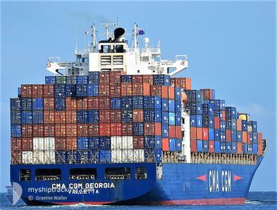
CMA CGM CORNEILLE
Container Ship
Current Trip
| Time Travelled | 9 days |
|---|---|
| Remaining Time | 23 h, 49 mins |
| Distance Travelled | 3428.43 nm |
| Remaining Distance | 567.91 nm |
| AVG Speed | 15.8 Knots |
| MAX Speed | 18.4 Knots |
| AVG Wind | 14.9 knots |
| MAX Wind | 23 knots |
| MIN Temp | 15.5°C / 59.9°F |
| MAX Temp | 28.4°C / 83.12°F |
| Draught | 11.4 m |
| Position Received | 5 d ago |
Current Position
| Longitude | 138.13213° |
|---|---|
| Latitude | -10.20531° |
| Status | Under way using engine |
| Speed | 16 Knots |
| Course | 278.9° |
| Area | Arafura Sea |
| Station | T-AIS |
| Position Received | 5 d ago |
Info
Information
The current position of CMA CGM CORNEILLE is in Arafura Sea with coordinates -10.20531° / 138.13213° as reported on 2024-06-21 04:02 by AIS to our vessel tracker app. The vessel's current speed is 16 Knots and is heading at the port of TANJUNG PELEPAS. The estimated time of arrival as calculated by vessel tracking app is 2024-06-27 05:43 LT
The vessel CMA CGM CORNEILLE (IMO: 9409170, MMSI: 636017425) is a Container Ship that was built in 2009 ( 15 years old ). It's sailing under the flag of [LR] Liberia.
In this page you can find informations about the vessels current position, last detected port calls, and current voyage information. If the vessels is not in coverage by AIS you will find the latest position.
The current position of CMA CGM CORNEILLE is detected by our AIS receivers and we are not responsible for the reliability of the data. The last position was recorded while the vessel was in Coverage by the Ais receivers of our vessel tracking app.
The current draught of CMA CGM CORNEILLE as reported by AIS is 11.4 meters
Weather
| Temperature | 28.6°C / 83.48°F |
|---|---|
| Wind Speed | 10 knots |
| Direction | 116° ESE |
| Pressure | 1007.6 hPa |
| Humidity | 78.9 % |
| Cloud Coverage | 36 % |
Featured Company
Last Port Calls
| Port | Arrival | Departure | Time In Port |
|---|---|---|---|
| 2024-06-14 18:42 | 2024-06-17 05:06 | 2 d | |
| 2024-06-10 16:59 | 2024-06-13 08:37 | 2 d | |
| 2024-06-13 08:37 | |||
| 2024-06-07 11:18 | 2024-06-09 01:25 | 1 d | |
| 2024-05-26 20:08 | 2024-05-27 23:11 | 1 d | |
| 2024-05-23 23:00 | 2024-05-25 14:35 | 1 d | |
| 2024-05-21 14:11 | 2024-05-22 08:19 | 18 h | |
| 2024-05-06 23:14 | 2024-05-09 00:56 | 2 d | |
| 2024-05-02 18:38 | 2024-05-04 20:55 | 2 d | |
| 2024-04-26 21:13 | 2024-04-30 21:34 | 4 d |
Most Visited Ports (Last year)
| Port | Arrivals | |
|---|---|---|
| 16 | ||
| 16 | ||
| 8 | ||
| 8 |
Last Trips
| Origin | Departure | Destination | Arrival | Distance | |
|---|---|---|---|---|---|
| 2024-06-13 18:37 | 2024-06-15 04:42 | 539.29 nm | |||
| 2024-06-09 11:25 | 2024-06-11 02:59 | 537.59 nm | |||
| 2024-05-28 07:11 | 2024-06-07 21:18 | 3816.25 nm | |||
| 2024-05-25 22:35 | 2024-05-27 04:08 | 23.70 nm | |||
| 2024-05-22 16:19 | 2024-05-24 07:00 | 233.63 nm | |||
| 2024-05-09 10:56 | 2024-05-21 22:11 | 3885.92 nm | |||
| 2024-05-05 06:55 | 2024-05-07 09:14 | 562.44 nm | |||
| 2024-05-01 07:34 | 2024-05-03 04:38 | 539.23 nm | |||
| 2024-04-16 13:08 | 2024-04-27 07:13 | 3857.28 nm | |||
| 2024-04-14 18:26 | 2024-04-15 02:46 | 6.88 nm |
Events
| Time | Event | Details | Position / Dest | Info |
|---|---|---|---|---|
| 2024-06-21 04:06 | Status Changed | Default Under way using engine |
-10.20305 / 138.11755
MYTPP
|
Speed: 16 kn Course: 278.9° |
| 2024-06-21 04:02 | OUT of Coverage |
-10.20531 / 138.13213
Arafura Sea
MYTPP
|
Speed: 16 kn Course: 278.9° |
|
| 2024-06-21 03:09 | Change Sea Area | Australian part of the Arafura Sea Indonesian part of the Arafura Sea |
-10.24365 / 138.36744
Arafura Sea
MYTPP
|
Speed: 15.7 kn Course: 276.9° |
| 2024-06-20 23:06 | Status Changed | Under way using engine Default |
-10.41506 / 139.41514
MYTPP
|
Speed: 15.5 kn Course: 281° |
| 2024-06-20 22:38 | Status Changed | Default Under way using engine |
-10.43637 / 139.53355
MYTPP
|
Speed: 15.7 kn Course: 278.7° |
| 2024-06-20 22:34 | Detected in Sea | Indonesian part of the Arafura Sea |
-10.43987 / 139.55338
Arafura Sea
MYTPP
|
Speed: 15.7 kn Course: 278.7° |
| 2024-06-20 22:34 | Status Changed | Under way using engine Default |
-10.43987 / 139.55338
MYTPP
|
Speed: 15.7 kn Course: 280° |
| 2024-06-20 22:27 | IN Coverage |
-10.43987 / 139.55338
Arafura Sea
MYTPP
|
Speed: 15.7 kn Course: 278.7° |
|
| 2024-06-20 05:36 | Status Changed | Default Under way using engine |
-11.59301 / 142.97816
MYTPP
|
Speed: 17 kn Course: 317.3° |
| 2024-06-20 05:30 | OUT of Coverage |
-11.61398 / 142.99753
Coral Sea
MYTPP
|
Speed: 17 kn Course: 317.3° |