
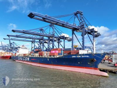
CMA CGM EIFFEL
Container Ship
Current Trip
SNDKR
| Time Travelled | 4 days |
|---|---|
| Remaining Time | --- |
| Distance Travelled | 489.40 nm |
| Remaining Distance | --- |
| AVG Speed | 12.4 Knots |
| MAX Speed | 13.3 Knots |
| AVG Wind | 10 knots |
| MAX Wind | 16.9 knots |
| MIN Temp | 23°C / 73.4°F |
| MAX Temp | 27.8°C / 82.04°F |
| Draught | 12.2 m |
| Position Received | 8 d ago |
Current Position
| Longitude | -14.43172° |
|---|---|
| Latitude | 27.12128° |
| Status | Under way using engine |
| Speed | 13.8 Knots |
| Course | 223.4° |
| Area | North Atlantic Ocean |
| Station | T-AIS |
| Position Received | 8 d ago |
Info
Information
The current position of CMA CGM EIFFEL is in North Atlantic Ocean with coordinates 27.12128° / -14.43172° as reported on 2024-05-29 17:26 by AIS to our vessel tracker app. The vessel's current speed is 13.8 Knots
The vessel CMA CGM EIFFEL (IMO: 9248112, MMSI: 248455000) is a Container Ship that was built in 2002 ( 22 years old ). It's sailing under the flag of [MT] Malta.
In this page you can find informations about the vessels current position, last detected port calls, and current voyage information. If the vessels is not in coverage by AIS you will find the latest position.
The current position of CMA CGM EIFFEL is detected by our AIS receivers and we are not responsible for the reliability of the data. The last position was recorded while the vessel was in Coverage by the Ais receivers of our vessel tracking app.
The current draught of CMA CGM EIFFEL as reported by AIS is 12.2 meters
Weather
| Temperature | 27.8°C / 82.04°F |
|---|---|
| Wind Speed | 9 knots |
| Direction | 334° NNW |
| Pressure | 1012.6 hPa |
| Humidity | 81.7 % |
| Cloud Coverage | 100 % |
Featured Company
Last Port Calls
| Port | Arrival | Departure | Time In Port |
|---|---|---|---|
| 2024-06-01 13:08 | 2024-06-02 15:56 | 1 d | |
| 2024-05-27 06:29 | 2024-05-27 13:31 | 7 h | |
| 2024-05-25 11:28 | 2024-05-26 13:53 | 1 d | |
| 2024-05-22 02:03 | 2024-05-22 12:53 | 10 h | |
| 2024-05-20 07:38 | 2024-05-20 20:28 | 12 h | |
| 2024-05-17 06:00 | 2024-05-18 23:55 | 1 d | |
| 2024-05-15 10:22 | 2024-05-15 20:43 | 10 h | |
| 2024-05-14 05:34 | 2024-05-15 02:38 | 21 h | |
| 2024-05-06 09:42 | 2024-05-07 02:26 | 16 h | |
| 2024-04-30 17:09 | 2024-05-02 22:42 | 2 d |
Most Visited Ports (Last year)
| Port | Arrivals | |
|---|---|---|
| 8 | ||
| 8 | ||
| 7 | ||
| 6 | ||
| 6 | ||
| 6 |
Last Trips
| Origin | Departure | Destination | Arrival | Distance | |
|---|---|---|---|---|---|
| 2024-05-27 15:31 | 2024-06-01 13:08 | 1582.43 nm | |||
| 2024-05-26 14:53 | 2024-05-27 08:29 | 83.10 nm | |||
| 2024-05-22 14:53 | 2024-05-25 12:28 | 1018.69 nm | |||
| 2024-05-20 22:28 | 2024-05-22 04:03 | 486.74 nm | |||
| 2024-05-19 01:55 | 2024-05-20 09:38 | 280.10 nm | |||
| 2024-05-15 22:43 | 2024-05-17 08:00 | 130.97 nm | |||
| 2024-05-15 03:38 | 2024-05-15 12:22 | 89.72 nm | |||
| 2024-05-07 02:26 | 2024-05-14 06:34 | 2635.89 nm | |||
| 2024-05-02 22:42 | 2024-05-06 09:42 | 1211.84 nm | |||
| 2024-04-26 16:06 | 2024-04-30 17:09 | 1206.03 nm |
Events
| Time | Event | Details | Position / Dest | Info |
|---|---|---|---|---|
| 2024-06-02 15:56 | START Moving | 0.77 nm, East of DAKAR |
14.67796 / -17.41460
SNDKR
|
Speed: 6.7 kn Course: 88° |
| 2024-06-02 15:56 | PORT DEPARTURE |
|
14.67796 / -17.41460
SNDKR
|
Speed: 1.5 kn Course: 97° |
| 2024-06-01 13:24 | STOP Moving |
14.68447 / -17.42637
[SN] DAKAR
|
Speed: 0.3 kn Course: 335° |
|
| 2024-06-01 13:08 | PORT ARRIVAL |
|
14.67947 / -17.42381
[SN] DAKAR
|
Speed: 4.9 kn Course: 282° |
| 2024-06-01 10:12 | START Moving | 10.16 nm, South of GOREE |
14.50003 / -17.38741
SNDKR
|
Speed: 4.1 kn Course: 5° |
| 2024-06-01 07:48 | STOP Moving | 9.1 nm, South of GOREE |
14.51834 / -17.38156
SNDKR
|
Speed: 0.1 kn Course: 331° |
| 2024-05-29 17:32 | Status Changed | Default Under way using engine |
27.10599 / -14.44796
SNDKR
|
Speed: 13.8 kn Course: 223.4° |
| 2024-05-29 17:26 | OUT of Coverage |
27.12128 / -14.43172
North Atlantic Ocean
SNDKR
|
Speed: 13.8 kn Course: 223.4° |
|
| 2024-05-29 17:17 | Status Changed | Under way using engine Default |
27.14809 / -14.40320
SNDKR
|
Speed: 13.6 kn Course: 222° |
| 2024-05-29 17:16 | Detected in Sea | Western Saharan part of the North Atlantic Ocean |
27.15088 / -14.40026
North Atlantic Ocean
SNDKR
|
Speed: 13.7 kn Course: 222.8° |