
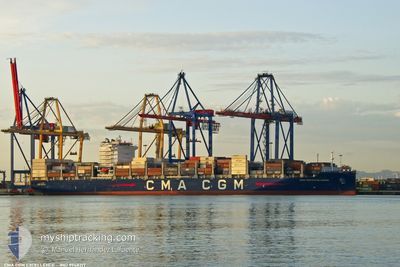
CMA CGM EXCELLENCE
Cargo
Current Trip
| Time Travelled | 2 days |
|---|---|
| Remaining Time | 4 days |
| Distance Travelled | 1213.22 nm |
| Remaining Distance | 2042.35 nm |
| AVG Speed | 16.6 Knots |
| MAX Speed | 18.4 Knots |
| AVG Wind | 13.6 knots |
| MAX Wind | 21.6 knots |
| MIN Temp | 16.5°C / 61.7°F |
| MAX Temp | 21.1°C / 69.98°F |
| Draught | 13.5 m |
| Position Received | 2 d ago |
Current Position
| Longitude | -9.77738° |
|---|---|
| Latitude | 35.43440° |
| Status | Under way using engine |
| Speed | 18 Knots |
| Course | 257.5° |
| Area | North Atlantic Ocean |
| Station | T-AIS |
| Position Received | 2 d ago |
Info
Information
The current position of CMA CGM EXCELLENCE is in North Atlantic Ocean with coordinates 35.43440° / -9.77738° as reported on 2024-05-13 23:24 by AIS to our vessel tracker app. The vessel's current speed is 18 Knots and is heading at the port of FORT DE FRANCE. The estimated time of arrival as calculated by vessel tracking app is 2024-05-21 07:34 LT
The vessel CMA CGM EXCELLENCE (IMO: 9948217, MMSI: 256482000) is a Cargo It's sailing under the flag of [MT] Malta.
In this page you can find informations about the vessels current position, last detected port calls, and current voyage information. If the vessels is not in coverage by AIS you will find the latest position.
The current position of CMA CGM EXCELLENCE is detected by our AIS receivers and we are not responsible for the reliability of the data. The last position was recorded while the vessel was in Coverage by the Ais receivers of our vessel tracking app.
The current draught of CMA CGM EXCELLENCE as reported by AIS is 13.5 meters
Weather
| Temperature | 19.9°C / 67.82°F |
|---|---|
| Wind Speed | 11 knots |
| Direction | 76° ENE |
| Pressure | 1021.9 hPa |
| Humidity | 72.1 % |
| Cloud Coverage | 100 % |
Featured Company
Last Port Calls
| Port | Arrival | Departure | Time In Port |
|---|---|---|---|
| 2024-05-12 13:01 | 2024-05-13 10:31 | 21 h | |
| 2024-05-10 04:36 | 2024-05-11 13:25 | 1 d | |
| 2024-05-08 10:14 | 2024-05-09 11:50 | 1 d | |
| 2024-05-06 03:07 | 2024-05-07 09:06 | 1 d | |
| 2024-05-04 09:45 | 2024-05-05 08:19 | 22 h | |
| 2024-05-01 07:36 | 2024-05-03 07:56 | 2 d | |
| 2024-04-28 10:53 | 2024-04-29 14:06 | 1 d | |
| 2024-04-23 13:58 | 2024-04-24 19:33 | 1 d | |
| 2024-04-13 07:54 | 2024-04-14 00:40 | 16 h | |
| 2024-04-06 09:28 | 2024-04-07 23:08 | 1 d |
Last Trips
| Origin | Departure | Destination | Arrival | Distance | |
|---|---|---|---|---|---|
| 2024-05-11 15:25 | 2024-05-12 14:01 | 414.92 nm | |||
| 2024-05-09 13:50 | 2024-05-10 06:36 | 175.61 nm | |||
| 2024-05-07 11:06 | 2024-05-08 12:14 | 213.69 nm | |||
| 2024-05-05 10:19 | 2024-05-06 05:07 | 227.74 nm | |||
| 2024-05-03 09:56 | 2024-05-04 11:45 | 130.59 nm | |||
| 2024-04-29 16:06 | 2024-05-01 09:36 | 590.30 nm | |||
| 2024-04-24 21:33 | 2024-04-28 12:53 | 1126.02 nm | |||
| 2024-04-13 19:40 | 2024-04-23 15:58 | 4152.12 nm | |||
| 2024-04-07 18:08 | 2024-04-13 02:54 | 1519.59 nm | |||
| 2024-04-04 16:45 | 2024-04-06 04:28 | 53.50 nm |
Events
| Time | Event | Details | Position / Dest | Info |
|---|---|---|---|---|
| 2024-05-13 23:28 | Status Changed | Default Under way using engine |
35.43068 / -9.79757
MAPTM - MQFDF
|
Speed: 18 kn Course: 257.5° |
| 2024-05-13 23:24 | Status Changed | Under way using engine Default |
35.43440 / -9.77738
MAPTM - MQFDF
|
Speed: 17.9 kn Course: 260° |
| 2024-05-13 23:24 | OUT of Coverage |
35.43440 / -9.77738
North Atlantic Ocean
MAPTM - MQFDF
|
Speed: 18 kn Course: 257.5° |
|
| 2024-05-13 23:06 | IN Coverage |
35.43440 / -9.77738
North Atlantic Ocean
MAPTM - MQFDF
|
Speed: 18 kn Course: 257.5° |
|
| 2024-05-13 21:26 | Status Changed | Default Under way using engine |
35.51671 / -9.05646
MAPTM - MQFDF
|
Speed: 18.2 kn Course: 260.5° |
| 2024-05-13 21:17 | OUT of Coverage |
35.52401 / -9.00081
North Atlantic Ocean
MAPTM - MQFDF
|
Speed: 18.2 kn Course: 260.5° |
|
| 2024-05-13 21:15 | Status Changed | Under way using engine Default |
35.52546 / -8.98996
MAPTM - MQFDF
|
Speed: 18.1 kn Course: 261° |
| 2024-05-13 21:02 | Status Changed | Default Under way using engine |
35.53672 / -8.90874
MAPTM - MQFDF
|
Speed: 18 kn Course: 259.7° |
| 2024-05-13 21:01 | Status Changed | Under way using engine Default |
35.53715 / -8.90567
MAPTM - MQFDF
|
Speed: 18 kn Course: 260° |
| 2024-05-13 20:41 | Status Changed | Default Under way using engine |
35.55571 / -8.78177
MAPTM - MQFDF
|
Speed: 17.8 kn Course: 259.4° |