
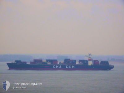
CMA CGM FLORIDA
Container Ship
Current Trip
| Time Travelled | 4 h, 2 mins |
|---|---|
| Remaining Time | 9 days |
| Distance Travelled | 47.92 nm |
| Remaining Distance | 3119.19 nm |
| AVG Speed | 13.5 Knots |
| MAX Speed | 14 Knots |
| AVG Wind | 6.5 knots |
| MAX Wind | 10 knots |
| MIN Temp | 4.2°C / 39.56°F |
| MAX Temp | 5.9°C / 42.62°F |
| Draught | 10.6 m |
| Position Received | 1 h, 17 m ago |
Current Position
| Longitude | -167.14758° |
|---|---|
| Latitude | 54.32650° |
| Status | Under way using engine |
| Speed | 13.9 Knots |
| Course | 307.3° |
| Area | Bering Sea |
| Station | T-AIS |
| Position Received | 1 h, 17 m ago |
Info
Information
The current position of CMA CGM FLORIDA is in Bering Sea with coordinates 54.32650° / -167.14758° as reported on 2024-06-01 17:13 by AIS to our vessel tracker app. The vessel's current speed is 13.9 Knots and is heading at the port of BUSAN. The estimated time of arrival as calculated by vessel tracking app is 2024-06-11 06:49 LT
The vessel CMA CGM FLORIDA (IMO: 9348704, MMSI: 215189000) is a Container Ship that was built in 2008 ( 16 years old ). It's sailing under the flag of [MT] Malta.
In this page you can find informations about the vessels current position, last detected port calls, and current voyage information. If the vessels is not in coverage by AIS you will find the latest position.
The current position of CMA CGM FLORIDA is detected by our AIS receivers and we are not responsible for the reliability of the data. The last position was recorded while the vessel was in Coverage by the Ais receivers of our vessel tracking app.
The current draught of CMA CGM FLORIDA as reported by AIS is 10.6 meters
Weather
| Temperature | 5.7°C / 42.26°F |
|---|---|
| Wind Speed | 9 knots |
| Direction | 64° ENE |
| Pressure | 992.1 hPa |
| Humidity | 90.8 % |
| Cloud Coverage | 100 % |
Featured Company
Last Port Calls
| Port | Arrival | Departure | Time In Port |
|---|---|---|---|
| 2024-05-28 14:11 | 2024-06-01 14:28 | 4 d | |
| 2024-05-18 09:37 | 2024-05-19 10:43 | 1 d | |
| 2024-05-14 15:35 | 2024-05-16 13:34 | 1 d | |
| 2024-05-01 23:04 | 2024-05-02 11:28 | 12 h | |
| 2024-04-29 13:20 | 2024-04-30 14:24 | 1 d | |
| 2024-04-23 16:19 | 2024-04-24 01:39 | 9 h | |
| 2024-04-07 01:41 | 2024-04-08 00:32 | 22 h | |
| 2024-04-01 11:21 | 2024-04-01 23:13 | 11 h |
Most Visited Ports (Last year)
| Port | Arrivals | |
|---|---|---|
| 8 | ||
| 8 | ||
| 8 | ||
| 7 | ||
| 4 | ||
| 3 |
Last Trips
| Origin | Departure | Destination | Arrival | Distance | |
|---|---|---|---|---|---|
| 2024-05-19 03:43 | 2024-05-28 06:11 | 2122.08 nm | |||
| 2024-05-16 06:34 | 2024-05-18 02:37 | 411.77 nm | |||
| 2024-05-02 19:28 | 2024-05-14 08:35 | 5742.85 nm | |||
| 2024-04-30 22:24 | 2024-05-02 07:04 | 255.56 nm | |||
| 2024-04-24 10:39 | 2024-04-29 21:20 | 1000.21 nm | |||
| 2024-04-07 14:32 | 2024-04-24 01:19 | 4442.58 nm | |||
| 2024-04-01 16:13 | 2024-04-06 15:41 | 2109.05 nm | |||
| 2024-03-30 20:55 | 2024-04-01 04:21 | 385.27 nm |
Events
| Time | Event | Details | Position / Dest | Info |
|---|---|---|---|---|
| 2024-06-01 17:17 | Status Changed | Default Under way using engine |
54.33667 / -167.17000
KRPUS
|
Speed: 13.9 kn Course: 307.3° |
| 2024-06-01 17:13 | Status Changed | Under way using engine Default |
54.32650 / -167.14758
KRPUS
|
Speed: 13.8 kn Course: 307° |
| 2024-06-01 17:13 | OUT of Coverage |
54.32650 / -167.14758
Bering Sea
KRPUS
|
Speed: 13.9 kn Course: 307.3° |
|
| 2024-06-01 17:11 | Status Changed | Default Under way using engine |
54.32039 / -167.13380
KRPUS
|
Speed: 13.6 kn Course: 305.6° |
| 2024-06-01 17:00 | Status Changed | Under way using engine Default |
54.29783 / -167.08030
KRPUS
|
Speed: 13.5 kn Course: 308° |
| 2024-06-01 16:51 | Status Changed | Default Under way using engine |
54.27750 / -167.03421
KRPUS
|
Speed: 13.5 kn Course: 306.9° |
| 2024-06-01 16:47 | Status Changed | Under way using engine Default |
54.26689 / -167.01057
KRPUS
|
Speed: 13.4 kn Course: 307° |
| 2024-06-01 15:59 | Status Changed | Default Under way using engine |
54.15833 / -166.76666
KRPUS
|
Speed: 13.4 kn Course: 307.9° |
| 2024-06-01 14:28 | PORT DEPARTURE |
|
53.90883 / -166.48695
KRPUS
|
Speed: 7.4 kn Course: 30° |
| 2024-06-01 14:22 | Draught Changed | 10.6 11 |
53.89883 / -166.50070
[US] DUTCH HARBOR
|
Speed: 8 kn Course: 43° |