
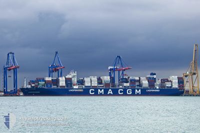
CMA CGM HOPE
Cargo
Current Trip
| Time Travelled | 18 h, 23 mins |
|---|---|
| Remaining Time | 15 days |
| Distance Travelled | 220.89 nm |
| Remaining Distance | 6216.65 nm |
| AVG Speed | 14.4 Knots |
| MAX Speed | 16.9 Knots |
| AVG Wind | 5 knots |
| MAX Wind | 7 knots |
| MIN Temp | 18.6°C / 65.48°F |
| MAX Temp | 21.2°C / 70.16°F |
| Draught | 15.3 m |
| Position Received | 3 h, 20 m ago |
Current Position
| Longitude | 132.33438° |
|---|---|
| Latitude | 36.64529° |
| Status | Under way using engine |
| Speed | 15.9 Knots |
| Course | 47.4° |
| Area | Japan Sea |
| Station | T-AIS |
| Position Received | 3 h, 20 m ago |
Info
Information
The current position of CMA CGM HOPE is in Japan Sea with coordinates 36.64529° / 132.33438° as reported on 2024-06-06 18:42 by AIS to our vessel tracker app. The vessel's current speed is 15.9 Knots and is heading at the port of MANZANILLO. The estimated time of arrival as calculated by vessel tracking app is 2024-06-22 16:05 LT
The vessel CMA CGM HOPE (IMO: 9897755, MMSI: 229326000) is a Cargo It's sailing under the flag of [MT] Malta.
In this page you can find informations about the vessels current position, last detected port calls, and current voyage information. If the vessels is not in coverage by AIS you will find the latest position.
The current position of CMA CGM HOPE is detected by our AIS receivers and we are not responsible for the reliability of the data. The last position was recorded while the vessel was in Coverage by the Ais receivers of our vessel tracking app.
The current draught of CMA CGM HOPE as reported by AIS is 15.3 meters
Weather
| Temperature | 18.5°C / 65.3°F |
|---|---|
| Wind Speed | 7 knots |
| Direction | 119° ESE |
| Pressure | 1015.5 hPa |
| Humidity | 84.8 % |
| Cloud Coverage | 96 % |
Featured Company
Last Port Calls
| Port | Arrival | Departure | Time In Port |
|---|---|---|---|
| 2024-06-04 22:03 | 2024-06-06 03:39 | 1 d | |
| 2024-06-01 06:43 | 2024-06-02 11:02 | 1 d | |
| 2024-05-28 18:47 | 2024-05-29 07:16 | 12 h | |
| 2024-05-27 06:16 | 2024-05-27 23:15 | 16 h | |
| 2024-05-25 11:08 | 2024-05-27 04:25 | 1 d | |
| 2024-05-20 10:20 | 2024-05-22 15:18 | 2 d | |
| 2024-05-16 08:09 | 2024-05-17 07:54 | 23 h | |
| 2024-04-30 16:46 | 2024-05-02 23:52 | 2 d | |
| 2024-04-26 23:10 | 2024-04-28 00:14 | 1 d | |
| 2024-04-20 16:37 | 2024-04-21 23:44 | 1 d |
Most Visited Ports (Last year)
| Port | Arrivals | |
|---|---|---|
| 7 | ||
| 5 | ||
| 4 | ||
| 4 | ||
| 4 | ||
| 3 |
Last Trips
| Origin | Departure | Destination | Arrival | Distance | |
|---|---|---|---|---|---|
| 2024-06-02 19:02 | 2024-06-05 07:03 | 503.61 nm | |||
| 2024-05-29 15:16 | 2024-06-01 14:43 | 689.24 nm | |||
| 2024-05-28 07:15 | 2024-05-29 02:47 | 355.69 nm | |||
| 2024-05-27 12:25 | 2024-05-27 14:16 | 21.80 nm | |||
| 2024-05-23 00:18 | 2024-05-25 19:08 | 1189.23 nm | |||
| 2024-05-17 16:54 | 2024-05-20 19:20 | 878.90 nm | |||
| 2024-05-02 18:52 | 2024-05-16 17:09 | 6027.04 nm | |||
| 2024-04-27 19:14 | 2024-04-30 11:46 | 223.01 nm | |||
| 2024-04-21 18:44 | 2024-04-26 18:10 | 1819.73 nm | |||
| 2024-04-17 18:22 | 2024-04-20 11:37 | 697.31 nm |
Events
| Time | Event | Details | Position / Dest | Info |
|---|---|---|---|---|
| 2024-06-06 18:42 | OUT of Coverage |
36.64529 / 132.33438
Japan Sea
KRPUS-MXZLO
|
Speed: 15.9 kn Course: 47.4° |
|
| 2024-06-06 17:04 | Detected in Sea | Japan - South Korea Conflict Zone part of the Japan Sea |
36.38938 / 131.90018
Japan Sea
KRPUS-MXZLO
|
Speed: 16.1 kn Course: 53.2° |
| 2024-06-06 17:02 | IN Coverage |
36.38938 / 131.90018
Japan Sea
KRPUS-MXZLO
|
Speed: 16.1 kn Course: 53.2° |
|
| 2024-06-06 15:04 | OUT of Coverage |
36.05886 / 131.35608
Japan Sea
KRPUS-MXZLO
|
Speed: 16.7 kn Course: 50.9° |
|
| 2024-06-06 13:17 | IN Coverage |
35.76418 / 130.89501
Japan Sea
KRPUS-MXZLO
|
Speed: 16 kn Course: 48.5° |
|
| 2024-06-06 12:12 | OUT of Coverage |
35.57917 / 130.60747
Japan Sea
KRPUS-MXZLO
|
Speed: 15.8 kn Course: 53.7° |
|
| 2024-06-06 12:11 | Change Sea Area | Japanese part of the Japan Sea South Korean part of the Japan Sea |
35.57554 / 130.60141
Japan Sea
KRPUS-MXZLO
|
Speed: 15.8 kn Course: 54.2° |
| 2024-06-06 08:59 | Change Sea Area | South Korean part of the Japan Sea Japanese part of the Japan Sea |
35.08805 / 129.81132
Japan Sea
KRPUS-MXZLO
|
Speed: 15 kn Course: 46.4° |
| 2024-06-06 06:26 | Change Sea Area | Japanese part of the Japan Sea South Korean part of the Japan Sea |
34.75592 / 129.13473
Japan Sea
KRPUS-MXZLO
|
Speed: 14.7 kn Course: 53.8° |
| 2024-06-06 04:41 | Draught Changed | 15.3 12.5 |
34.90553 / 128.84903
KRPUS-MXZLO
|
Speed: 11.4 kn Course: 158.6° |