
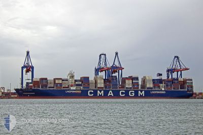
CMA CGM INTEGRITY
Cargo
Current Trip
| Time Travelled | 15 h, 34 mins |
|---|---|
| Remaining Time | 15 days |
| Distance Travelled | 251.21 nm |
| Remaining Distance | 6375.88 nm |
| AVG Speed | 16.8 Knots |
| MAX Speed | 18.7 Knots |
| AVG Wind | 7.6 knots |
| MAX Wind | 13 knots |
| MIN Temp | 17.2°C / 62.96°F |
| MAX Temp | 19.9°C / 67.82°F |
| Draught | 15 m |
| Position Received | 11 h, 44 m ago |
Current Position
| Longitude | 129.68331° |
|---|---|
| Latitude | 35.12372° |
| Status | Under way using engine |
| Speed | 18.2 Knots |
| Course | 60.2° |
| Area | Japan Sea |
| Station | T-AIS |
| Position Received | 11 h, 44 m ago |
Info
Information
The current position of CMA CGM INTEGRITY is in Japan Sea with coordinates 35.12372° / 129.68331° as reported on 2024-05-31 22:23 by AIS to our vessel tracker app. The vessel's current speed is 18.2 Knots and is heading at the port of MANZANILLO. The estimated time of arrival as calculated by vessel tracking app is 2024-06-16 17:37 LT
The vessel CMA CGM INTEGRITY (IMO: 9897781, MMSI: 229464000) is a Cargo It's sailing under the flag of [MT] Malta.
In this page you can find informations about the vessels current position, last detected port calls, and current voyage information. If the vessels is not in coverage by AIS you will find the latest position.
The current position of CMA CGM INTEGRITY is detected by our AIS receivers and we are not responsible for the reliability of the data. The last position was recorded while the vessel was in Coverage by the Ais receivers of our vessel tracking app.
The current draught of CMA CGM INTEGRITY as reported by AIS is 15 meters
Weather
| Temperature | 17.2°C / 62.96°F |
|---|---|
| Wind Speed | 7 knots |
| Direction | 34° NE |
| Pressure | 1008.6 hPa |
| Humidity | 82.4 % |
| Cloud Coverage | 87 % |
Featured Company
Last Port Calls
| Port | Arrival | Departure | Time In Port |
|---|---|---|---|
| 2024-05-30 15:49 | 2024-05-31 18:33 | 1 d | |
| 2024-05-28 03:29 | 2024-05-29 05:25 | 1 d | |
| 2024-05-19 02:36 | 2024-05-20 15:28 | 1 d | |
| 2024-05-17 00:55 | 2024-05-17 13:21 | 12 h | |
| 2024-05-15 04:22 | 2024-05-15 20:56 | 16 h | |
| 2024-05-12 13:24 | 2024-05-14 06:44 | 1 d | |
| 2024-05-07 23:44 | 2024-05-09 13:31 | 1 d | |
| 2024-05-04 08:07 | 2024-05-05 18:45 | 1 d | |
| 2024-04-16 16:19 | 2024-04-19 05:28 | 2 d | |
| 2024-04-13 10:16 | 2024-04-14 22:40 | 1 d |
Most Visited Ports (Last year)
| Port | Arrivals | |
|---|---|---|
| 9 | ||
| 8 | ||
| 8 | ||
| 5 | ||
| 4 | ||
| 4 |
Last Trips
| Origin | Departure | Destination | Arrival | Distance | |
|---|---|---|---|---|---|
| 2024-05-29 13:25 | 2024-05-31 00:49 | 556.35 nm | |||
| 2024-05-20 23:28 | 2024-05-28 11:29 | 738.64 nm | |||
| 2024-05-17 21:21 | 2024-05-19 10:36 | 580.09 nm | |||
| 2024-05-16 04:56 | 2024-05-17 08:55 | 363.52 nm | |||
| 2024-05-14 14:44 | 2024-05-15 12:22 | 115.54 nm | |||
| 2024-05-09 22:31 | 2024-05-12 21:24 | 1205.22 nm | |||
| 2024-05-06 03:45 | 2024-05-08 08:44 | 873.08 nm | |||
| 2024-04-19 00:28 | 2024-05-04 17:07 | 6203.72 nm | |||
| 2024-04-14 17:40 | 2024-04-16 11:19 | 184.99 nm | |||
| 2024-04-07 16:59 | 2024-04-13 05:16 | 1827.99 nm |
Events
| Time | Event | Details | Position / Dest | Info |
|---|---|---|---|---|
| 2024-05-31 22:26 | Status Changed | Default Under way using engine |
35.13231 / 129.70171
KRPUS-MXZLO
|
Speed: 18.2 kn Course: 60.2° |
| 2024-05-31 22:23 | OUT of Coverage |
35.12372 / 129.68331
Japan Sea
KRPUS-MXZLO
|
Speed: 18.2 kn Course: 60.2° |
|
| 2024-05-31 21:25 | Change Sea Area | South Korean part of the Japan Sea Japanese part of the Japan Sea |
34.97692 / 129.41547
Japan Sea
KRPUS-MXZLO
|
Speed: 17.1 kn Course: 53.7° |
| 2024-05-31 21:16 | Change Sea Area | Japanese part of the Japan Sea South Korean part of the Japan Sea |
34.95090 / 129.37206
Japan Sea
KRPUS-MXZLO
|
Speed: 17.2 kn Course: 54.3° |
| 2024-05-31 20:14 | Destination Changed | KRPUS-MXZLO CNTAO-KRPUS |
34.83994 / 129.05767
KRPUS-MXZLO
|
Speed: 16.4 kn Course: 83.7° |
| 2024-05-31 20:14 | ETA Changed | 2024/06/16 03:00 2024/05/30 14:00 |
34.83994 / 129.05767
KRPUS-MXZLO
|
Speed: 16.4 kn Course: 83.7° |
| 2024-05-31 19:53 | Status Changed | Under way using engine Default |
34.84676 / 128.94849
CNTAO-KRPUS
|
Speed: 15.5 kn Course: 115° |
| 2024-05-31 19:53 | IN Coverage |
34.84676 / 128.94849
Japan Sea
|
Speed: 15.7 kn Course: 103.7° |
|
| 2024-05-31 18:33 | PORT DEPARTURE |
|
35.05491 / 128.78203
CNTAO-KRPUS
|
Speed: 10 kn Course: 195° |
| 2024-05-31 18:22 | START Moving |
35.07087 / 128.80069
[KR] BUSAN NEW PORT
|
Speed: 4.6 kn Course: 265° |