
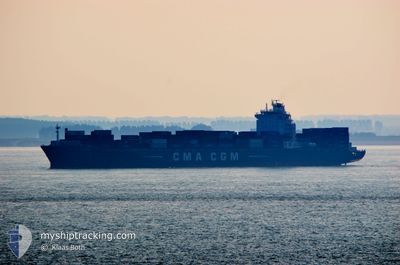
CMA CGM JAMAICA
Container Ship
Aktuelle Reise
| Bisherige Reisezeit | 3 Tage |
|---|---|
| Verbleibende Reisezeit | -2 Minuten |
| Zurückgelegte Distanz | 1020.35 nm |
| Verbleibende Distanz | 2.84 nm |
| Durchschnittliche Geschwindigkeit | 11.6 Knoten |
| Maximale Geschwindigkeit | 15.7 Knoten |
| Durchschnittliche Windgeschwindigkeit | 8.4 Knoten |
| Maximale Windgeschwindigkeit | 18 Knoten |
| Minimale Temperatur | 17.8°C / 64.04°F |
| Maximale Temperatur | 22.5°C / 72.5°F |
| Tiefgang | 11.4 m |
| Position erhalten | 2 m alt |
Aktuelle Position
| Länge | -5.55324° |
|---|---|
| Breite | 35.91537° |
| Zustand | Under way using engine |
| Geschwindigkeit | 2.1 Knoten |
| Kurs | 135° |
| Gebiet | Strait of Gibraltar |
| Station | T-AIS |
| Position erhalten | 2 m alt |
Schiffsdetails
Information
Die CMA CGM JAMAICA befindet sich derzeit in Strait of Gibraltar mit den Koordinaten 35.91537° / -5.55324°, Diese Position wurde am 2024-09-22 01:03 von unserer Schiffsverfolgungs-App über AIS erfasst. Das Schiff fährt momentan mit einer Geschwindigkeit von 2.1 Knoten und fahrt in den Hafen von TANGER MED. Die geschatzte Ankunftszeit, berechnet von der -App zur Schiffsverfolgung, ist 2024-09-22 01:03 LT
Das Schiff CMA CGM JAMAICA (IMO: 9326770, MMSI: 215650000) ist Container Ship das wurde im Jahr 2006 ( 18 Jahre alt ) gebaut. und fährt unter der Flagge von [MT] Malta.
Auf dieser Seite erhalten Sie Informationen zur aktuellen Position des Schiffes, zu den letzten bekannten Hafenanläufen und zu den aktuellen Reiseinformationen. Sollte das Schiff nicht durch AIS abgedeckt sein, wird die zuletzt erfasste Position angezeigt.
Die CMA CGM JAMAICA wird durch unsere AIS-Empfänger ermittelt. Wir übernehmen keine Gewähr für die Richtigkeit der Daten. Die letzte Position wurde von unseren AIS-Empfängern aufgezeichnet, während das Schiff in Reichweite war.
Der aktuelle Entwurf von CMA CGM JAMAICA, wie von AIS gemeldet, betragt 11.4 meter
Wetter
| Temperatur | --- |
|---|---|
| Windgeschwindigkeit | --- |
| Windrichtung | --- |
| Luftdruck | --- |
| Luftfeuchtigkeit | --- |
| Wolken | --- |
Featured Company
Letzte Hafenanläufe
| Hafen | Ankunft | Abfahrt | Time In Port |
|---|---|---|---|
| 2024-09-18 02:18 | 2024-09-18 11:36 | 9 h | |
| 2024-09-14 13:36 | 2024-09-16 04:55 | 1 d | |
| 2024-09-12 18:50 | 2024-09-13 18:38 | 23 h | |
| 2024-09-11 11:31 | 2024-09-12 16:11 | 1 d | |
| 2024-09-10 11:18 | 2024-09-11 02:29 | 15 h | |
| 2024-09-09 04:50 | 2024-09-10 02:28 | 21 h | |
| 2024-08-30 10:57 | 2024-08-31 18:34 | 1 d | |
| 2024-08-24 03:35 | 2024-08-25 17:47 | 1 d | |
| 2024-08-20 05:01 | 2024-08-21 03:53 | 22 h | |
| 2024-08-02 11:15 | 2024-08-04 00:38 | 1 d |
Letzte Reisen
| Herkunft | Abfahrt | Ziel | Ankunft | Distanz | |
|---|---|---|---|---|---|
| 2024-09-16 06:55 | 2024-09-18 04:18 | 499.40 nm | |||
| 2024-09-13 20:38 | 2024-09-14 15:36 | 246.72 nm | |||
| 2024-09-12 18:11 | 2024-09-12 20:50 | 31.44 nm | |||
| 2024-09-11 04:29 | 2024-09-11 13:31 | 126.48 nm | |||
| 2024-09-10 03:28 | 2024-09-10 13:18 | 106.63 nm | |||
| 2024-08-31 18:34 | 2024-09-09 05:50 | 2609.11 nm | |||
| 2024-08-25 17:47 | 2024-08-30 10:57 | 1213.44 nm | |||
| 2024-08-21 04:53 | 2024-08-24 03:35 | 464.16 nm | |||
| 2024-08-04 01:38 | 2024-08-20 06:01 | 3369.54 nm | |||
| 2024-08-02 00:29 | 2024-08-02 12:15 | 62.49 nm |
Events
| Zeit | Ereignis | Details | Position / Ziel | Information |
|---|---|---|---|---|
| 2024-09-22 00:53 | STOP Bewegung | 2.35 nm, North West of TANGER MED |
35.91313 / -5.54682
TANGER MED
|
Geschwindigkeit: 0.2 kn Kurs: 96° |
| 2024-09-21 23:24 | geänderter Status | Under way using engine Default |
35.90425 / -5.78566
TANGER MED
|
Geschwindigkeit: 6 kn Kurs: 86° |
| 2024-09-21 23:23 | geänderter Status | Default Under way using engine |
35.90414 / -5.78702
TANGER MED
|
Geschwindigkeit: 5.8 kn Kurs: 84.2° |
| 2024-09-21 23:22 | geänderter Status | Under way using engine Default |
35.90407 / -5.78841
TANGER MED
|
Geschwindigkeit: 4.3 kn Kurs: 90° |
| 2024-09-21 23:19 | geänderter Status | Default Under way using engine |
35.90405 / -5.79462
TANGER MED
|
Geschwindigkeit: 0.9 kn Kurs: 91° |
| 2024-09-21 22:20 | geänderter Status | Under way using engine Default |
35.90702 / -5.84803
TANGER MED
|
Geschwindigkeit: 6.3 kn Kurs: 95° |
| 2024-09-21 21:59 | geänderter Status | Default Under way using engine |
35.91063 / -5.88275
TANGER MED
|
Geschwindigkeit: 5.6 kn Kurs: 91.8° |
| 2024-09-21 21:46 | geänderte voraussichtliche Ankunftszeit | 2024/09/21 23:00 2024/09/22 00:00 |
35.91116 / -5.90636
TANGER MED
|
Geschwindigkeit: 4.2 kn Kurs: 95° |
| 2024-09-21 21:43 | geänderter Status | Under way using engine Default |
35.91074 / -5.91080
TANGER MED
|
Geschwindigkeit: 3.6 kn Kurs: 91° |
| 2024-09-21 21:35 | geänderter Status | Default Under way using engine |
35.90967 / -5.92057
TANGER MED
|
Geschwindigkeit: 5.1 kn Kurs: 84.7° |