
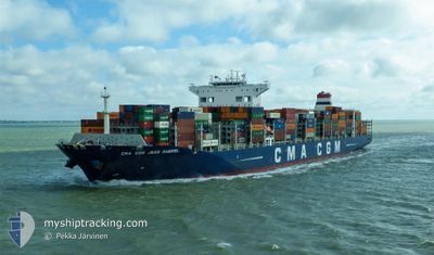
CMA CGM JEAN GABRIEL
Cargo A
Current Trip
| Time Travelled | 3 days |
|---|---|
| Remaining Time | --- |
| Distance Travelled | 1404.99 nm |
| Remaining Distance | --- |
| AVG Speed | 18 Knots |
| MAX Speed | 21 Knots |
| AVG Wind | 8 knots |
| MAX Wind | 23 knots |
| MIN Temp | 6.2°C / 43.16°F |
| MAX Temp | 12.4°C / 54.32°F |
| Draught | 11.1 m |
| Position Received | 2 d ago |
Current Position
| Longitude | -127.20103° |
|---|---|
| Latitude | 48.55409° |
| Status | Under way using engine |
| Speed | 18.9 Knots |
| Course | 273.6° |
| Area | North Pacific Ocean |
| Station | T-AIS |
| Position Received | 2 d ago |
Info
Information
The current position of CMA CGM JEAN GABRIEL is in North Pacific Ocean with coordinates 48.55409° / -127.20103° as reported on 2024-05-31 23:18 by AIS to our vessel tracker app. The vessel's current speed is 18.9 Knots and is heading at the port of GWANGYANG. The estimated time of arrival as calculated by vessel tracking app is 2024-06-10 18:00 LT
The vessel CMA CGM JEAN GABRIEL (IMO: 9729128, MMSI: 248703000) is a Cargo A It's sailing under the flag of [MT] Malta.
In this page you can find informations about the vessels current position, last detected port calls, and current voyage information. If the vessels is not in coverage by AIS you will find the latest position.
The current position of CMA CGM JEAN GABRIEL is detected by our AIS receivers and we are not responsible for the reliability of the data. The last position was recorded while the vessel was in Coverage by the Ais receivers of our vessel tracking app.
The current draught of CMA CGM JEAN GABRIEL as reported by AIS is 11.1 meters
Weather
| Temperature | 6.6°C / 43.88°F |
|---|---|
| Wind Speed | 19 knots |
| Direction | 339° NNW |
| Pressure | 987.9 hPa |
| Humidity | 95.2 % |
| Cloud Coverage | 100 % |
Featured Company
Last Port Calls
| Port | Arrival | Departure | Time In Port |
|---|---|---|---|
| 2024-05-30 12:03 | 2024-05-31 09:46 | 21 h | |
| 2024-05-26 07:26 | 2024-05-30 09:47 | 4 d | |
| 2024-05-22 12:39 | 2024-05-25 22:54 | 3 d | |
| 2024-05-06 08:56 | 2024-05-08 03:46 | 1 d | |
| 2024-05-03 08:51 | 2024-05-04 07:41 | 22 h | |
| 2024-04-21 23:01 | 2024-04-22 18:16 | 19 h | |
| 2024-04-07 19:42 | 2024-04-11 01:15 | 3 d | |
| 2024-04-04 15:34 | 2024-04-07 08:47 | 2 d |
Last Trips
| Origin | Departure | Destination | Arrival | Distance | |
|---|---|---|---|---|---|
| 2024-05-30 02:47 | 2024-05-30 05:03 | 29.72 nm | |||
| 2024-05-25 15:54 | 2024-05-26 00:26 | 133.34 nm | |||
| 2024-05-08 12:46 | 2024-05-22 05:39 | 4734.79 nm | |||
| 2024-05-04 15:41 | 2024-05-06 17:56 | 527.89 nm | |||
| 2024-04-23 03:16 | 2024-05-03 16:51 | 1598.63 nm | |||
| 2024-04-10 18:15 | 2024-04-22 08:01 | 4755.67 nm | |||
| 2024-04-07 01:47 | 2024-04-07 12:42 | 172.38 nm | |||
| 2024-03-24 06:55 | 2024-04-04 08:34 | 4668.80 nm |
Events
| Time | Event | Details | Position / Dest | Info |
|---|---|---|---|---|
| 2024-05-31 23:22 | Status Changed | Default Under way using engine |
48.55500 / -127.22833
KRKAN
|
Speed: 18.9 kn Course: 273.6° |
| 2024-05-31 23:18 | Status Changed | Under way using engine Default |
48.55409 / -127.20103
KRKAN
|
Speed: 18.9 kn Course: 273° |
| 2024-05-31 23:18 | OUT of Coverage |
48.55409 / -127.20103
North Pacific Ocean
KRKAN
|
Speed: 18.9 kn Course: 273.6° |
|
| 2024-05-31 23:14 | Status Changed | Default Under way using engine |
48.55312 / -127.17033
KRKAN
|
Speed: 19 kn Course: 273° |
| 2024-05-31 20:14 | ETA Changed | 2024/06/10 18:00 2024/06/10 17:00 |
48.52641 / -125.74916
KRKAN
|
Speed: 19.4 kn Course: 270.2° |
| 2024-05-31 18:21 | Status Changed | Under way using engine Default |
48.52079 / -124.90792
KRKAN
|
Speed: 16.6 kn Course: 268° |
| 2024-05-31 18:16 | Status Changed | Default Under way using engine |
48.52142 / -124.87673
KRKAN
|
Speed: 16.3 kn Course: 269.7° |
| 2024-05-31 17:53 | Change Sea Area | Canadian part of the North Pacific Ocean Canadian part of the The Coastal Waters of Southeast Alaska and British Columbia |
48.51243 / -124.72491
North Pacific Ocean
KRKAN
|
Speed: 16.4 kn Course: 287.1° |
| 2024-05-31 13:10 | Change Sea Area | Canadian part of the The Coastal Waters of Southeast Alaska and British Columbia United States part of the The Coastal Waters of Southeast Alaska and British Columbia |
48.54328 / -123.21856
The Coastal Waters of Southeast Alaska and British Columbia
KRKAN
|
Speed: 20.7 kn Course: 171.3° |
| 2024-05-31 12:43 | Change Sea Area | United States part of the The Coastal Waters of Southeast Alaska and British Columbia Canadian part of the The Coastal Waters of Southeast Alaska and British Columbia |
48.69115 / -123.25628
The Coastal Waters of Southeast Alaska and British Columbia
KRKAN
|
Speed: 18.7 kn Course: 195.6° |