
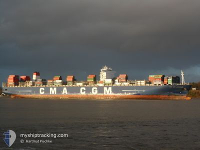
CMA CGM LAPEROUSE
Container Ship
Current Trip
| Time Travelled | 8 days |
|---|---|
| Remaining Time | --- |
| Distance Travelled | 3888.45 nm |
| Remaining Distance | --- |
| AVG Speed | 18.9 Knots |
| MAX Speed | 21.5 Knots |
| AVG Wind | 12.6 knots |
| MAX Wind | 21 knots |
| MIN Temp | 16.1°C / 60.98°F |
| MAX Temp | 29.1°C / 84.38°F |
| Draught | 14.6 m |
| Position Received | 2 h, 8 m ago |
Current Position
| Longitude | 27.91786° |
|---|---|
| Latitude | -33.25297° |
| Status | Under way using engine |
| Speed | 20.3 Knots |
| Course | 240.7° |
| Area | Indian Ocean |
| Station | T-AIS |
| Position Received | 2 h, 8 m ago |
Info
Information
The current position of CMA CGM LAPEROUSE is in Indian Ocean with coordinates -33.25297° / 27.91786° as reported on 2024-06-20 07:18 by AIS to our vessel tracker app. The vessel's current speed is 20.3 Knots and is heading at the port of HALIFAX. The estimated time of arrival as calculated by vessel tracking app is 2024-07-05 18:30 LT
The vessel CMA CGM LAPEROUSE (IMO: 9454412, MMSI: 215930000) is a Container Ship that was built in 2010 ( 14 years old ). It's sailing under the flag of [MT] Malta.
In this page you can find informations about the vessels current position, last detected port calls, and current voyage information. If the vessels is not in coverage by AIS you will find the latest position.
The current position of CMA CGM LAPEROUSE is detected by our AIS receivers and we are not responsible for the reliability of the data. The last position was recorded while the vessel was in Coverage by the Ais receivers of our vessel tracking app.
The current draught of CMA CGM LAPEROUSE as reported by AIS is 14.6 meters
Weather
| Temperature | 16.3°C / 61.34°F |
|---|---|
| Wind Speed | 7 knots |
| Direction | 54° NE |
| Pressure | 1028.4 hPa |
| Humidity | 63 % |
| Cloud Coverage | --- |
Featured Company
Last Port Calls
| Port | Arrival | Departure | Time In Port |
|---|---|---|---|
| 2024-06-10 12:05 | 2024-06-11 18:01 | 1 d | |
| 2024-06-03 07:46 | 2024-06-04 19:51 | 1 d | |
| 2024-05-30 16:09 | 2024-06-01 06:36 | 1 d | |
| 2024-05-23 13:12 | 2024-05-24 16:52 | 1 d | |
| 2024-05-21 21:13 | 2024-05-22 13:39 | 16 h | |
| 2024-04-26 23:21 | 2024-04-30 02:42 | 3 d | |
| 2024-04-19 21:18 | 2024-04-23 14:06 | 3 d | |
| 2024-04-03 18:25 | 2024-04-04 22:49 | 1 d |
Last Trips
| Origin | Departure | Destination | Arrival | Distance | |
|---|---|---|---|---|---|
| 2024-06-05 03:51 | 2024-06-10 17:35 | 1447.56 nm | |||
| 2024-06-01 14:36 | 2024-06-03 15:46 | 205.54 nm | |||
| 2024-05-25 00:52 | 2024-05-31 00:09 | 1602.92 nm | |||
| 2024-05-22 21:39 | 2024-05-23 21:12 | 350.30 nm | |||
| 2024-04-29 19:42 | 2024-05-22 05:13 | 6080.64 nm | |||
| 2024-04-23 07:06 | 2024-04-26 16:21 | 490.17 nm | |||
| 2024-04-05 06:49 | 2024-04-19 14:18 | 6449.98 nm | |||
| 2024-03-29 08:32 | 2024-04-04 02:25 | 1682.34 nm |
Events
| Time | Event | Details | Position / Dest | Info |
|---|---|---|---|---|
| 2024-06-20 07:23 | Status Changed | Default Under way using engine |
-33.26666 / 27.88854
CAHAL
|
Speed: 20.3 kn Course: 240.7° |
| 2024-06-20 07:18 | Status Changed | Under way using engine Default |
-33.25297 / 27.91786
CAHAL
|
Speed: 20.9 kn Course: 240° |
| 2024-06-20 07:18 | OUT of Coverage |
-33.25297 / 27.91786
Indian Ocean
CAHAL
|
Speed: 20.3 kn Course: 240.7° |
|
| 2024-06-20 07:10 | Status Changed | Default Under way using engine |
-33.22950 / 27.96847
CAHAL
|
Speed: 20.8 kn Course: 241.6° |
| 2024-06-20 05:36 | Status Changed | Under way using engine Default |
-32.89523 / 28.48748
CAHAL
|
Speed: 20.9 kn Course: 232° |
| 2024-06-20 05:22 | Status Changed | Default Under way using engine |
-32.84461 / 28.56125
CAHAL
|
Speed: 21 kn Course: 231.5° |
| 2024-06-20 05:15 | Status Changed | Under way using engine Default |
-32.82039 / 28.59651
CAHAL
|
Speed: 21.1 kn Course: 231° |
| 2024-06-20 05:11 | IN Coverage |
-32.82039 / 28.59651
Indian Ocean
CAHAL
|
Speed: 21.3 kn Course: 230.6° |
|
| 2024-06-19 16:55 | Status Changed | Default Under way using engine |
-30.69325 / 32.65498
CAHAL
|
Speed: 18.3 kn Course: 249.6° |
| 2024-06-19 16:51 | OUT of Coverage |
-30.68701 / 32.67450
Indian Ocean
CAHAL
|
Speed: 18.3 kn Course: 249.6° |