
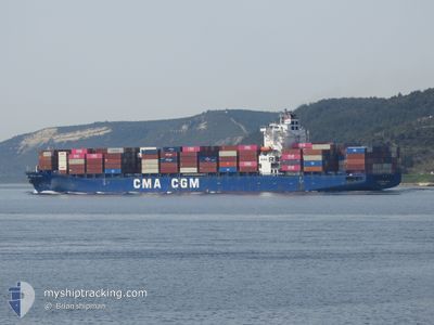
CMA CGM LAPIS
Container Ship
Current Trip
| Time Travelled | 6 days |
|---|---|
| Remaining Time | 1 day |
| Distance Travelled | 2733.09 nm |
| Remaining Distance | 791.81 nm |
| AVG Speed | 17 Knots |
| MAX Speed | 19.3 Knots |
| AVG Wind | 10.9 knots |
| MAX Wind | 19 knots |
| MIN Temp | 13.6°C / 56.48°F |
| MAX Temp | 21.1°C / 69.98°F |
| Draught | 11.3 m |
| Position Received | 4 d ago |
Current Position
| Longitude | -29.36096° |
|---|---|
| Latitude | 40.76742° |
| Status | Under way using engine |
| Speed | 18.6 Knots |
| Course | 278.4° |
| Area | North Atlantic Ocean |
| Station | T-AIS |
| Position Received | 4 d ago |
Info
Information
The current position of CMA CGM LAPIS is in North Atlantic Ocean with coordinates 40.76742° / -29.36096° as reported on 2024-05-19 06:52 by AIS to our vessel tracker app. The vessel's current speed is 18.6 Knots and is heading at the port of NEW YORK. The estimated time of arrival as calculated by vessel tracking app is 2024-05-24 14:41 LT
The vessel CMA CGM LAPIS (IMO: 9386495, MMSI: 636014199) is a Container Ship that was built in 2009 ( 15 years old ). It's sailing under the flag of [LR] Liberia.
In this page you can find informations about the vessels current position, last detected port calls, and current voyage information. If the vessels is not in coverage by AIS you will find the latest position.
The current position of CMA CGM LAPIS is detected by our AIS receivers and we are not responsible for the reliability of the data. The last position was recorded while the vessel was in Coverage by the Ais receivers of our vessel tracking app.
The current draught of CMA CGM LAPIS as reported by AIS is 11.3 meters
Weather
| Temperature | 17.6°C / 63.68°F |
|---|---|
| Wind Speed | 11 knots |
| Direction | 254° WSW |
| Pressure | 1016.7 hPa |
| Humidity | 89.9 % |
| Cloud Coverage | --- |
Featured Company
Last Port Calls
| Port | Arrival | Departure | Time In Port |
|---|---|---|---|
| 2024-05-16 07:18 | 2024-05-16 11:10 | 3 h | |
| 2024-05-13 03:58 | 2024-05-14 02:47 | 22 h | |
| 2024-05-08 10:40 | 2024-05-09 04:48 | 18 h | |
| 2024-05-04 06:29 | 2024-05-07 05:35 | 2 d | |
| 2024-04-30 02:42 | 2024-05-01 12:23 | 1 d | |
| 2024-04-27 10:52 | 2024-04-28 08:25 | 21 h | |
| 2024-04-21 02:48 | 2024-04-21 22:58 | 20 h | |
| 2024-04-05 21:05 | 2024-04-07 00:52 | 1 d | |
| 2024-04-03 07:04 | 2024-04-04 05:38 | 22 h | |
| 2024-03-30 17:53 | 2024-04-01 22:00 | 2 d |
Last Trips
| Origin | Departure | Destination | Arrival | Distance | |
|---|---|---|---|---|---|
| 2024-05-14 04:47 | 2024-05-16 09:18 | 884.04 nm | |||
| 2024-05-09 07:48 | 2024-05-13 05:58 | 1279.93 nm | |||
| 2024-05-07 08:35 | 2024-05-08 13:40 | 368.99 nm | |||
| 2024-05-01 15:23 | 2024-05-04 09:29 | 215.46 nm | |||
| 2024-04-28 11:25 | 2024-04-30 05:42 | 694.40 nm | |||
| 2024-04-22 00:58 | 2024-04-27 13:52 | 2072.01 nm | |||
| 2024-04-06 20:52 | 2024-04-21 04:48 | 3898.29 nm | |||
| 2024-04-04 01:38 | 2024-04-05 17:05 | 526.30 nm | |||
| 2024-04-01 18:00 | 2024-04-03 03:04 | 305.73 nm | |||
| 2024-03-23 01:59 | 2024-03-30 13:53 | 3247.04 nm |
Events
| Time | Event | Details | Position / Dest | Info |
|---|---|---|---|---|
| 2024-05-19 18:53 | START Moving |
40.94205 / -31.05623
USNYC
|
Speed: 8.6 kn Course: 281° |
|
| 2024-05-19 11:49 | STOP Moving |
40.96167 / -31.07833
USNYC
|
Speed: Course: -1° |
|
| 2024-05-19 07:07 | Status Changed | Default Under way using engine |
40.77667 / -29.45833
USNYC
|
Speed: 18.6 kn Course: 278.4° |
| 2024-05-19 06:52 | OUT of Coverage |
40.76742 / -29.36096
North Atlantic Ocean
USNYC
|
Speed: 18.6 kn Course: 278.4° |
|
| 2024-05-19 06:51 | Status Changed | Under way using engine Default |
40.76687 / -29.35566
USNYC
|
Speed: 18 kn Course: 278° |
| 2024-05-19 06:46 | Status Changed | Default Under way using engine |
40.76167 / -29.31667
USNYC
|
Speed: 18.8 kn Course: 280.7° |
| 2024-05-19 06:37 | Status Changed | Under way using engine Default |
40.75447 / -29.25567
USNYC
|
Speed: 18 kn Course: 281° |
| 2024-05-19 06:34 | Status Changed | Default Under way using engine |
40.75167 / -29.23667
USNYC
|
Speed: 19.2 kn Course: 278.4° |
| 2024-05-19 05:34 | Status Changed | Under way using engine Default |
40.70553 / -28.83307
USNYC
|
Speed: 18.8 kn Course: 279° |
| 2024-05-19 05:21 | Status Changed | Default Under way using engine |
40.69740 / -28.74326
USNYC
|
Speed: 18.9 kn Course: 286.4° |