
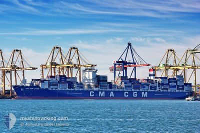
CMA CGM LITANI
Cargo D
Current Trip
| Time Travelled | 10 days |
|---|---|
| Remaining Time | 11 days |
| Distance Travelled | 4487.08 nm |
| Remaining Distance | 4543.97 nm |
| AVG Speed | 17.1 Knots |
| MAX Speed | 20.7 Knots |
| AVG Wind | 12.4 knots |
| MAX Wind | 22.1 knots |
| MIN Temp | 17°C / 62.6°F |
| MAX Temp | 26.2°C / 79.16°F |
| Draught | 14.3 m |
| Position Received | 2 d ago |
Current Position
| Longitude | 20.23344° |
|---|---|
| Latitude | -35.16901° |
| Status | Under way using engine |
| Speed | 16.7 Knots |
| Course | 91° |
| Area | Indian Ocean |
| Station | T-AIS |
| Position Received | 2 d ago |
Info
Information
The current position of CMA CGM LITANI is in Indian Ocean with coordinates -35.16901° / 20.23344° as reported on 2024-05-14 15:37 by AIS to our vessel tracker app. The vessel's current speed is 16.7 Knots and is heading at the port of SINGAPORE. The estimated time of arrival as calculated by vessel tracking app is 2024-05-29 03:58 LT
The vessel CMA CGM LITANI (IMO: 9705055, MMSI: 256033000) is a Cargo D It's sailing under the flag of [MT] Malta.
In this page you can find informations about the vessels current position, last detected port calls, and current voyage information. If the vessels is not in coverage by AIS you will find the latest position.
The current position of CMA CGM LITANI is detected by our AIS receivers and we are not responsible for the reliability of the data. The last position was recorded while the vessel was in Coverage by the Ais receivers of our vessel tracking app.
The current draught of CMA CGM LITANI as reported by AIS is 14.3 meters
Weather
| Temperature | 21.6°C / 70.88°F |
|---|---|
| Wind Speed | 16 knots |
| Direction | 312° NW |
| Pressure | 1017.7 hPa |
| Humidity | 79 % |
| Cloud Coverage | 79 % |
Featured Company
Last Port Calls
| Port | Arrival | Departure | Time In Port |
|---|---|---|---|
| 2024-05-03 09:37 | 2024-05-06 05:58 | 2 d | |
| 2024-04-26 15:15 | 2024-04-27 10:50 | 19 h | |
| 2024-04-21 02:12 | 2024-04-22 19:05 | 1 d | |
| 2024-04-18 01:54 | 2024-04-19 19:09 | 1 d | |
| 2024-04-15 10:47 | 2024-04-16 06:28 | 19 h | |
| 2024-04-09 17:04 | 2024-04-12 09:16 | 2 d | |
| 2024-04-07 13:33 | 2024-04-07 13:41 | 7 m | |
| 2024-03-17 08:17 | 2024-03-19 04:47 | 1 d | |
| 2024-03-10 10:27 | 2024-03-11 02:27 | 15 h | |
| 2024-03-08 23:01 | 2024-03-10 06:07 | 1 d |
Last Trips
| Origin | Departure | Destination | Arrival | Distance | |
|---|---|---|---|---|---|
| 2024-04-27 07:50 | 2024-05-03 06:37 | 226.01 nm | |||
| 2024-04-22 16:05 | 2024-04-26 12:15 | 843.20 nm | |||
| 2024-04-19 16:09 | 2024-04-20 23:12 | 148.62 nm | |||
| 2024-04-16 03:28 | 2024-04-17 22:54 | 798.22 nm | |||
| 2024-04-12 06:16 | 2024-04-15 07:47 | 171.50 nm | |||
| 2024-04-07 10:41 | 2024-04-09 14:04 | 247.57 nm | |||
| 2024-03-19 12:47 | 2024-04-07 10:33 | 8867.88 nm | |||
| 2024-03-11 10:27 | 2024-03-17 16:17 | 1462.01 nm | |||
| 2024-03-10 14:07 | 2024-03-10 18:27 | 60.33 nm | |||
| 2024-02-26 10:47 | 2024-03-09 07:01 | 3123.02 nm |
Events
| Time | Event | Details | Position / Dest | Info |
|---|---|---|---|---|
| 2024-05-14 15:40 | Status Changed | Default Under way using engine |
-35.16918 / 20.24804
SGSIN
|
Speed: 16.7 kn Course: 91° |
| 2024-05-14 15:37 | OUT of Coverage |
-35.16901 / 20.23344
Indian Ocean
SGSIN
|
Speed: 16.7 kn Course: 91° |
|
| 2024-05-14 15:37 | Status Changed | Under way using engine Default |
-35.16898 / 20.23107
SGSIN
|
Speed: 16.7 kn Course: 92° |
| 2024-05-14 15:35 | Status Changed | Default Under way using engine |
-35.16886 / 20.21859
SGSIN
|
Speed: 16.7 kn Course: 89.6° |
| 2024-05-14 15:27 | Status Changed | Under way using engine Default |
-35.16834 / 20.17561
SGSIN
|
Speed: 16.8 kn Course: 90° |
| 2024-05-14 15:14 | Status Changed | Default Under way using engine |
-35.16766 / 20.10298
SGSIN
|
Speed: 16.6 kn Course: 91.4° |
| 2024-05-14 14:57 | Detected in Sea | South African part of the Indian Ocean |
-35.16659 / 20.00596
Indian Ocean
SGSIN
|
Speed: 16.8 kn Course: 91.2° |
| 2024-05-14 14:55 | Status Changed | Under way using engine Default |
-35.16642 / 19.99239
SGSIN
|
Speed: 16.6 kn Course: 94° |
| 2024-05-14 14:40 | Status Changed | Default Under way using engine |
-35.16517 / 19.90750
SGSIN
|
Speed: 16.7 kn Course: 90.6° |
| 2024-05-14 14:16 | Status Changed | Under way using engine Default |
-35.16265 / 19.77238
SGSIN
|
Speed: 16.6 kn Course: 92° |