
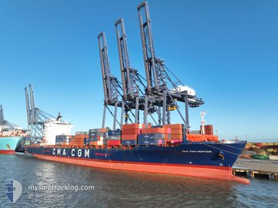
CMA CGM MONTOIR
Container Ship
Current Trip
| Time Travelled | 4 days |
|---|---|
| Remaining Time | --- |
| Distance Travelled | 680.22 nm |
| Remaining Distance | --- |
| AVG Speed | 12.3 Knots |
| MAX Speed | 19.7 Knots |
| AVG Wind | 12.7 knots |
| MAX Wind | 17.2 knots |
| MIN Temp | 18.7°C / 65.66°F |
| MAX Temp | 22.6°C / 72.68°F |
| Draught | 11.9 m |
| Position Received | 1 m ago |
Current Position
| Longitude | 1.50549° |
|---|---|
| Latitude | 37.81326° |
| Status | Under way using engine |
| Speed | 1.8 Knots |
| Course | 21° |
| Area | Mediterranean Sea - Western Basin |
| Station | T-AIS |
| Position Received | 1 m ago |
Info
Information
The current position of CMA CGM MONTOIR is in Mediterranean Sea - Western Basin with coordinates 37.81326° / 1.50549° as reported on 2024-06-06 18:48 by AIS to our vessel tracker app. The vessel's current speed is 1.8 Knots
The vessel CMA CGM MONTOIR (IMO: 9348443, MMSI: 229290000) is a Container Ship that was built in 2008 ( 16 years old ). It's sailing under the flag of [MT] Malta.
In this page you can find informations about the vessels current position, last detected port calls, and current voyage information. If the vessels is not in coverage by AIS you will find the latest position.
The current position of CMA CGM MONTOIR is detected by our AIS receivers and we are not responsible for the reliability of the data. The last position was recorded while the vessel was in Coverage by the Ais receivers of our vessel tracking app.
The current draught of CMA CGM MONTOIR as reported by AIS is 11.9 meters
Weather
| Temperature | 21.6°C / 70.88°F |
|---|---|
| Wind Speed | 16 knots |
| Direction | 80° E |
| Pressure | 1014.6 hPa |
| Humidity | 82.1 % |
| Cloud Coverage | 75 % |
Featured Company
Last Port Calls
| Port | Arrival | Departure | Time In Port |
|---|---|---|---|
| 2024-06-02 04:09 | 2024-06-02 15:53 | 11 h | |
| 2024-05-30 03:35 | 2024-05-31 02:19 | 22 h | |
| 2024-05-29 04:28 | 2024-05-29 10:03 | 5 h | |
| 2024-05-26 10:13 | 2024-05-27 19:59 | 1 d | |
| 2024-05-22 21:54 | 2024-05-23 16:39 | 18 h | |
| 2024-05-21 20:53 | 2024-05-22 17:20 | 20 h | |
| 2024-05-17 19:44 | 2024-05-19 09:25 | 1 d | |
| 2024-05-08 03:01 | 2024-05-11 05:24 | 3 d | |
| 2024-05-05 08:15 | 2024-05-06 22:57 | 1 d | |
| 2024-05-03 22:13 | 2024-05-04 21:28 | 23 h |
Most Visited Ports (Last year)
| Port | Arrivals | |
|---|---|---|
| 9 | ||
| 6 | ||
| 6 | ||
| 6 | ||
| 6 | ||
| 6 |
Last Trips
| Origin | Departure | Destination | Arrival | Distance | |
|---|---|---|---|---|---|
| 2024-05-31 05:19 | 2024-06-02 06:09 | 830.21 nm | |||
| 2024-05-29 13:03 | 2024-05-30 06:35 | 205.26 nm | |||
| 2024-05-27 22:59 | 2024-05-29 07:28 | 402.43 nm | |||
| 2024-05-23 19:39 | 2024-05-26 13:13 | 115.77 nm | |||
| 2024-05-22 20:20 | 2024-05-23 00:54 | 46.42 nm | |||
| 2024-05-19 11:25 | 2024-05-21 23:53 | 841.52 nm | |||
| 2024-05-11 07:24 | 2024-05-17 21:44 | 2723.00 nm | |||
| 2024-05-07 00:57 | 2024-05-08 05:01 | 395.79 nm | |||
| 2024-05-04 22:28 | 2024-05-05 10:15 | 159.91 nm | |||
| 2024-04-30 10:43 | 2024-05-03 23:13 | 1362.65 nm |
Events
| Time | Event | Details | Position / Dest | Info |
|---|---|---|---|---|
| 2024-06-06 16:39 | Draught Changed | 11.9 11 |
37.75599 / 1.54426
MAPTM
|
Speed: 1.7 kn Course: 3° |
| 2024-06-06 16:39 | ETA Changed | 2024/06/12 10:00 |
37.75599 / 1.54426
MAPTM
|
Speed: 1.7 kn Course: 3° |
| 2024-06-06 11:32 | Detected in Sea | Spanish part of the Mediterranean Sea - Western Basin |
37.61441 / 1.63640
Mediterranean Sea - Western Basin
|
Speed: 1.7 kn Course: 329.8° |
| 2024-06-05 14:42 | Draught Changed | 11 11.9 |
37.22293 / 2.14536
MAPTM
|
Speed: 1.8 kn Course: 17° |
| 2024-06-05 14:14 | Draught Changed | 11.9 11 |
37.21665 / 2.16160
MAPTM
|
Speed: 0.9 kn Course: 17° |
| 2024-06-05 14:14 | ETA Changed | 2024/06/07 06:00 |
37.21665 / 2.16160
MAPTM
|
Speed: 0.9 kn Course: 17° |
| 2024-06-05 13:57 | Draught Changed | 11 11.9 |
37.21299 / 2.17140
MAPTM
|
Speed: 1.8 kn Course: 18° |
| 2024-06-05 13:17 | Draught Changed | 11.9 11 |
37.20491 / 2.19494
MAPTM
|
Speed: 1.9 kn Course: 14° |
| 2024-06-05 13:17 | ETA Changed | 2024/06/07 06:00 |
37.20491 / 2.19494
MAPTM
|
Speed: 1.9 kn Course: 14° |
| 2024-06-05 11:08 | Draught Changed | 11 11.9 |
37.19921 / 2.27267
MAPTM
|
Speed: 1.6 kn Course: 354° |