
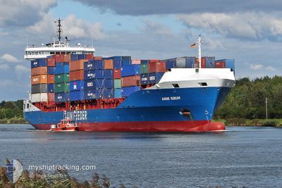
CMA CGM NADOR
Container Ship
Current Trip
LYMRA
| Time Travelled | 1 day |
|---|---|
| Remaining Time | --- |
| Distance Travelled | 344.03 nm |
| Remaining Distance | --- |
| AVG Speed | 13.8 Knots |
| MAX Speed | 15 Knots |
| AVG Wind | 5.6 knots |
| MAX Wind | 8.3 knots |
| MIN Temp | 20.1°C / 68.18°F |
| MAX Temp | 22.6°C / 72.68°F |
| Draught | 8.5 m |
| Position Received | 1 h, 3 m ago |
Current Position
| Longitude | 21.23343° |
|---|---|
| Latitude | 34.85796° |
| Status | Under way using engine |
| Speed | 11.3 Knots |
| Course | 63.6° |
| Area | Mediterranean Sea - Eastern Basin |
| Station | T-AIS |
| Position Received | 1 h, 3 m ago |
Info
Information
The current position of CMA CGM NADOR is in Mediterranean Sea - Eastern Basin with coordinates 34.85796° / 21.23343° as reported on 2024-05-28 17:03 by AIS to our vessel tracker app. The vessel's current speed is 11.3 Knots
The vessel CMA CGM NADOR (IMO: 9396696, MMSI: 242410400) is a Container Ship that was built in 2007 ( 17 years old ). It's sailing under the flag of [MA] Morocco.
In this page you can find informations about the vessels current position, last detected port calls, and current voyage information. If the vessels is not in coverage by AIS you will find the latest position.
The current position of CMA CGM NADOR is detected by our AIS receivers and we are not responsible for the reliability of the data. The last position was recorded while the vessel was in Coverage by the Ais receivers of our vessel tracking app.
The current draught of CMA CGM NADOR as reported by AIS is 8.5 meters
Weather
| Temperature | 20.5°C / 68.9°F |
|---|---|
| Wind Speed | 9 knots |
| Direction | 306° NW |
| Pressure | 1015.7 hPa |
| Humidity | 72.4 % |
| Cloud Coverage | 60 % |
Featured Company
Last Port Calls
| Port | Arrival | Departure | Time In Port |
|---|---|---|---|
| 2024-05-25 19:36 | 2024-05-27 17:02 | 1 d | |
| 2024-05-22 17:15 | 2024-05-23 11:04 | 17 h | |
| 2024-05-17 08:08 | 2024-05-18 02:19 | 18 h | |
| 2024-05-16 14:14 | 2024-05-17 01:23 | 11 h | |
| 2024-05-14 21:31 | 2024-05-15 15:49 | 18 h | |
| 2024-05-10 19:07 | 2024-05-12 17:48 | 1 d | |
| 2024-05-07 15:40 | 2024-05-08 15:04 | 23 h | |
| 2024-05-05 00:31 | 2024-05-05 08:47 | 8 h | |
| 2024-05-04 05:29 | 2024-05-04 17:38 | 12 h | |
| 2024-05-02 20:20 | 2024-05-03 08:47 | 12 h |
Most Visited Ports (Last year)
| Port | Arrivals | |
|---|---|---|
| 10 | ||
| 7 | ||
| 6 | ||
| 6 | ||
| 6 | ||
| 5 |
Last Trips
| Origin | Departure | Destination | Arrival | Distance | |
|---|---|---|---|---|---|
| 2024-05-23 13:04 | 2024-05-25 21:36 | 778.88 nm | |||
| 2024-05-18 05:19 | 2024-05-22 19:15 | 888.75 nm | |||
| 2024-05-17 04:23 | 2024-05-17 11:08 | 52.60 nm | |||
| 2024-05-15 18:49 | 2024-05-16 17:14 | 285.05 nm | |||
| 2024-05-12 19:48 | 2024-05-15 00:31 | 741.52 nm | |||
| 2024-05-08 17:04 | 2024-05-10 21:07 | 778.85 nm | |||
| 2024-05-05 11:47 | 2024-05-07 17:40 | 752.55 nm | |||
| 2024-05-04 20:38 | 2024-05-05 03:31 | 56.54 nm | |||
| 2024-05-03 11:47 | 2024-05-04 08:29 | 282.12 nm | |||
| 2024-04-30 14:29 | 2024-05-02 23:20 | 752.16 nm |
Events
| Time | Event | Details | Position / Dest | Info |
|---|---|---|---|---|
| 2024-05-28 17:04 | Status Changed | Default Under way using engine |
34.85833 / 21.23500
LYMRA
|
Speed: 11.3 kn Course: 63.6° |
| 2024-05-28 17:03 | Status Changed | Under way using engine Default |
34.85796 / 21.23343
LYMRA
|
Speed: 12 kn Course: 64° |
| 2024-05-28 17:03 | IN Coverage |
34.85796 / 21.23343
Mediterranean Sea - Eastern Basin
|
Speed: 11.3 kn Course: 63.6° |
|
| 2024-05-28 17:03 | OUT of Coverage |
34.85796 / 21.23343
Mediterranean Sea - Eastern Basin
|
Speed: 11.3 kn Course: 63.6° |
|
| 2024-05-28 17:03 | Change Sea Area | Greek part of the Mediterranean Sea - Eastern Basin Libyan part of the Mediterranean Sea - Eastern Basin |
34.85796 / 21.23343
Mediterranean Sea - Eastern Basin
|
Speed: 11.3 kn Course: 63.6° |
| 2024-05-27 17:03 | START Moving | 0.79 nm, North of MISURATA |
32.37167 / 15.23667
LYMRA
|
Speed: 10 kn Course: -1° |
| 2024-05-27 17:02 | PORT DEPARTURE |
|
32.37167 / 15.23667
LYMRA
|
Speed: 1 kn Course: -1° |
| 2024-05-25 19:36 | STOP Moving |
32.36833 / 15.21833
[LY] MISURATA
|
Speed: Course: -1° |
|
| 2024-05-25 19:36 | PORT ARRIVAL |
|
32.36833 / 15.21833
[LY] MISURATA
|
Speed: 6.4 kn Course: 254° |
| 2024-05-25 02:13 | OUT of Coverage |
33.35013 / 19.70472
Mediterranean Sea - Eastern Basin
LYMRA
|
Speed: 14.1 kn Course: 256.8° |