
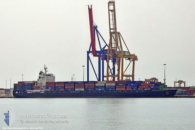
CMA CGM NAVEGANTES
Container Ship
Current Trip
| Trip Time | 13 days |
|---|---|
| Trip Distance | 4306.93 nm |
| AVG Speed | 13.2 Knots |
| MAX Speed | 20.1 Knots |
| Draught | 10.8 m |
| AVG Wind | 10.3 knots |
| MAX Wind | 27 knots |
| MIN Temp | 16.3°C / 61.34°F |
| MAX Temp | 30.2°C / 86.36°F |
| Position Received | 3 m ago |
Current Position
| Longitude | -80.15152° |
|---|---|
| Latitude | 25.76608° |
| Status | Moored |
| Speed | 0.1 Knots |
| Course | 92° |
| Area | North Atlantic Ocean |
| Station | T-AIS |
| Position Received | 3 m ago |
Info
Information
The current position of CMA CGM NAVEGANTES is in North Atlantic Ocean with coordinates 25.76608° / -80.15152° as reported on 2024-06-07 11:55 by AIS to our vessel tracker app. The vessel's current speed is 0.1 Knots and is currently inside the port of MIAMI.
The vessel CMA CGM NAVEGANTES (IMO: 9303780, MMSI: 256144000) is a Container Ship that was built in 2006 ( 18 years old ). It's sailing under the flag of [MT] Malta.
In this page you can find informations about the vessels current position, last detected port calls, and current voyage information. If the vessels is not in coverage by AIS you will find the latest position.
The current position of CMA CGM NAVEGANTES is detected by our AIS receivers and we are not responsible for the reliability of the data. The last position was recorded while the vessel was in Coverage by the Ais receivers of our vessel tracking app.
The current draught of CMA CGM NAVEGANTES as reported by AIS is 10.8 meters
Weather
| Temperature | 28.5°C / 83.3°F |
|---|---|
| Wind Speed | 4 knots |
| Direction | 198° SSW |
| Pressure | 1011.9 hPa |
| Humidity | 72.2 % |
| Cloud Coverage | 1 % |
Featured Company
Last Port Calls
| Port | Arrival | Departure | Time In Port |
|---|---|---|---|
| 2024-06-06 23:40 | |||
| 2024-05-23 23:08 | 2024-05-24 22:35 | 23 h | |
| 2024-05-21 15:19 | 2024-05-22 08:53 | 17 h | |
| 2024-05-18 15:41 | 2024-05-20 00:17 | 1 d | |
| 2024-05-17 16:04 | 2024-05-18 08:41 | 16 h | |
| 2024-04-29 04:30 | 2024-04-30 07:06 | 1 d | |
| 2024-04-26 12:06 | 2024-04-27 14:11 | 1 d | |
| 2024-04-24 13:04 | 2024-04-25 17:53 | 1 d | |
| 2024-04-20 18:05 | 2024-04-21 11:09 | 17 h | |
| 2024-04-07 11:09 | 2024-04-08 15:16 | 1 d |
Last Trips
| Origin | Departure | Destination | Arrival | Distance | |
|---|---|---|---|---|---|
| 2024-05-25 00:35 | 2024-06-06 19:40 | 4306.93 nm | |||
| 2024-05-22 10:53 | 2024-05-24 01:08 | 171.49 nm | |||
| 2024-05-20 02:17 | 2024-05-21 17:19 | 377.01 nm | |||
| 2024-05-18 10:41 | 2024-05-18 17:41 | 74.59 nm | |||
| 2024-04-30 02:06 | 2024-05-17 18:04 | 5929.71 nm | |||
| 2024-04-27 09:11 | 2024-04-28 23:30 | 516.66 nm | |||
| 2024-04-25 12:53 | 2024-04-26 07:06 | 239.87 nm | |||
| 2024-04-21 07:09 | 2024-04-24 08:04 | 1084.59 nm | |||
| 2024-04-08 17:16 | 2024-04-20 14:05 | 4371.04 nm | |||
| 2024-04-05 05:04 | 2024-04-07 13:09 | 173.44 nm |
Events
| Time | Event | Details | Position / Dest | Info |
|---|---|---|---|---|
| 2024-06-07 00:28 | Status Changed | Moored Under way using engine |
25.76606 / -80.15151
[US] MIAMI
|
Speed: 0.1 kn Course: 92° |
| 2024-06-07 00:26 | STOP Moving |
25.76594 / -80.15162
[US] MIAMI
|
Speed: 0.3 kn Course: 91° |
|
| 2024-06-06 23:40 | PORT ARRIVAL |
|
25.76252 / -80.13023
[US] MIAMI
|
Speed: 7.5 kn Course: 291.3° |
| 2024-06-06 20:41 | ETA Changed | 2024/06/06 23:00 2024/06/06 11:30 |
26.06186 / -79.70015
ESVLC>USMIA
|
Speed: 10.7 kn Course: 179.6° |
| 2024-06-06 12:14 | START Moving |
25.94998 / -79.71526
ESVLC>USMIA
|
Speed: 3.1 kn Course: 120° |
|
| 2024-06-06 11:51 | STOP Moving |
25.93897 / -79.72192
ESVLC>USMIA
|
Speed: 0.3 kn Course: 178° |
|
| 2024-06-06 11:28 | Change Sea Area | United States part of the North Atlantic Ocean Bahamas part of the North Atlantic Ocean |
25.95756 / -79.68331
North Atlantic Ocean
ESVLC>USMIA
|
Speed: 8.9 kn Course: 238.7° |
| 2024-06-06 09:11 | ETA Changed | 2024/06/06 11:30 2024/06/06 12:30 |
26.12968 / -79.32756
ESVLC>USMIA
|
Speed: 10.2 kn Course: 244.2° |
| 2024-06-06 09:01 | Change Sea Area | Bahamas part of the North Atlantic Ocean High seas of the North Atlantic Ocean |
26.14179 / -79.29902
North Atlantic Ocean
ESVLC>USMIA
|
Speed: 10.4 kn Course: 247° |
| 2024-06-06 09:01 | Status Changed | Under way using engine Default |
26.14179 / -79.29902
ESVLC>USMIA
|
Speed: 10.4 kn Course: 246° |