
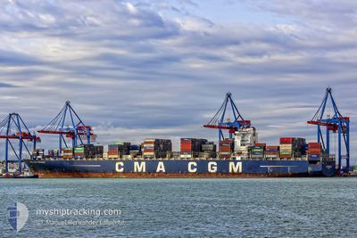
CMA CGM PEGASUS
Container Ship
Current Trip
| Time Travelled | 18 days |
|---|---|
| Remaining Time | 8 days |
| Distance Travelled | 6720.47 nm |
| Remaining Distance | 3238.72 nm |
| AVG Speed | 14.8 Knots |
| MAX Speed | 18 Knots |
| AVG Wind | 13.2 knots |
| MAX Wind | 25.4 knots |
| MIN Temp | 15.6°C / 60.08°F |
| MAX Temp | 27.8°C / 82.04°F |
| Draught | 15 m |
| Position Received | 2 d ago |
Current Position
| Longitude | 32.00275° |
|---|---|
| Latitude | -29.53722° |
| Status | Under way using engine |
| Speed | 13.9 Knots |
| Course | 34.4° |
| Area | Indian Ocean |
| Station | T-AIS |
| Position Received | 2 d ago |
Info
Information
The current position of CMA CGM PEGASUS is in Indian Ocean with coordinates -29.53722° / 32.00275° as reported on 2024-06-14 09:03 by AIS to our vessel tracker app. The vessel's current speed is 13.9 Knots and is heading at the port of JEBEL ALI. The estimated time of arrival as calculated by vessel tracking app is 2024-06-25 03:57 LT
The vessel CMA CGM PEGASUS (IMO: 9399210, MMSI: 248013000) is a Container Ship that was built in 2010 ( 14 years old ). It's sailing under the flag of [MT] Malta.
In this page you can find informations about the vessels current position, last detected port calls, and current voyage information. If the vessels is not in coverage by AIS you will find the latest position.
The current position of CMA CGM PEGASUS is detected by our AIS receivers and we are not responsible for the reliability of the data. The last position was recorded while the vessel was in Coverage by the Ais receivers of our vessel tracking app.
The current draught of CMA CGM PEGASUS as reported by AIS is 15 meters
Weather
| Temperature | 24.4°C / 75.92°F |
|---|---|
| Wind Speed | 18 knots |
| Direction | 176° S |
| Pressure | 1018 hPa |
| Humidity | 64.9 % |
| Cloud Coverage | --- |
Featured Company
Last Port Calls
| Port | Arrival | Departure | Time In Port |
|---|---|---|---|
| 2024-05-27 16:18 | 2024-05-28 15:45 | 23 h | |
| 2024-05-18 10:50 | 2024-05-19 10:19 | 23 h | |
| 2024-05-16 05:25 | 2024-05-17 06:46 | 1 d | |
| 2024-05-12 10:59 | 2024-05-14 04:58 | 1 d | |
| 2024-05-08 09:18 | 2024-05-10 01:31 | 1 d | |
| 2024-05-04 22:10 | 2024-05-06 06:27 | 1 d | |
| 2024-04-30 10:24 | 2024-05-01 00:19 | 13 h | |
| 2024-04-04 22:25 | 2024-04-05 22:35 | 1 d | |
| 2024-04-02 16:45 | 2024-04-03 19:57 | 1 d |
Most Visited Ports (Last year)
| Port | Arrivals | |
|---|---|---|
| 7 | ||
| 6 | ||
| 5 | ||
| 5 | ||
| 5 | ||
| 5 |
Last Trips
| Origin | Departure | Destination | Arrival | Distance | |
|---|---|---|---|---|---|
| 2024-05-19 12:19 | 2024-05-27 18:18 | 1490.47 nm | |||
| 2024-05-17 08:46 | 2024-05-18 12:50 | 273.93 nm | |||
| 2024-05-14 06:58 | 2024-05-16 07:25 | 132.92 nm | |||
| 2024-05-10 03:31 | 2024-05-12 12:59 | 268.27 nm | |||
| 2024-05-06 07:27 | 2024-05-08 11:18 | 495.34 nm | |||
| 2024-05-01 01:19 | 2024-05-04 23:10 | 1206.80 nm | |||
| 2024-04-06 04:05 | 2024-04-30 11:24 | 9781.23 nm | |||
| 2024-04-04 01:27 | 2024-04-05 03:55 | 428.86 nm | |||
| 2024-03-29 07:34 | 2024-04-02 22:15 | 1346.55 nm |
Events
| Time | Event | Details | Position / Dest | Info |
|---|---|---|---|---|
| 2024-06-14 09:08 | Status Changed | Default Under way using engine |
-29.52231 / 32.01495
AEJEA
|
Speed: 13.9 kn Course: 34.4° |
| 2024-06-14 09:03 | OUT of Coverage |
-29.53722 / 32.00275
Indian Ocean
AEJEA
|
Speed: 13.9 kn Course: 34.4° |
|
| 2024-06-14 04:19 | Status Changed | Under way using engine Default |
-30.46843 / 31.21120
AEJEA
|
Speed: 16.3 kn Course: 34° |
| 2024-06-14 04:15 | Status Changed | Default Under way using engine |
-30.48382 / 31.19965
AEJEA
|
Speed: 16.1 kn Course: 34.7° |
| 2024-06-14 04:07 | Status Changed | Under way using engine Default |
-30.51636 / 31.17398
AEJEA
|
Speed: 16 kn Course: 36° |
| 2024-06-14 03:48 | IN Coverage |
-30.51636 / 31.17398
Indian Ocean
AEJEA
|
Speed: 16.1 kn Course: 34.7° |
|
| 2024-06-13 09:51 | Status Changed | Default Under way using engine |
-33.86500 / 27.48500
AEJEA
|
Speed: 14.8 kn Course: 58.4° |
| 2024-06-13 09:47 | Status Changed | Under way using engine Default |
-33.87150 / 27.47019
AEJEA
|
Speed: 15 kn Course: 60° |
| 2024-06-13 09:47 | OUT of Coverage |
-33.87150 / 27.47019
Indian Ocean
AEJEA
|
Speed: 14.8 kn Course: 58.4° |
|
| 2024-06-13 09:47 | Change Sea Area | South African part of the Indian Ocean South African part of the South Atlantic Ocean |
-33.87150 / 27.47019
Indian Ocean
AEJEA
|
Speed: 14.8 kn Course: 58.4° |