
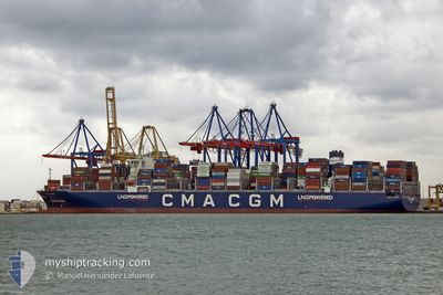
CMA CGM PRIDE
Cargo
Current Trip
| Time Travelled | 2 days |
|---|---|
| Remaining Time | 12 days |
| Distance Travelled | 922.13 nm |
| Remaining Distance | 5512.76 nm |
| AVG Speed | 16.6 Knots |
| MAX Speed | 21 Knots |
| AVG Wind | 9.7 knots |
| MAX Wind | 23.3 knots |
| MIN Temp | 14.7°C / 58.46°F |
| MAX Temp | 24.8°C / 76.64°F |
| Draught | 15 m |
| Position Received | 7 h, 49 m ago |
Current Position
| Longitude | 142.43011° |
|---|---|
| Latitude | 41.64311° |
| Status | Under way using engine |
| Speed | 18.8 Knots |
| Course | 89.8° |
| Area | North Pacific Ocean |
| Station | T-AIS |
| Position Received | 7 h, 49 m ago |
Info
Information
The current position of CMA CGM PRIDE is in North Pacific Ocean with coordinates 41.64311° / 142.43011° as reported on 2024-06-16 21:17 by AIS to our vessel tracker app. The vessel's current speed is 18.8 Knots and is heading at the port of MANZANILLO. The estimated time of arrival as calculated by vessel tracking app is 2024-06-29 06:33 LT
The vessel CMA CGM PRIDE (IMO: 9924429, MMSI: 229997000) is a Cargo It's sailing under the flag of [MT] Malta.
In this page you can find informations about the vessels current position, last detected port calls, and current voyage information. If the vessels is not in coverage by AIS you will find the latest position.
The current position of CMA CGM PRIDE is detected by our AIS receivers and we are not responsible for the reliability of the data. The last position was recorded while the vessel was in Coverage by the Ais receivers of our vessel tracking app.
The current draught of CMA CGM PRIDE as reported by AIS is 15 meters
Weather
| Temperature | 16.1°C / 60.98°F |
|---|---|
| Wind Speed | 21 knots |
| Direction | 242° WSW |
| Pressure | 1003 hPa |
| Humidity | 81.5 % |
| Cloud Coverage | 3 % |
Featured Company
Last Port Calls
| Port | Arrival | Departure | Time In Port |
|---|---|---|---|
| 2024-06-14 01:09 | 2024-06-15 01:38 | 1 d | |
| 2024-06-07 05:17 | 2024-06-08 09:01 | 1 d | |
| 2024-06-04 17:50 | 2024-06-05 08:13 | 14 h | |
| 2024-06-03 08:09 | 2024-06-03 19:48 | 11 h | |
| 2024-06-01 08:18 | 2024-06-03 06:22 | 1 d | |
| 2024-05-27 10:49 | 2024-05-28 20:21 | 1 d | |
| 2024-05-23 20:51 | 2024-05-25 08:47 | 1 d | |
| 2024-05-06 16:04 | 2024-05-08 18:33 | 2 d | |
| 2024-05-04 04:46 | 2024-05-05 16:51 | 1 d | |
| 2024-04-27 12:23 | 2024-04-28 12:47 | 1 d |
Most Visited Ports (Last year)
| Port | Arrivals | |
|---|---|---|
| 4 | ||
| 4 | ||
| 4 | ||
| 3 | ||
| 3 | ||
| 3 |
Last Trips
| Origin | Departure | Destination | Arrival | Distance | |
|---|---|---|---|---|---|
| 2024-06-08 17:01 | 2024-06-14 10:09 | 677.51 nm | |||
| 2024-06-05 16:13 | 2024-06-07 13:17 | 560.53 nm | |||
| 2024-06-04 03:48 | 2024-06-05 01:50 | 355.87 nm | |||
| 2024-06-03 14:22 | 2024-06-03 16:09 | 21.22 nm | |||
| 2024-05-29 05:21 | 2024-06-01 16:18 | 1436.74 nm | |||
| 2024-05-25 17:47 | 2024-05-27 19:49 | 890.01 nm | |||
| 2024-05-08 13:33 | 2024-05-24 05:51 | 6010.83 nm | |||
| 2024-05-05 11:51 | 2024-05-06 11:04 | 167.84 nm | |||
| 2024-04-28 07:47 | 2024-05-03 23:46 | 1827.94 nm | |||
| 2024-04-25 00:37 | 2024-04-27 07:23 | 708.85 nm |
Events
| Time | Event | Details | Position / Dest | Info |
|---|---|---|---|---|
| 2024-06-16 21:25 | Status Changed | Default Under way using engine |
41.64307 / 142.48825
KRPUS>MXZLO
|
Speed: 18.8 kn Course: 89.8° |
| 2024-06-16 21:17 | OUT of Coverage |
41.64311 / 142.43011
North Pacific Ocean
KRPUS>MXZLO
|
Speed: 18.8 kn Course: 89.8° |
|
| 2024-06-16 21:11 | Status Changed | Under way using engine Default |
41.64287 / 142.38625
KRPUS>MXZLO
|
Speed: 18.7 kn Course: 90° |
| 2024-06-16 21:09 | Status Changed | Default Under way using engine |
41.64282 / 142.37581
KRPUS>MXZLO
|
Speed: 18.7 kn Course: 89.3° |
| 2024-06-16 20:54 | Status Changed | Under way using engine Default |
41.64141 / 142.26864
KRPUS>MXZLO
|
Speed: 18.6 kn Course: 87° |
| 2024-06-16 20:49 | Status Changed | Default Under way using engine |
41.64001 / 142.23404
KRPUS>MXZLO
|
Speed: 18.4 kn Course: 87.6° |
| 2024-06-16 18:41 | Change Sea Area | Japanese part of the North Pacific Ocean Japanese part of the Japan Sea |
41.62892 / 141.31034
North Pacific Ocean
KRPUS>MXZLO
|
Speed: 18.5 kn Course: 86° |
| 2024-06-16 16:26 | Status Changed | Under way using engine Default |
41.36883 / 140.38166
KRPUS>MXZLO
|
Speed: 19.3 kn Course: 57° |
| 2024-06-16 16:09 | IN Coverage |
41.37780 / 140.39973
Japan Sea
KRPUS>MXZLO
|
Speed: 19.7 kn Course: 56.6° |
|
| 2024-06-16 15:13 | OUT of Coverage |
41.13905 / 139.96278
Japan Sea
KRPUS>MXZLO
|
Speed: 18.9 kn Course: 53.1° |