
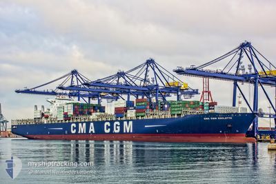
CMA CGM RIGOLETTO
Container Ship
Current Trip
| Time Travelled | 3 days |
|---|---|
| Remaining Time | 2 days |
| Distance Travelled | 1674.00 nm |
| Remaining Distance | 1487.21 nm |
| AVG Speed | 18.3 Knots |
| MAX Speed | 22 Knots |
| AVG Wind | 12.5 knots |
| MAX Wind | 32.7 knots |
| MIN Temp | 12.3°C / 54.14°F |
| MAX Temp | 16°C / 60.8°F |
| Draught | 13.8 m |
| Position Received | 2 d ago |
Current Position
| Longitude | -10.00242° |
|---|---|
| Latitude | 50.09470° |
| Status | Under way using engine |
| Speed | 21.4 Knots |
| Course | 283.2° |
| Area | Celtic Sea |
| Station | T-AIS |
| Position Received | 2 d ago |
Info
Information
The current position of CMA CGM RIGOLETTO is in Celtic Sea with coordinates 50.09470° / -10.00242° as reported on 2024-06-23 11:42 by AIS to our vessel tracker app. The vessel's current speed is 21.4 Knots and is heading at the port of NEW YORK. The estimated time of arrival as calculated by vessel tracking app is 2024-06-29 01:43 LT
The vessel CMA CGM RIGOLETTO (IMO: 9299654, MMSI: 228354600) is a Container Ship that was built in 2006 ( 18 years old ). It's sailing under the flag of [FR] France.
In this page you can find informations about the vessels current position, last detected port calls, and current voyage information. If the vessels is not in coverage by AIS you will find the latest position.
The current position of CMA CGM RIGOLETTO is detected by our AIS receivers and we are not responsible for the reliability of the data. The last position was recorded while the vessel was in Coverage by the Ais receivers of our vessel tracking app.
The current draught of CMA CGM RIGOLETTO as reported by AIS is 13.8 meters
Weather
| Temperature | 14°C / 57.2°F |
|---|---|
| Wind Speed | 3 knots |
| Direction | 190° S |
| Pressure | 1016.6 hPa |
| Humidity | 89 % |
| Cloud Coverage | 100 % |
Featured Company
Last Port Calls
| Port | Arrival | Departure | Time In Port |
|---|---|---|---|
| 2024-06-20 11:18 | 2024-06-22 14:11 | 2 d | |
| 2024-06-13 18:09 | 2024-06-17 04:04 | 3 d | |
| 2024-06-09 19:10 | 2024-06-12 11:24 | 2 d | |
| 2024-06-01 19:39 | 2024-06-03 06:34 | 1 d | |
| 2024-05-30 22:45 | 2024-05-31 19:10 | 20 h | |
| 2024-05-18 18:26 | 2024-05-19 16:02 | 21 h | |
| 2024-05-11 07:19 | 2024-05-12 19:20 | 1 d | |
| 2024-05-06 14:52 | 2024-05-08 04:15 | 1 d | |
| 2024-05-03 08:20 | 2024-05-04 20:03 | 1 d | |
| 2024-04-24 15:51 | 2024-04-25 12:58 | 21 h |
Most Visited Ports (Last year)
| Port | Arrivals | |
|---|---|---|
| 6 | ||
| 5 | ||
| 5 | ||
| 5 | ||
| 5 | ||
| 5 |
Last Trips
| Origin | Departure | Destination | Arrival | Distance | |
|---|---|---|---|---|---|
| 2024-06-17 06:04 | 2024-06-20 13:18 | 479.21 nm | |||
| 2024-06-12 13:24 | 2024-06-13 20:09 | 271.69 nm | |||
| 2024-06-03 08:34 | 2024-06-09 21:10 | 137.63 nm | |||
| 2024-05-31 20:10 | 2024-06-01 21:39 | 273.34 nm | |||
| 2024-05-19 12:02 | 2024-05-30 23:45 | 3671.58 nm | |||
| 2024-05-12 15:20 | 2024-05-18 14:26 | 156.82 nm | |||
| 2024-05-08 00:15 | 2024-05-11 03:19 | 530.96 nm | |||
| 2024-05-04 16:03 | 2024-05-06 10:52 | 323.66 nm | |||
| 2024-04-25 14:58 | 2024-05-03 04:20 | 3156.33 nm | |||
| 2024-04-23 10:14 | 2024-04-24 17:51 | 294.25 nm |
Events
| Time | Event | Details | Position / Dest | Info |
|---|---|---|---|---|
| 2024-06-23 11:47 | Status Changed | Default Under way using engine |
50.10218 / -10.05208
USNYC
|
Speed: 21.4 kn Course: 283.2° |
| 2024-06-23 11:42 | Status Changed | Under way using engine Default |
50.09470 / -10.00242
USNYC
|
Speed: 21.5 kn Course: 281° |
| 2024-06-23 11:42 | OUT of Coverage |
50.09470 / -10.00242
Celtic Sea
USNYC
|
Speed: 21.4 kn Course: 283.2° |
|
| 2024-06-23 11:09 | Status Changed | Default Under way using engine |
50.05347 / -9.70827
USNYC
|
Speed: 21.6 kn Course: 283.3° |
| 2024-06-23 10:19 | Status Changed | Under way using engine Default |
49.98353 / -9.25392
USNYC
|
Speed: 21 kn Course: 281° |
| 2024-06-23 10:04 | Status Changed | Default Under way using engine |
49.96449 / -9.12693
USNYC
|
Speed: 21 kn Course: 284.1° |
| 2024-06-23 10:00 | Status Changed | Under way using engine Default |
49.95880 / -9.09187
USNYC
|
Speed: 21 kn Course: 283° |
| 2024-06-23 09:48 | Status Changed | Default Under way using engine |
49.94217 / -8.98092
USNYC
|
Speed: 21 kn Course: 284.3° |
| 2024-06-23 09:37 | Change Sea Area | Irish part of the Celtic Sea United Kingdom part of the Celtic Sea |
49.92873 / -8.89112
Celtic Sea
USNYC
|
Speed: 21 kn Course: 283.9° |
| 2024-06-23 09:37 | Status Changed | Under way using engine Default |
49.92873 / -8.89112
USNYC
|
Speed: 20.9 kn Course: 284° |