
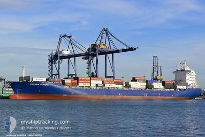
CMA CGM SEMARANG
Container Ship
Current Trip
| Time Travelled | 3 days |
|---|---|
| Remaining Time | --- |
| Distance Travelled | 710.09 nm |
| Remaining Distance | 8.46 nm |
| AVG Speed | 9.8 Knots |
| MAX Speed | 19.6 Knots |
| AVG Wind | 12.9 knots |
| MAX Wind | 22.8 knots |
| MIN Temp | 9°C / 48.2°F |
| MAX Temp | 15.6°C / 60.08°F |
| Draught | 8.4 m |
| Position Received | 2 m ago |
Current Position
| Longitude | 176.15081° |
|---|---|
| Latitude | -37.50650° |
| Status | At anchor |
| Speed | |
| Course | 64° |
| Area | South Pacific Ocean |
| Station | T-AIS |
| Position Received | 2 m ago |
Info
Information
The current position of CMA CGM SEMARANG is in South Pacific Ocean with coordinates -37.50650° / 176.15081° as reported on 2024-06-28 02:56 by AIS to our vessel tracker app. The vessel's current speed is 0 Knots and is heading at the port of TAURANGA. The estimated time of arrival as calculated by vessel tracking app is 2024-06-28 12:01 LT
The vessel CMA CGM SEMARANG (IMO: 9377133, MMSI: 229756000) is a Container Ship that was built in 2007 ( 17 years old ). It's sailing under the flag of [MT] Malta.
In this page you can find informations about the vessels current position, last detected port calls, and current voyage information. If the vessels is not in coverage by AIS you will find the latest position.
The current position of CMA CGM SEMARANG is detected by our AIS receivers and we are not responsible for the reliability of the data. The last position was recorded while the vessel was in Coverage by the Ais receivers of our vessel tracking app.
The current draught of CMA CGM SEMARANG as reported by AIS is 8.4 meters
Weather
| Temperature | 13.8°C / 56.84°F |
|---|---|
| Wind Speed | 4 knots |
| Direction | 313° NW |
| Pressure | 1019.2 hPa |
| Humidity | 62 % |
| Cloud Coverage | 12 % |
Featured Company
Last Port Calls
| Port | Arrival | Departure | Time In Port |
|---|---|---|---|
| 2024-06-23 07:53 | 2024-06-24 21:15 | 1 d | |
| 2024-06-21 03:44 | 2024-06-22 07:29 | 1 d | |
| 2024-06-19 03:01 | 2024-06-20 03:24 | 1 d | |
| 2024-06-13 20:38 | 2024-06-15 01:21 | 1 d | |
| 2024-06-08 00:24 | 2024-06-08 23:46 | 23 h | |
| 2024-06-05 09:03 | 2024-06-06 12:16 | 1 d | |
| 2024-05-31 23:10 | 2024-06-01 22:55 | 23 h | |
| 2024-05-29 23:33 | 2024-05-30 10:49 | 11 h | |
| 2024-05-26 22:29 | 2024-05-27 21:32 | 23 h | |
| 2024-05-21 23:26 | 2024-05-24 05:46 | 2 d |
Last Trips
| Origin | Departure | Destination | Arrival | Distance | |
|---|---|---|---|---|---|
| 2024-06-22 19:29 | 2024-06-23 19:53 | 272.55 nm | |||
| 2024-06-20 15:24 | 2024-06-21 15:44 | 221.41 nm | |||
| 2024-06-15 13:21 | 2024-06-19 15:01 | 856.05 nm | |||
| 2024-06-09 09:46 | 2024-06-14 08:38 | 1696.53 nm | |||
| 2024-06-06 22:16 | 2024-06-08 10:24 | 579.96 nm | |||
| 2024-06-02 10:55 | 2024-06-05 19:03 | 1363.40 nm | |||
| 2024-05-30 22:49 | 2024-06-01 11:10 | 317.37 nm | |||
| 2024-05-28 09:32 | 2024-05-30 11:33 | 354.99 nm | |||
| 2024-05-24 17:46 | 2024-05-27 10:29 | 285.36 nm | |||
| 2024-05-19 17:23 | 2024-05-22 11:26 | 687.95 nm |
Events
| Time | Event | Details | Position / Dest | Info |
|---|---|---|---|---|
| 2024-06-27 20:44 | Status Changed | At anchor Under way using engine |
-37.50495 / 176.15223
NZTRG
|
Speed: 0.4 kn Course: 146° |
| 2024-06-27 20:31 | STOP Moving | 9.41 nm, North of TAURANGA |
-37.50574 / 176.15330
NZTRG
|
Speed: 0.3 kn Course: 173° |
| 2024-06-27 17:50 | ETA Changed | 2024/06/28 12:01 2024/06/28 09:30 |
-37.11033 / 176.14962
NZTRG
|
Speed: 9.4 kn Course: 187.5° |
| 2024-06-27 17:42 | Status Changed | Under way using engine Default |
-37.08866 / 176.15491
NZTRG
|
Speed: 9.4 kn Course: 198° |
| 2024-06-27 17:42 | IN Coverage |
-37.08866 / 176.15491
South Pacific Ocean
NZTRG
|
Speed: 9.4 kn Course: 194.6° |
|
| 2024-06-27 01:14 | Status Changed | Default Under way using engine |
-34.98007 / 174.56647
NZTRG
|
Speed: 9.5 kn Course: 118° |
| 2024-06-27 01:12 | OUT of Coverage |
-34.97771 / 174.56094
South Pacific Ocean
NZTRG
|
Speed: 9.5 kn Course: 118° |
|
| 2024-06-27 01:11 | Status Changed | Under way using engine Default |
-34.97729 / 174.55995
NZTRG
|
Speed: 9.6 kn Course: 118° |
| 2024-06-27 00:54 | Status Changed | Default Under way using engine |
-34.95569 / 174.51128
NZTRG
|
Speed: 9.6 kn Course: 117.7° |
| 2024-06-27 00:43 | Status Changed | Under way using engine Default |
-34.94159 / 174.47930
NZTRG
|
Speed: 9.8 kn Course: 118° |