
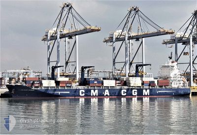
CMA CGM ST. LAURENT
Cargo A
Current Trip
| Time Travelled | 2 days |
|---|---|
| Remaining Time | --- |
| Distance Travelled | 1004.20 nm |
| Remaining Distance | --- |
| AVG Speed | 15.7 Knots |
| MAX Speed | 17.9 Knots |
| AVG Wind | 11.4 knots |
| MAX Wind | 17.9 knots |
| MIN Temp | 24.8°C / 76.64°F |
| MAX Temp | 28.7°C / 83.66°F |
| Draught | 7.7 m |
| Position Received | 2 d ago |
Current Position
| Longitude | -38.43219° |
|---|---|
| Latitude | -3.54336° |
| Status | Under way using engine |
| Speed | 14.3 Knots |
| Course | 28.4° |
| Area | South Atlantic Ocean |
| Station | T-AIS |
| Position Received | 2 d ago |
Info
Information
The current position of CMA CGM ST. LAURENT is in South Atlantic Ocean with coordinates -3.54336° / -38.43219° as reported on 2024-06-25 18:06 by AIS to our vessel tracker app. The vessel's current speed is 14.3 Knots and is heading at the port of PECEM. The estimated time of arrival as calculated by vessel tracking app is 2024-06-22 11:00 LT
The vessel CMA CGM ST. LAURENT (IMO: 9709219, MMSI: 228369800) is a Cargo A It's sailing under the flag of [FR] France.
In this page you can find informations about the vessels current position, last detected port calls, and current voyage information. If the vessels is not in coverage by AIS you will find the latest position.
The current position of CMA CGM ST. LAURENT is detected by our AIS receivers and we are not responsible for the reliability of the data. The last position was recorded while the vessel was in Coverage by the Ais receivers of our vessel tracking app.
The current draught of CMA CGM ST. LAURENT as reported by AIS is 7.7 meters
Weather
| Temperature | 26°C / 78.8°F |
|---|---|
| Wind Speed | 15 knots |
| Direction | 43° NE |
| Pressure | 1011.6 hPa |
| Humidity | 83.4 % |
| Cloud Coverage | 80 % |
Featured Company
Last Port Calls
| Port | Arrival | Departure | Time In Port |
|---|---|---|---|
| 2024-06-23 20:48 | 2024-06-25 17:09 | 1 d | |
| 2024-06-23 06:20 | 2024-06-23 16:12 | 9 h | |
| 2024-06-19 17:21 | 2024-06-20 11:24 | 18 h | |
| 2024-06-13 02:14 | 2024-06-18 03:57 | 5 d | |
| 2024-06-06 17:09 | 2024-06-07 20:57 | 1 d | |
| 2024-06-04 17:25 | 2024-06-05 09:41 | 16 h | |
| 2024-05-23 18:05 | 2024-05-24 16:23 | 22 h | |
| 2024-05-21 22:30 | 2024-05-22 05:17 | 6 h | |
| 2024-05-19 06:17 | 2024-05-20 04:32 | 22 h | |
| 2024-05-16 05:31 | 2024-05-16 16:18 | 10 h |
Most Visited Ports (Last year)
| Port | Arrivals | |
|---|---|---|
| 8 | ||
| 8 | ||
| 8 | ||
| 8 | ||
| 7 | ||
| 7 |
Last Trips
| Origin | Departure | Destination | Arrival | Distance | |
|---|---|---|---|---|---|
| 2024-06-23 13:12 | 2024-06-23 17:48 | 34.43 nm | |||
| 2024-06-20 08:24 | 2024-06-23 03:20 | 720.55 nm | |||
| 2024-06-18 00:57 | 2024-06-19 14:21 | 555.34 nm | |||
| 2024-06-07 16:57 | 2024-06-12 23:14 | 728.85 nm | |||
| 2024-06-05 05:41 | 2024-06-06 13:09 | 467.42 nm | |||
| 2024-05-24 18:23 | 2024-06-04 13:25 | 3608.05 nm | |||
| 2024-05-22 06:17 | 2024-05-23 20:05 | 203.78 nm | |||
| 2024-05-20 06:32 | 2024-05-21 23:30 | 166.22 nm | |||
| 2024-05-16 18:18 | 2024-05-19 08:17 | 898.29 nm | |||
| 2024-05-07 12:42 | 2024-05-16 07:31 | 3196.00 nm |
Events
| Time | Event | Details | Position / Dest | Info |
|---|---|---|---|---|
| 2024-06-25 18:09 | Status Changed | Default Under way using engine |
-3.53468 / -38.42731
BRPEC
|
Speed: 14.3 kn Course: 28.4° |
| 2024-06-25 18:06 | OUT of Coverage |
-3.54336 / -38.43219
South Atlantic Ocean
|
Speed: 14.3 kn Course: 28.4° |
|
| 2024-06-25 17:09 | PORT DEPARTURE |
|
-3.69735 / -38.48753
BRPEC
|
Speed: 7.4 kn Course: 1° |
| 2024-06-25 17:01 | Status Changed | Under way using engine Moored |
-3.70831 / -38.47959
[BR] FORTALEZA
|
Speed: 4.1 kn Course: 298° |
| 2024-06-25 16:57 | START Moving |
-3.70707 / -38.47528
[BR] FORTALEZA
|
Speed: 3.7 kn Course: 234° |
|
| 2024-06-25 15:21 | Status Changed | Moored Default |
-3.70488 / -38.47483
[BR] FORTALEZA
|
Speed: Course: 134° |
| 2024-06-25 15:18 | Status Changed | Default Moored |
-3.70488 / -38.47483
[BR] FORTALEZA
|
Speed: Course: 134° |
| 2024-06-25 12:45 | Status Changed | Moored Default |
-3.70465 / -38.47489
[BR] FORTALEZA
|
Speed: Course: 134° |
| 2024-06-25 12:45 | IN Coverage |
-3.70465 / -38.47489
South Atlantic Ocean
[BR] FORTALEZA
|
Speed: Course: 125.3° |
|
| 2024-06-25 11:39 | OUT of Coverage |
-3.70486 / -38.47485
South Atlantic Ocean
[BR] FORTALEZA
|
Speed: Course: 18.2° |