
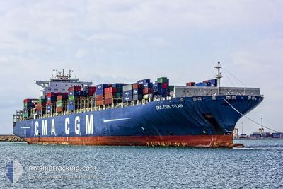
CMA CGM TITAN
Container Ship
Current Trip
| Time Travelled | 7 days |
|---|---|
| Remaining Time | --- |
| Distance Travelled | 2975.79 nm |
| Remaining Distance | --- |
| AVG Speed | 16 Knots |
| MAX Speed | 19.3 Knots |
| AVG Wind | 14 knots |
| MAX Wind | 23.8 knots |
| MIN Temp | 18.2°C / 64.76°F |
| MAX Temp | 27.8°C / 82.04°F |
| Draught | 15.5 m |
| Position Received | 5 d ago |
Current Position
| Longitude | -14.08346° |
|---|---|
| Latitude | 27.32791° |
| Status | Under way using engine |
| Speed | 17.3 Knots |
| Course | 222.4° |
| Area | North Atlantic Ocean |
| Station | T-AIS |
| Position Received | 5 d ago |
Info
Information
The current position of CMA CGM TITAN is in North Atlantic Ocean with coordinates 27.32791° / -14.08346° as reported on 2024-06-15 06:16 by AIS to our vessel tracker app. The vessel's current speed is 17.3 Knots and is heading at the port of JEBEL ALI. The estimated time of arrival as calculated by vessel tracking app is 2024-07-09 05:00 LT
The vessel CMA CGM TITAN (IMO: 9399222, MMSI: 248052000) is a Container Ship that was built in 2011 ( 13 years old ). It's sailing under the flag of [MT] Malta.
In this page you can find informations about the vessels current position, last detected port calls, and current voyage information. If the vessels is not in coverage by AIS you will find the latest position.
The current position of CMA CGM TITAN is detected by our AIS receivers and we are not responsible for the reliability of the data. The last position was recorded while the vessel was in Coverage by the Ais receivers of our vessel tracking app.
The current draught of CMA CGM TITAN as reported by AIS is 15.5 meters
Weather
| Temperature | 24.7°C / 76.46°F |
|---|---|
| Wind Speed | 15 knots |
| Direction | 139° SE |
| Pressure | 1014.5 hPa |
| Humidity | 77.5 % |
| Cloud Coverage | 100 % |
Featured Company
Last Port Calls
| Port | Arrival | Departure | Time In Port |
|---|---|---|---|
| 2024-06-12 06:39 | 2024-06-13 12:50 | 1 d | |
| 2024-06-07 14:07 | 2024-06-08 01:36 | 11 h | |
| 2024-06-05 10:47 | 2024-06-07 02:56 | 1 d | |
| 2024-06-03 08:25 | 2024-06-04 09:37 | 1 d | |
| 2024-06-01 00:32 | 2024-06-02 06:48 | 1 d | |
| 2024-05-29 01:02 | 2024-05-30 01:14 | 1 d | |
| 2024-05-26 17:06 | 2024-05-28 03:26 | 1 d | |
| 2024-05-22 13:15 | 2024-05-23 08:43 | 19 h | |
| 2024-04-29 01:26 | 2024-04-30 13:53 | 1 d | |
| 2024-04-26 18:40 | 2024-04-28 01:12 | 1 d |
Most Visited Ports (Last year)
| Port | Arrivals | |
|---|---|---|
| 8 | ||
| 8 | ||
| 6 | ||
| 6 | ||
| 6 | ||
| 6 |
Last Trips
| Origin | Departure | Destination | Arrival | Distance | |
|---|---|---|---|---|---|
| 2024-06-08 03:36 | 2024-06-12 08:39 | 1345.14 nm | |||
| 2024-06-07 04:56 | 2024-06-07 16:07 | 155.15 nm | |||
| 2024-06-04 11:37 | 2024-06-05 12:47 | 278.76 nm | |||
| 2024-06-02 07:48 | 2024-06-03 10:25 | 281.20 nm | |||
| 2024-05-30 03:14 | 2024-06-01 01:32 | 501.71 nm | |||
| 2024-05-28 05:26 | 2024-05-29 03:02 | 244.55 nm | |||
| 2024-05-23 09:43 | 2024-05-26 19:06 | 1396.97 nm | |||
| 2024-04-30 19:23 | 2024-05-22 14:15 | 9771.84 nm | |||
| 2024-04-28 06:42 | 2024-04-29 06:56 | 421.51 nm | |||
| 2024-04-24 00:52 | 2024-04-27 00:10 | 1214.88 nm |
Events
| Time | Event | Details | Position / Dest | Info |
|---|---|---|---|---|
| 2024-06-15 06:23 | Status Changed | Default Under way using engine |
27.29817 / -14.10847
AEJEA
|
Speed: 17.3 kn Course: 222.4° |
| 2024-06-15 06:16 | OUT of Coverage |
27.32791 / -14.08346
North Atlantic Ocean
AEJEA
|
Speed: 17.3 kn Course: 222.4° |
|
| 2024-06-15 06:14 | Status Changed | Under way using engine Default |
27.33324 / -14.07795
AEJEA
|
Speed: 17.3 kn Course: 222° |
| 2024-06-15 05:51 | Status Changed | Default Under way using engine |
27.41500 / -13.99500
AEJEA
|
Speed: 17.3 kn Course: 221° |
| 2024-06-15 05:47 | Status Changed | Under way using engine Default |
27.42938 / -13.98217
AEJEA
|
Speed: 17.3 kn Course: 220° |
| 2024-06-15 05:33 | Status Changed | Default Under way using engine |
27.48167 / -13.93333
AEJEA
|
Speed: 17.3 kn Course: 218.4° |
| 2024-06-15 05:20 | Status Changed | Under way using engine Default |
27.53098 / -13.89015
AEJEA
|
Speed: 17.3 kn Course: 218° |
| 2024-06-15 05:12 | Status Changed | Default Under way using engine |
27.56167 / -13.86333
AEJEA
|
Speed: 17.2 kn Course: 214.1° |
| 2024-06-15 05:04 | Change Sea Area | Western Saharan part of the North Atlantic Ocean Moroccan part of the North Atlantic Ocean |
27.59549 / -13.83562
North Atlantic Ocean
AEJEA
|
Speed: 17.2 kn Course: 215.2° |
| 2024-06-15 05:04 | Status Changed | Under way using engine Default |
27.59549 / -13.83562
AEJEA
|
Speed: 17 kn Course: 216° |