
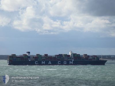
CMACGM GEORG FORSTER
Cargo A
Current Trip
| Time Travelled | 14 days |
|---|---|
| Remaining Time | 8 days |
| Distance Travelled | 6538.61 nm |
| Remaining Distance | 4016.77 nm |
| AVG Speed | 18.9 Knots |
| MAX Speed | 21 Knots |
| AVG Wind | 12.1 knots |
| MAX Wind | 27 knots |
| MIN Temp | 15.2°C / 59.36°F |
| MAX Temp | 28.6°C / 83.48°F |
| Draught | 13 m |
| Position Received | 1 d ago |
Current Position
| Longitude | 34.73053° |
|---|---|
| Latitude | -31.93200° |
| Status | Under way using engine |
| Speed | 19.1 Knots |
| Course | 67.5° |
| Area | Indian Ocean |
| Station | T-AIS |
| Position Received | 1 d ago |
Info
Information
The current position of CMACGM GEORG FORSTER is in Indian Ocean with coordinates -31.93200° / 34.73053° as reported on 2024-06-19 13:40 by AIS to our vessel tracker app. The vessel's current speed is 19.1 Knots and is heading at the port of PORT KLANG. The estimated time of arrival as calculated by vessel tracking app is 2024-06-29 15:46 LT
The vessel CMACGM GEORG FORSTER (IMO: 9702144, MMSI: 215221000) is a Cargo A It's sailing under the flag of [MT] Malta.
In this page you can find informations about the vessels current position, last detected port calls, and current voyage information. If the vessels is not in coverage by AIS you will find the latest position.
The current position of CMACGM GEORG FORSTER is detected by our AIS receivers and we are not responsible for the reliability of the data. The last position was recorded while the vessel was in Coverage by the Ais receivers of our vessel tracking app.
The current draught of CMACGM GEORG FORSTER as reported by AIS is 13 meters
Weather
| Temperature | 23.1°C / 73.58°F |
|---|---|
| Wind Speed | 14 knots |
| Direction | 96° E |
| Pressure | 1024.5 hPa |
| Humidity | 80.1 % |
| Cloud Coverage | 47 % |
Featured Company
Last Port Calls
| Port | Arrival | Departure | Time In Port |
|---|---|---|---|
| 2024-06-05 12:21 | 2024-06-06 10:07 | 21 h | |
| 2024-05-29 18:01 | 2024-05-31 11:39 | 1 d | |
| 2024-05-26 02:23 | 2024-05-27 01:12 | 22 h | |
| 2024-05-20 13:02 | 2024-05-23 04:51 | 2 d | |
| 2024-05-17 03:36 | 2024-05-18 03:24 | 23 h | |
| 2024-05-14 14:14 | 2024-05-16 11:07 | 1 d | |
| 2024-04-14 14:22 | 2024-04-15 13:43 | 23 h | |
| 2024-04-08 22:51 | 2024-04-09 19:06 | 20 h | |
| 2024-04-05 12:16 | 2024-04-06 22:01 | 1 d |
Most Visited Ports (Last year)
| Port | Arrivals | |
|---|---|---|
| 7 | ||
| 5 | ||
| 5 | ||
| 4 | ||
| 4 | ||
| 4 |
Last Trips
| Origin | Departure | Destination | Arrival | Distance | |
|---|---|---|---|---|---|
| 2024-05-31 13:39 | 2024-06-05 13:21 | 1476.45 nm | |||
| 2024-05-27 03:12 | 2024-05-29 20:01 | 1049.72 nm | |||
| 2024-05-23 06:51 | 2024-05-26 04:23 | 982.66 nm | |||
| 2024-05-18 05:24 | 2024-05-20 15:02 | 415.12 nm | |||
| 2024-05-16 13:07 | 2024-05-17 05:36 | 158.82 nm | |||
| 2024-04-15 21:43 | 2024-05-14 16:14 | 11627.32 nm | |||
| 2024-04-10 03:06 | 2024-04-14 22:22 | 1466.70 nm | |||
| 2024-04-07 06:01 | 2024-04-09 06:51 | 808.87 nm | |||
| 2024-03-31 11:39 | 2024-04-05 20:16 | 696.31 nm |
Events
| Time | Event | Details | Position / Dest | Info |
|---|---|---|---|---|
| 2024-06-19 13:49 | Status Changed | Default Under way using engine |
-31.91360 / 34.78240
PORT KLANG (MYPKG)
|
Speed: 19.1 kn Course: 67.5° |
| 2024-06-19 13:40 | OUT of Coverage |
-31.93200 / 34.73053
Indian Ocean
PORT KLANG (MYPKG)
|
Speed: 19.1 kn Course: 67.5° |
|
| 2024-06-19 13:31 | Status Changed | Under way using engine Default |
-31.95185 / 34.67488
PORT KLANG (MYPKG)
|
Speed: 19.1 kn Course: 66° |
| 2024-06-19 13:18 | Status Changed | Default Under way using engine |
-31.97918 / 34.59848
PORT KLANG (MYPKG)
|
Speed: 19.6 kn Course: 67.3° |
| 2024-06-19 13:08 | Status Changed | Under way using engine Default |
-32.00007 / 34.53955
PORT KLANG (MYPKG)
|
Speed: 19.6 kn Course: 68° |
| 2024-06-19 12:44 | Status Changed | Default Under way using engine |
-32.04917 / 34.40098
PORT KLANG (MYPKG)
|
Speed: 19.8 kn Course: 67.2° |
| 2024-06-19 12:16 | Status Changed | Under way using engine Default |
-32.10727 / 34.23608
PORT KLANG (MYPKG)
|
Speed: 19.2 kn Course: 67° |
| 2024-06-19 12:11 | Status Changed | Default Under way using engine |
-32.11797 / 34.20569
PORT KLANG (MYPKG)
|
Speed: 19.1 kn Course: 67.9° |
| 2024-06-19 11:34 | Change Sea Area | High seas of the Indian Ocean South African part of the Indian Ocean |
-32.19300 / 33.99120
Indian Ocean
PORT KLANG (MYPKG)
|
Speed: 19.4 kn Course: 67.1° |
| 2024-06-19 10:54 | Status Changed | Under way using engine Default |
-32.27633 / 33.75137
PORT KLANG (MYPKG)
|
Speed: 19.5 kn Course: 68° |