
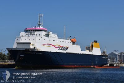
COMMODORE GOODWILL
Cargo A
Current Trip
| Time Travelled | 8 h, 24 mins |
|---|---|
| Remaining Time | -4 mins |
| Distance Travelled | 109.11 nm |
| Remaining Distance | 3.78 nm |
| AVG Speed | 14.1 Knots |
| MAX Speed | 19.5 Knots |
| AVG Wind | 8.4 knots |
| MAX Wind | 13.8 knots |
| MIN Temp | 16°C / 60.8°F |
| MAX Temp | 20.3°C / 68.54°F |
| Draught | 5.2 m |
| Position Received | Now |
Current Position
| Longitude | -2.51567° |
|---|---|
| Latitude | 49.45617° |
| Status | Under way using engine |
| Speed | 9.7 Knots |
| Course | 267° |
| Area | English Channel |
| Station | T-AIS |
| Position Received | Now |
Info
Information
The current position of COMMODORE GOODWILL is in English Channel with coordinates 49.45617° / -2.51567° as reported on 2024-06-27 03:38 by AIS to our vessel tracker app. The vessel's current speed is 9.7 Knots and is heading at the port of GUERNSEY. The estimated time of arrival as calculated by vessel tracking app is 2024-06-27 03:35 LT
The vessel COMMODORE GOODWILL (IMO: 9117985, MMSI: 309536000) is a Cargo A It's sailing under the flag of [BS] Bahamas.
In this page you can find informations about the vessels current position, last detected port calls, and current voyage information. If the vessels is not in coverage by AIS you will find the latest position.
The current position of COMMODORE GOODWILL is detected by our AIS receivers and we are not responsible for the reliability of the data. The last position was recorded while the vessel was in Coverage by the Ais receivers of our vessel tracking app.
The current draught of COMMODORE GOODWILL as reported by AIS is 5.2 meters
Weather
| Temperature | 16.1°C / 60.98°F |
|---|---|
| Wind Speed | 14 knots |
| Direction | 280° W |
| Pressure | 1010 hPa |
| Humidity | 91.7 % |
| Cloud Coverage | 100 % |
Featured Company
Last Port Calls
| Port | Arrival | Departure | Time In Port |
|---|---|---|---|
| 2024-06-26 15:41 | 2024-06-26 19:15 | 3 h | |
| 2024-06-26 05:48 | 2024-06-26 08:06 | 2 h | |
| 2024-06-26 02:52 | 2024-06-26 04:09 | 1 h | |
| 2024-06-25 14:40 | 2024-06-25 18:47 | 4 h | |
| 2024-06-25 05:18 | 2024-06-25 07:42 | 2 h | |
| 2024-06-25 02:21 | 2024-06-25 03:51 | 1 h | |
| 2024-06-24 15:11 | 2024-06-24 18:52 | 3 h | |
| 2024-06-24 04:48 | 2024-06-24 06:48 | 2 h | |
| 2024-06-24 01:51 | 2024-06-24 02:37 | 45 m | |
| 2024-06-23 06:32 | 2024-06-23 17:47 | 11 h |
Most Visited Ports (Last year)
| Port | Arrivals | |
|---|---|---|
| 266 | ||
| 261 | ||
| 213 | ||
| 43 | ||
| 3 | ||
| 2 |
Last Trips
| Origin | Departure | Destination | Arrival | Distance | |
|---|---|---|---|---|---|
| 2024-06-26 09:06 | 2024-06-26 16:41 | 122.46 nm | |||
| 2024-06-26 05:09 | 2024-06-26 06:48 | 27.37 nm | |||
| 2024-06-25 19:47 | 2024-06-26 03:52 | 110.76 nm | |||
| 2024-06-25 08:42 | 2024-06-25 15:40 | 123.94 nm | |||
| 2024-06-25 04:51 | 2024-06-25 06:18 | 27.08 nm | |||
| 2024-06-24 19:52 | 2024-06-25 03:21 | 109.92 nm | |||
| 2024-06-24 07:48 | 2024-06-24 16:11 | 124.77 nm | |||
| 2024-06-24 03:37 | 2024-06-24 05:48 | 27.91 nm | |||
| 2024-06-23 18:47 | 2024-06-24 02:51 | 108.05 nm | |||
| 2024-06-22 20:58 | 2024-06-23 07:32 | 109.81 nm |
Events
| Time | Event | Details | Position / Dest | Info |
|---|---|---|---|---|
| 2024-06-27 03:30 | Draught Changed | 5.2 5 |
49.43183 / -2.48900
GUERNSEY
|
Speed: 17.1 kn Course: 341° |
| 2024-06-27 03:30 | ETA Changed | 2024/06/27 03:50 |
49.43183 / -2.48900
GUERNSEY
|
Speed: 17.1 kn Course: 341° |
| 2024-06-27 03:24 | Draught Changed | 5 5.2 |
49.42383 / -2.45500
GUERNSEY
|
Speed: 18.7 kn Course: 237° |
| 2024-06-27 03:18 | Draught Changed | 5.2 5 |
49.44267 / -2.41533
GUERNSEY
|
Speed: 19.5 kn Course: 232° |
| 2024-06-27 03:18 | ETA Changed | 2024/06/27 03:50 |
49.44267 / -2.41533
GUERNSEY
|
Speed: 19.5 kn Course: 232° |
| 2024-06-27 03:00 | Draught Changed | 5 5.2 |
49.49800 / -2.30717
GUERNSEY
|
Speed: 16.8 kn Course: 232° |
| 2024-06-27 02:55 | Draught Changed | 5.2 5 |
49.51383 / -2.27400
GUERNSEY
|
Speed: 16.3 kn Course: 238° |
| 2024-06-27 02:55 | ETA Changed | 2024/06/27 03:50 |
49.51383 / -2.27400
GUERNSEY
|
Speed: 16.3 kn Course: 238° |
| 2024-06-27 02:48 | Draught Changed | 5 5.2 |
49.52883 / -2.23800
GUERNSEY
|
Speed: 16.5 kn Course: 238° |
| 2024-06-27 02:25 | Change Sea Area | Guernsey part of the English Channel French part of the English Channel |
49.58717 / -2.11750
English Channel
GUERNSEY
|
Speed: 13.7 kn Course: 203° |