
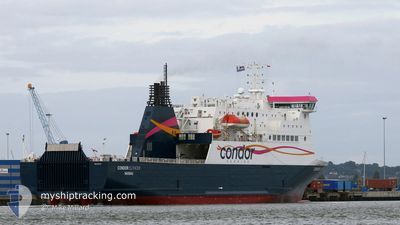
CONDOR ISLANDER
Ro-Ro/Passenger Ship
Current Trip
| Trip Time | 4 h, 40 mins |
|---|---|
| Trip Distance | 12.92 nm |
| AVG Speed | 9.3 Knots |
| MAX Speed | 15.6 Knots |
| Draught | 4.9 m |
| AVG Wind | 12.8 knots |
| MAX Wind | 13.9 knots |
| MIN Temp | 14.1°C / 57.38°F |
| MAX Temp | 15.7°C / 60.26°F |
| Position Received | 1 m ago |
Current Position
| Longitude | -1.09452° |
|---|---|
| Latitude | 50.81239° |
| Status | Moored |
| Speed | |
| Course | 218° |
| Area | English Channel |
| Station | T-AIS |
| Position Received | 1 m ago |
Info
Information
The current position of CONDOR ISLANDER is in English Channel with coordinates 50.81239° / -1.09452° as reported on 2024-06-10 04:57 by AIS to our vessel tracker app. The vessel's current speed is 0 Knots and is currently inside the port of PORTSMOUTH.
The vessel CONDOR ISLANDER (IMO: 9323704, MMSI: 311001287) is a Ro-Ro/Passenger Ship that was built in 2005 ( 19 years old ). It's sailing under the flag of [BS] Bahamas.
In this page you can find informations about the vessels current position, last detected port calls, and current voyage information. If the vessels is not in coverage by AIS you will find the latest position.
The current position of CONDOR ISLANDER is detected by our AIS receivers and we are not responsible for the reliability of the data. The last position was recorded while the vessel was in Coverage by the Ais receivers of our vessel tracking app.
The current draught of CONDOR ISLANDER as reported by AIS is 5.1 meters
Weather
| Temperature | 12.9°C / 55.22°F |
|---|---|
| Wind Speed | 17 knots |
| Direction | 267° W |
| Pressure | 1008.2 hPa |
| Humidity | 86.4 % |
| Cloud Coverage | 100 % |
Featured Company
Last Port Calls
| Port | Arrival | Departure | Time In Port |
|---|---|---|---|
| 2024-06-09 19:39 | |||
| 2024-06-09 05:11 | 2024-06-09 14:59 | 9 h | |
| 2024-06-08 19:38 | 2024-06-08 21:38 | 1 h | |
| 2024-06-08 15:33 | 2024-06-08 17:19 | 1 h | |
| 2024-06-08 05:52 | 2024-06-08 09:08 | 3 h | |
| 2024-06-07 19:15 | 2024-06-07 21:58 | 2 h | |
| 2024-06-07 15:59 | 2024-06-07 17:34 | 1 h | |
| 2024-06-07 06:33 | 2024-06-07 10:21 | 3 h | |
| 2024-06-06 19:48 | 2024-06-06 22:29 | 2 h | |
| 2024-06-06 16:28 | 2024-06-06 18:04 | 1 h |
Most Visited Ports (Last year)
| Port | Arrivals | |
|---|---|---|
| 185 | ||
| 163 | ||
| 126 | ||
| 4 | ||
| 1 | ||
| 1 |
Last Trips
| Origin | Departure | Destination | Arrival | Distance | |
|---|---|---|---|---|---|
| 2024-06-09 15:59 | 2024-06-09 20:39 | 12.92 nm | |||
| 2024-06-08 22:38 | 2024-06-09 06:11 | 123.40 nm | |||
| 2024-06-08 18:19 | 2024-06-08 20:38 | 27.50 nm | |||
| 2024-06-08 10:08 | 2024-06-08 16:33 | 105.65 nm | |||
| 2024-06-07 22:58 | 2024-06-08 06:52 | 124.52 nm | |||
| 2024-06-07 18:34 | 2024-06-07 20:15 | 27.19 nm | |||
| 2024-06-07 11:21 | 2024-06-07 16:59 | 101.31 nm | |||
| 2024-06-06 23:29 | 2024-06-07 07:33 | 122.71 nm | |||
| 2024-06-06 19:04 | 2024-06-06 20:48 | 27.36 nm | |||
| 2024-06-06 10:07 | 2024-06-06 17:28 | 103.44 nm |
Events
| Time | Event | Details | Position / Dest | Info |
|---|---|---|---|---|
| 2024-06-09 20:12 | Draught Changed | 5.1 4.9 |
50.81238 / -1.09451
[GB] PORTSMOUTH
|
Speed: Course: 218° |
| 2024-06-09 20:12 | Destination Changed | GUERNSEY PORTSMOUTH |
50.81238 / -1.09451
[GB] PORTSMOUTH
|
Speed: Course: 218° |
| 2024-06-09 20:12 | ETA Changed | 2024/06/10 14:05 2024/06/09 15:00 |
50.81238 / -1.09451
[GB] PORTSMOUTH
|
Speed: Course: 218° |
| 2024-06-09 20:01 | Status Changed | Moored Under way using engine |
50.81238 / -1.09452
[GB] PORTSMOUTH
|
Speed: Course: 218° |
| 2024-06-09 19:53 | STOP Moving |
50.81229 / -1.09463
[GB] PORTSMOUTH
|
Speed: 0.2 kn Course: 218° |
|
| 2024-06-09 19:39 | PORT ARRIVAL |
|
50.80842 / -1.11258
[GB] PORTSMOUTH
|
Speed: 6 kn Course: 46.1° |
| 2024-06-09 19:02 | START Moving | 2.75 nm, East of ST HELENS |
50.70864 / -1.04166
PORTSMOUTH
|
Speed: 11.4 kn Course: 325.2° |
| 2024-06-09 18:45 | Destination Changed | PORTSMOUTH ST HELENS ANCHORAGE |
50.70704 / -1.03802
PORTSMOUTH
|
Speed: 0.2 kn Course: 279° |
| 2024-06-09 18:45 | Status Changed | Under way using engine At anchor |
50.70704 / -1.03799
ST HELENS ANCHORAGE
|
Speed: Course: 290° |
| 2024-06-09 18:24 | Status Changed | At anchor Default |
50.70711 / -1.03798
ST HELENS ANCHORAGE
|
Speed: Course: -1° |